Category:Maps showing 1952
Jump to navigation
Jump to search
| ← 1950 1951 1952 1953 1954 1955 1956 1957 1958 1959→ |
English: Maps showing the year 1952 (i.e. history maps)
See also category: 1952 maps. and 1950s maps for old maps created in this time.
See also category: 1952 maps. and 1950s maps for old maps created in this time.
Subcategories
This category has only the following subcategory.
Media in category "Maps showing 1952"
The following 4 files are in this category, out of 4 total.
-

-
 Mk 1952 opstini.gif 1,014 × 814; 29 KB
-
 MTT map of Adelaide's metropolitan public transport routes, 28 May 1952.png 1,653 × 2,338; 6.11 MB
-
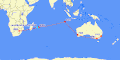 Original Wallaby Route Qantas 1952.gif 720 × 360; 13 KB


