Category:Maps showing 1949
Jump to navigation
Jump to search
| ← 1940 1941 1942 1943 1944 1945 1946 1947 1948 1949→ |
English: Maps showing the year 1949 (i.e. history maps)
See also category: 1949 maps. and 1940s maps for old maps created in this time.
See also category: 1949 maps. and 1940s maps for old maps created in this time.
Subcategories
This category has only the following subcategory.
Media in category "Maps showing 1949"
The following 10 files are in this category, out of 10 total.
-
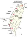 1949 Taiwan de.svg 808 × 1,049; 70 KB
-
 1949-1950 Australian cyclone season summary.jpg 3,000 × 1,785; 389 KB
-
 Airline Routes in South America, March,1949 - DPLA - 587ef873c1242698a31a8378f5cccb42.jpg 8,424 × 12,581; 10.42 MB
-
 China in 1949.svg 1,181 × 940; 2.12 MB
-
Evolution of United States standard time zone boundaries.webm 29 s, 3,507 × 2,480; 4.58 MB
-
 Germany location map 23 April 1949 - 22 May 1949.svg 1,075 × 1,273; 1.13 MB
-
 Germany, Federal Republic of location map 23 May 1949 - 6 Oct 1949.svg 1,075 × 1,273; 1.12 MB
-
 Map of the United States of Indonesia-id.svg 786 × 361; 890 KB
-
 Map of the United States of Indonesia.svg 786 × 361; 872 KB
-


