Category:Maps of municipalities in the canton of Lucerne
Jump to navigation
Jump to search
Cantons of Switzerland: Aargau (AG) · Appenzell Ausserrhoden (AR) · Appenzell Innerrhoden (AI) · Basel-Stadt (BS) · Basel-Landschaft (BL) · Bern (BE) · Fribourg (FR) · Geneva (GE) · Glarus (GL) · Jura (JU) · Luzern (LU) · Neuchâtel (NE) · Nidwalden (NW) · Obwalden (OW) · Schaffhausen (SH) · Schwyz (SZ) · Solothurn (SO) · Thurgau (TG) · Ticino (TI) · Uri (UR) · Valais (VS) · Vaud (VD) · Zug (ZG) · Zürich (ZH)
Subcategories
This category has the following 6 subcategories, out of 6 total.
2
O
Media in category "Maps of municipalities in the canton of Lucerne"
The following 12 files are in this category, out of 12 total.
-
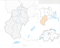 Karte Wahlkreis Entlebuch 2013 blank.png 2,066 × 1,642; 645 KB
-
 Karte Wahlkreis Entlebuch 2013.png 2,066 × 1,642; 809 KB
-
 Karte Wahlkreis Hochdorf 2021 blank.png 2,065 × 1,527; 479 KB
-
 Karte Wahlkreis Hochdorf 2021.png 2,065 × 1,527; 583 KB
-
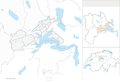 Karte Wahlkreis Luzern-Land 2013 blank.png 2,066 × 1,419; 610 KB
-
 Karte Wahlkreis Luzern-Land 2013.png 2,066 × 1,419; 745 KB
-
 Karte Wahlkreis Luzern-Stadt 2013 blank.png 2,066 × 1,376; 482 KB
-
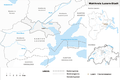 Karte Wahlkreis Luzern-Stadt 2013.png 2,066 × 1,376; 617 KB
-
 Karte Wahlkreis Sursee 2015 blank.png 2,066 × 1,603; 667 KB
-
 Karte Wahlkreis Sursee 2015.png 2,066 × 1,603; 825 KB
-
 Karte Wahlkreis Willisau 2021 blank.png 2,066 × 1,568; 501 KB
-
 Karte Wahlkreis Willisau 2021.png 2,066 × 1,568; 611 KB


