Category:Maps of municipalities in the canton of Basel-Landschaft
Jump to navigation
Jump to search
Cantons of Switzerland: Aargau (AG) · Appenzell Ausserrhoden (AR) · Appenzell Innerrhoden (AI) · Basel-Stadt (BS) · Basel-Landschaft (BL) · Bern (BE) · Fribourg (FR) · Geneva (GE) · Glarus (GL) · Jura (JU) · Luzern (LU) · Neuchâtel (NE) · Nidwalden (NW) · Obwalden (OW) · Schaffhausen (SH) · Schwyz (SZ) · Solothurn (SO) · Thurgau (TG) · Ticino (TI) · Uri (UR) · Valais (VS) · Vaud (VD) · Zug (ZG) · Zürich (ZH)
Subcategories
This category has the following 7 subcategories, out of 7 total.
A
L
S
W
Media in category "Maps of municipalities in the canton of Basel-Landschaft"
The following 10 files are in this category, out of 10 total.
-
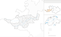
 Karte Bezirk Arlesheim 2007 blank.png 2,066 × 1,328; 342 KB
-
 Karte Bezirk Arlesheim 2007.png 2,066 × 1,328; 428 KB
-
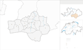
 Karte Bezirk Laufen 2007 blank.png 2,066 × 1,265; 440 KB
-
 Karte Bezirk Laufen 2007.png 2,066 × 1,265; 564 KB
-
 Karte Bezirk Liestal 2007 blank.png 1,240 × 894; 216 KB
-
 Karte Bezirk Liestal 2007.png 1,240 × 894; 270 KB
-
 Karte Bezirk Sissach 2007 blank.png 1,771 × 1,225; 518 KB
-
 Karte Bezirk Sissach 2007.png 1,771 × 1,225; 664 KB
-
 Karte Bezirk Waldenburg 2007 blank.png 2,066 × 1,249; 447 KB
-
 Karte Bezirk Waldenburg 2007.png 2,066 × 1,249; 571 KB


