Category:Maps of districts of Telangana
Jump to navigation
Jump to search
States of India: Andhra Pradesh · Arunachal Pradesh · Assam · Bihar · Chhattisgarh · Goa · Gujarat · Haryana · Himachal Pradesh · Jharkhand · Karnataka · Kerala · Madhya Pradesh · Maharashtra · Manipur · Meghalaya · Mizoram · Nagaland · Odisha · Punjab · Rajasthan · Sikkim · Tamil Nadu · Telangana · Tripura · Uttar Pradesh · Uttarakhand · West Bengal
Union territories: Dadra and Nagar Haveli and Daman and Diu ·
Former states of India:
Former union territories:
Union territories: Dadra and Nagar Haveli and Daman and Diu ·
Former states of India:
Former union territories:

Subcategories
This category has the following 2 subcategories, out of 2 total.
L
Media in category "Maps of districts of Telangana"
The following 19 files are in this category, out of 19 total.
-
 India Telangana numbered district map 2022.svg 681 × 681; 233 KB
-
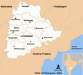
 Location Map Telangana India.PNG 431 × 338; 32 KB
-
 Mahabubabad district map.png 766 × 805; 383 KB
-
 Map of Telangana at the time of formation on June 02 2014.svg 512 × 497; 129 KB
-
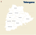
 Telangana Districts Map MR.png 1,062 × 878; 202 KB
-
 Telangana Districts Map.png 1,184 × 1,064; 398 KB
-
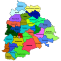
 Telangana districts(en).png 794 × 1,123; 194 KB
-
 Telangana districts.svg 512 × 497; 5.05 MB
-
 Telangana locator map.svg 537 × 508; 1.82 MB
-
 Telangana new districts 2016.jpg 4,200 × 4,200; 2.11 MB
-
 Telangana new districts and old districts 2016.jpg 4,200 × 4,200; 3.91 MB
-
 Telangana Rebellion District-ta.svg 601 × 601; 120 KB
-
 Telangana State English Map.svg 637 × 602; 1.84 MB
-
 Telangana State Map with Districts.png 1,000 × 1,000; 238 KB
-
 Telangana State Telugu Map.svg 637 × 602; 1.85 MB
-
 Telangana-odayanchal.png 2,219 × 2,095; 500 KB
-
 Telangana.jpg 600 × 450; 25 KB
-
 Telangana.png 1,231 × 896; 194 KB
-
 TG-districts-te.svg 667 × 630; 2.7 MB


.png)


