Category:Maps of districts of Goa
Jump to navigation
Jump to search
States of India: Andhra Pradesh · Arunachal Pradesh · Assam · Bihar · Chhattisgarh · Goa · Gujarat · Haryana · Himachal Pradesh · Jharkhand · Karnataka · Kerala · Madhya Pradesh · Maharashtra · Manipur · Meghalaya · Mizoram · Nagaland · Odisha · Punjab · Rajasthan · Sikkim · Tamil Nadu · Telangana · Tripura · Uttar Pradesh · Uttarakhand · West Bengal
Union territories: Dadra and Nagar Haveli and Daman and Diu ·
Former states of India:
Former union territories:
Union territories: Dadra and Nagar Haveli and Daman and Diu ·
Former states of India:
Former union territories:

Subcategories
This category has only the following subcategory.
Media in category "Maps of districts of Goa"
The following 12 files are in this category, out of 12 total.
-
 Administrative map of Goa.png 808 × 1,298; 163 KB
-
 Goa districts Assamese.svg 630 × 870; 41 KB
-
 Goa-districts-blank.png 500 × 568; 7 KB
-
 Goa-districts-numbered.png 500 × 568; 7 KB
-
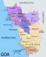
 Goamap.png 795 × 1,000; 86 KB
-
 Goamap.svg 633 × 820; 159 KB
-
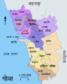
 Goamapbardez hindi.png 795 × 1,000; 72 KB
-
 Goamapbicholim hindi.png 795 × 1,000; 73 KB
-
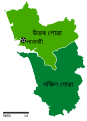
 Goamaphindi.png 795 × 1,000; 72 KB
-
 Mappa di Goa.png 795 × 1,000; 84 KB
-
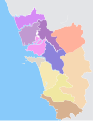
 North goa map.jpg 473 × 540; 43 KB
-
 North Goa Political Map.png 808 × 1,298; 197 KB


