Category:Maps of districts of Assam
Jump to navigation
Jump to search
States of India: Andhra Pradesh · Arunachal Pradesh · Assam · Bihar · Chhattisgarh · Goa · Gujarat · Haryana · Himachal Pradesh · Jharkhand · Karnataka · Kerala · Madhya Pradesh · Maharashtra · Manipur · Meghalaya · Mizoram · Nagaland · Odisha · Punjab · Rajasthan · Sikkim · Tamil Nadu · Telangana · Tripura · Uttar Pradesh · Uttarakhand · West Bengal
Union territories: Dadra and Nagar Haveli and Daman and Diu ·
Former states of India:
Former union territories:
Union territories: Dadra and Nagar Haveli and Daman and Diu ·
Former states of India:
Former union territories:

Subcategories
This category has only the following subcategory.
Media in category "Maps of districts of Assam"
The following 18 files are in this category, out of 18 total.
-
 Assam districts map.as.svg 1,326 × 917; 528 KB
-
 Assam districts map.svg 1,326 × 917; 522 KB
-
 Assam Districts.as.jpg 2,340 × 1,660; 836 KB
-
 Assam Districts.png 1,667 × 1,250; 207 KB
-
 Assam map.jpg 1,087 × 756; 176 KB
-
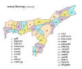 Assam-districts-2001 as.svg 631 × 530; 212 KB
-
 Assam-districts-2001 ml.svg 631 × 530; 214 KB
-
 Assam-districts-2001-assamese.svg 631 × 530; 135 KB
-
 Assam-districts-2001-bn.svg 631 × 530; 215 KB
-
 Assam-districts-2001-gu.svg 631 × 530; 212 KB
-
 Assam-districts-2001-hi.svg 631 × 530; 214 KB
-
 Assam-districts-2001-kn.svg 631 × 530; 218 KB
-
 Assam-districts-2001-mr.svg 631 × 530; 168 KB
-
 Assam-districts-2001-ne.svg 631 × 530; 219 KB
-
 Assam-districts-2001-pa.svg 631 × 530; 169 KB
-
 District wise Sdrf bn location.png 800 × 553; 194 KB
-
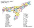 Districts of Assam (2014).svg 765 × 633; 85 KB
-
 Distrikte von Assam.svg 765 × 633; 81 KB


.svg)
