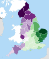
Category:Maps of counties of England
| NO WIKIDATA ID FOUND! Search for Maps of counties of England on Wikidata | |
| Upload media |
Maps of English counties, which are territorial divisions of England for the purposes of administrative, political and geographical demarcation. Many current counties have foundations in older divisions such as the Anglo-Saxon kingdoms. The names, boundaries and functions of these divisions have changed considerably in modern times. Indeed, a series of local government reforms from the 19th century onwards has left the exact definition of the term county ambiguous. The terms counties of England do not, therefore, refer to a unique canonical set of names or boundaries; in formal use, the type of county relevant to the specific task and period is explicitly stated, e.g. ceremonial county, registration county, historic county or former postal county.
.svg)
- Northumberland
- Tyne and Wear
- County Durham
- Cumbria
- Lancashire
- North Yorkshire
- East Riding of Yorkshire
- South Yorkshire
- West Yorkshire
- Greater Manchester
- Merseyside
- Cheshire
- Derbyshire
- Nottinghamshire
- Lincolnshire
- Rutland
- Leicestershire
- Staffordshire
- Shropshire
- Herefordshire
- Worcestershire
- West Midlands
- Warwickshire
- Northamptonshire
- Cambridgeshire
- Norfolk
- Suffolk
- Essex
- Hertfordshire
- Bedfordshire
- Buckinghamshire
- Oxfordshire
- Gloucestershire
- Bristol (county-city)
- Somerset
- Wiltshire
- Berkshire
- Greater London
Not shown:
City of London (county-city) - Kent
- East Sussex
- West Sussex
- Surrey
- Hampshire
- Isle of Wight
- Dorset
- Devon
- Cornwall

City-counties: Bristol · City of London
Former historic counties: Cumberland · Huntingdonshire · County of London · Middlesex · North Riding of Yorkshire · Sussex · West Riding of Yorkshire · Westmorland · Yorkshire
Other former counties: Avon · Cambridgeshire and Isle of Ely · Cleveland · East Suffolk · Hereford and Worcester · Hexhamshire · Humberside · Huntingdon and Peterborough · Isle of Ely · Parts of Holland · Parts of Kesteven · Parts of Lindsey · Soke of Peterborough · West Suffolk
Subcategories
This category has the following 53 subcategories, out of 53 total.
!
B
C
D
E
G
H
I
K
L
M
N
O
R
S
T
W
Media in category "Maps of counties of England"
The following 67 files are in this category, out of 67 total.
-
 AxG Counties Visited.svg 200 × 247; 236 KB
-
 BlankMap-EnglandSubdivisions.png 2,165 × 2,670; 124 KB
-
 BlankMap-EnglandSubdivisions.svg 2,165 × 2,670; 221 KB
-
 BlankMap-EnglandSubdivisions2009.png 2,165 × 2,670; 114 KB
-
 Division of Level 6 teams by English Counties (2022–23).svg 1,129 × 1,385; 110 KB
-
 Division of Level 6 to Level 9 teams by English Counties.svg 2,480 × 2,657; 514 KB
-
 Division of Level 7 teams by English Counties (2022–23).svg 1,129 × 1,385; 111 KB
-
 Division of Level 8 teams by English Counties (2022–23).svg 1,129 × 1,385; 137 KB
-
 Division of Level 9 teams by English Counties (2022–23).svg 1,129 × 1,385; 191 KB
-

-
 England counties 1851 grey.png 1,459 × 1,769; 86 KB
-
 England counties population.png 1,083 × 1,458; 229 KB
-
 England local elections locations 2013.svg 1,108 × 1,345; 338 KB
-
 England traditional counties main page.png 100 × 125; 8 KB
-
 EnglandSubdivisions.png 400 × 493; 76 KB
-
 EnglandSubdivisions1998 new.png 2,165 × 2,670; 129 KB
-
 EnglandSubdivisions1998 rainbow.png 2,165 × 2,670; 130 KB
-
 EnglandSubdivisionsProposed2004.png 392 × 486; 79 KB
-
 English administrative divisions 2009.svg 1,108 × 1,345; 520 KB
-
 English administrative divisions 2010.svg 1,108 × 1,345; 366 KB
-
 English administrative divisions by type 2009.svg 1,108 × 1,345; 504 KB
-
 English administrative divisions coloured map 2019.svg 1,108 × 1,345; 520 KB
-
 English administrative divisions coloured map 2021.svg 1,108 × 1,345; 521 KB
-
 English administrative divisions coloured map 2023.svg 1,108 × 1,345; 524 KB
-
 English administrative divisions map 2019.svg 1,108 × 1,345; 367 KB
-
 English administrative divisions map 2021.svg 1,108 × 1,345; 368 KB
-
 English administrative divisions map 2023.svg 1,108 × 1,345; 371 KB
-
 English administrative divisions map coloured by type 2019.svg 1,108 × 1,345; 496 KB
-
 English administrative divisions map coloured by type 2020.svg 1,108 × 1,345; 496 KB
-
 English administrative divisions map coloured by type 2021.svg 1,108 × 1,345; 498 KB
-
 English administrative divisions map coloured by type 2023.svg 1,108 × 1,345; 502 KB
-
 English ceremonial counties 2010 thin.svg 1,108 × 1,345; 300 KB
-
 English ceremonial counties 2010.svg 1,108 × 1,345; 302 KB
-
 English combined authorities.svg 1,108 × 1,345; 326 KB
-
 English county tops map.svg 1,108 × 1,345; 305 KB
-
 English Football Conference county coverage.png 1,107 × 1,346; 312 KB
-
 English local elections 2013 results.svg 1,108 × 1,345; 367 KB
-
 English metropolitan and non-metropolitan counties 2010.svg 1,108 × 1,345; 332 KB
-
 English metropolitan and non-metropolitan counties map 2019.svg 1,108 × 1,345; 333 KB
-
 English metropolitan and non-metropolitan counties map 2021.svg 1,108 × 1,345; 335 KB
-
 English metropolitan and non-metropolitan counties map 2023.svg 1,108 × 1,345; 338 KB
-
 English regions and counties by type 2009.svg 1,108 × 1,345; 483 KB
-
 English regions and counties by type 2019.jpg 4,617 × 5,604; 827 KB
-
 English regions and counties by type 2021.jpg 4,617 × 5,604; 1.46 MB
-
 English regions and counties coloured by type map 2019.svg 1,108 × 1,345; 476 KB
-
 English regions and counties coloured by type map 2020.svg 1,108 × 1,345; 476 KB
-
 English regions and counties coloured by type map 2021.svg 1,039 × 1,261; 460 KB
-
 English regions and counties coloured by type map 2023.svg 1,108 × 1,345; 482 KB
-
 EnglishSouthMidlandsCountiesMap.png 625 × 569; 27 KB
-
 Engstubsplit.png 2,175 × 2,670; 144 KB
-
 GreaterManchesterEnglishCounties1974.png 2,165 × 2,670; 94 KB
-
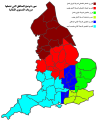
 GreenPartycounties.svg 1,108 × 1,345; 302 KB
-
 GVA of ceremonial counties in England (2007).svg 1,200 × 1,385; 119 KB
-
 Home Counties (1889 county borders).svg 430 × 345; 63 KB
-
 Level 7 Possible 2018.svg 1,129 × 1,385; 59 KB
-
 Level 7.svg 1,129 × 1,385; 54 KB
-
 Level 8 Football League areas in England-ar.svg 1,129 × 1,385; 176 KB
-
 Level 8 Football League areas in England.svg 1,129 × 1,385; 58 KB
-
 Levels 9–10 Football League areas in England.png 1,244 × 1,469; 270 KB
-
 Levels 9–10 Football League areas in England.svg 1,129 × 1,385; 59 KB
-
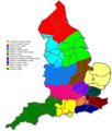
 Liberalcounties.svg 1,108 × 1,345; 302 KB
-
 Map of England 1086.png 2,398 × 3,000; 1.43 MB
-
 Metropolitan and non-metropolitan counties of England 2009 (numbered).svg 1,108 × 1,345; 557 KB
-
 MetCountiesEngland.png 200 × 247; 26 KB
-
 North,west,east&southyorkshire.png 800 × 680; 77 KB
-
 ShireCountiesEngland.png 200 × 247; 19 KB
-
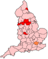
 UKIPcounties.svg 1,108 × 1,345; 302 KB

.svg)

.svg)
.svg)
.svg)
.png)


.svg)
.svg)


.svg)


