Category:Locator maps of counties of England
Jump to navigation
Jump to search
Subcategories
This category has only the following subcategory.
S
Pages in category "Locator maps of counties of England"
This category contains only the following page.
Media in category "Locator maps of counties of England"
The following 200 files are in this category, out of 211 total.
(previous page) (next page)-
 2009 Bedfordshire Ceremonial Numbered.png 200 × 298; 3 KB
-
 99Bristol outline map with UK.png 702 × 780; 170 KB
-
 Bedfo.svg 1,129 × 1,385; 107 KB
-
 Bedfordshire outline map with UK (2009).png 504 × 600; 190 KB
-
 Bedfordshire outline map with UK.png 504 × 600; 196 KB
-
 Berks.svg 1,129 × 1,385; 107 KB
-
 BidefordBayMap.png 580 × 579; 295 KB
-
 BlankMap-EnglandAdministrativeCounties.png 2,165 × 2,670; 97 KB
-
 BlankMap-EnglandAdministrativeCounties1974.png 2,165 × 2,670; 89 KB
-
 BlankMap-EnglandCeremonialCounties.png 2,175 × 2,670; 91 KB
-
 Brist.svg 1,129 × 1,385; 107 KB
-
 Bristol outline map with UK.png 540 × 600; 170 KB
-
 Buck.svg 1,129 × 1,385; 107 KB
-
 Buckinghamshire outline map with UK.png 600 × 714; 292 KB
-
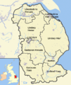
 Cambridgeshire districts.png 600 × 714; 385 KB
-
 Cambridgeshire outline map with UK.png 600 × 714; 342 KB
-
 Ceremonial counties of England labeled.png 1,102 × 1,365; 234 KB
-
 Chesh.svg 1,129 × 1,385; 107 KB
-
 Cheshire outline map with UK (2009).png 722 × 552; 396 KB
-
 Cheshire outline map with UK.png 722 × 552; 412 KB
-
 Cornwall outline map with UK (2009).png 1,351 × 1,069; 80 KB
-
 Cornwall.svg 1,129 × 1,385; 107 KB
-
 Cumb.svg 1,129 × 1,385; 107 KB
-
 Cumbria outline map with UK.png 600 × 714; 352 KB
-
 Derb.svg 1,129 × 1,385; 107 KB
-
 Derbyshire outline map with UK.png 819 × 1,205; 185 KB
-
 Devo.svg 1,129 × 1,385; 107 KB
-
 EnglandDevon.png 200 × 247; 22 KB
-
 Devon outline map with UK.png 580 × 579; 198 KB
-
 Dorse.svg 1,129 × 1,385; 107 KB
-
 Dorset outline.png 1,016 × 740; 90 KB
-
 Durh.svg 1,129 × 1,385; 107 KB
-
 Durham outline map with UK (2009).png 722 × 478; 270 KB
-
 East Riding of Yorks outline map with UK.png 722 × 552; 242 KB
-
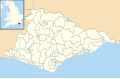
 East Sussex outline map with UK.png 800 × 558; 170 KB
-
 East Sussex UK constituency map (blank).svg 1,425 × 928; 852 KB
-
 East Sussex UK electoral division map (blank).svg 1,425 × 928; 1.19 MB
-
 East Sussex UK electoral division map 2017 (blank).svg 1,425 × 928; 1.41 MB
-
 East Sussex UK parish map (blank).svg 1,425 × 928; 1.51 MB
-
 East Sussex UK ward map (blank).svg 1,425 × 928; 1.52 MB
-
 England in the UK - Northumberland outlined.png 369 × 420; 11 KB
-
 England in the UK - Northumberland outlined.svg 369 × 420; 42 KB
-
 EnglandAdminCounties1996.png 200 × 247; 25 KB
-
 EnglandAdminCounties1997.png 200 × 247; 25 KB
-
 EnglandAdminCounties1998.png 200 × 247; 27 KB
-
 EnglandAdminCountiesNumbered.png 400 × 493; 96 KB
-
 EnglandAndWales1974Numbered.png 400 × 493; 92 KB
-
 EnglandAvon.svg 200 × 247; 189 KB
-
 EnglandBedfordshire.png 200 × 247; 22 KB
-
 EnglandBedfordshire.svg 200 × 247; 232 KB
-
 EnglandBerkshire.svg 200 × 247; 231 KB
-
 EnglandBuckinghamshire.png 200 × 247; 18 KB
-
 EnglandBuckinghamshire.svg 200 × 247; 232 KB
-
 EnglandCambridgeshire.svg 200 × 247; 232 KB
-
 EnglandCeremonialCounties.png 2,175 × 2,670; 89 KB
-
 EnglandCheshire.png 200 × 247; 22 KB
-
 EnglandCheshire.svg 200 × 247; 232 KB
-
 EnglandCleveland.png 200 × 247; 24 KB
-
 EnglandCleveland.svg 200 × 247; 189 KB
-
 EnglandCornwall.svg 200 × 247; 231 KB
-
 EnglandCounties1974.png 400 × 493; 78 KB
-
 EnglandCounties1974Blank.png 400 × 493; 63 KB
-
 EnglandCountiesAdmin.png 400 × 493; 69 KB
-
 EnglandCountiesCere.png 392 × 485; 11 KB
-
 EnglandCumberlandTrad.png 200 × 250; 28 KB
-
 EnglandCumbria.png 200 × 247; 26 KB
-
 EnglandCumbria.svg 200 × 247; 231 KB
-
 EnglandDerbyshire.svg 200 × 247; 232 KB
-
 EnglandDevon.svg 200 × 247; 232 KB
-
 EnglandDorset.png 197 × 244; 20 KB
-
 EnglandDorset.svg 200 × 247; 232 KB
-
 EnglandDurham.png 200 × 247; 16 KB
-
 EnglandDurham.svg 200 × 247; 233 KB
-
 EnglandEastRiding.png 200 × 247; 22 KB
-
 EnglandEastSussex.png 200 × 247; 22 KB
-
 EnglandEastSussex.svg 200 × 247; 232 KB
-
 EnglandEssex.png 200 × 247; 22 KB
-
 EnglandEssex.svg 200 × 247; 232 KB
-
 EnglandGloucestershire.png 200 × 247; 17 KB
-
 EnglandGloucestershire.svg 200 × 247; 232 KB
-
 EnglandGreaterManchester.png 200 × 247; 26 KB
-
 EnglandGreaterManchester.svg 200 × 247; 231 KB
-
 EnglandHampshire.svg 200 × 247; 232 KB
-
 EnglandHerefordshire.png 200 × 247; 26 KB
-
 EnglandHerefordshire.svg 200 × 247; 231 KB
-
 EnglandHerefordWorcester.png 200 × 247; 22 KB
-
 EnglandHertfordshire.png 200 × 247; 16 KB
-
 EnglandHertfordshire.svg 200 × 247; 231 KB
-
 EnglandHumberside.svg 200 × 247; 189 KB
-
 EnglandIsleWight.png 200 × 247; 26 KB
-
 EnglandIsleWight.svg 200 × 247; 232 KB
-
 EnglandKent.png 200 × 247; 22 KB
-
 EnglandKent.svg 200 × 247; 232 KB
-
 EnglandLancashire.png 200 × 247; 22 KB
-
 EnglandLancashire.svg 200 × 247; 232 KB
-
 EnglandLeicestershire.png 200 × 247; 22 KB
-
 EnglandLeicestershire.svg 200 × 247; 232 KB
-
 EnglandLincolnshire.png 200 × 247; 22 KB
-
 EnglandLincolnshire.svg 200 × 247; 232 KB
-
 EnglandMerseyside.svg 200 × 247; 231 KB
-
 EnglandNorfolk.png 200 × 247; 26 KB
-
 EnglandNorfolk.svg 200 × 247; 231 KB
-
 EnglandNorthamptonshire.png 200 × 247; 26 KB
-
 EnglandNorthamptonshire.svg 200 × 247; 231 KB
-
 EnglandNorthumberland.png 200 × 247; 26 KB
-
 EnglandNorthumberland.svg 200 × 247; 231 KB
-
 EnglandNorthYorkshire.svg 200 × 247; 233 KB
-
 EnglandNottinghamshire.png 200 × 247; 22 KB
-
 EnglandNottinghamshire.svg 200 × 247; 232 KB
-
 EnglandOxfordshire.png 200 × 247; 26 KB
-
 EnglandOxfordshire.svg 200 × 247; 231 KB
-
 EnglandRutland.png 200 × 247; 26 KB
-
 EnglandShropshire.png 200 × 247; 22 KB
-
 EnglandShropshire.svg 200 × 247; 232 KB
-
 EnglandSomerset.png 200 × 247; 26 KB
-
 EnglandSomerset.svg 200 × 247; 232 KB
-
 EnglandSouthYorkshire.png 200 × 247; 26 KB
-
 EnglandSouthYorkshire.svg 200 × 247; 231 KB
-
 EnglandStaffordshire.png 200 × 247; 22 KB
-
 EnglandStaffordshire.svg 200 × 247; 232 KB
-
 EnglandSuffolk.png 200 × 247; 26 KB
-
 EnglandSuffolk.svg 200 × 247; 231 KB
-
 EnglandSurrey.png 200 × 247; 26 KB
-
 EnglandSurrey.svg 200 × 247; 231 KB
-
 EnglandTyneWear.png 200 × 247; 26 KB
-
 EnglandTyneWear.svg 200 × 247; 231 KB
-
 EnglandWarwickshire.svg 200 × 247; 231 KB
-
 EnglandWestMidlandsCounty.png 200 × 247; 26 KB
-
 EnglandWestMidlandsCounty.svg 200 × 247; 231 KB
-
 EnglandWestSussex.png 200 × 247; 26 KB
-
 EnglandWestSussex.svg 200 × 247; 231 KB
-
 EnglandWestYorkshire.svg 200 × 247; 231 KB
-
 EnglandWiltshire(UA2009).svg 200 × 247; 233 KB
-
 EnglandWiltshire.png 200 × 247; 22 KB
-
 EnglandWiltshire.svg 200 × 247; 232 KB
-
 EnglandWorcestershire.png 200 × 247; 16 KB
-
 EnglandWorcestershire.svg 200 × 247; 231 KB
-
 ERY.svg 1,129 × 1,385; 107 KB
-
 Ess.svg 1,129 × 1,385; 107 KB
-
 Essex outline map.svg 799 × 673; 119 KB
-
 ESus.svg 1,129 × 1,385; 107 KB
-
 GLon.svg 1,129 × 1,385; 107 KB
-
 Glou.svg 1,129 × 1,385; 107 KB
-
 Gloucestershire outline map with UK.png 600 × 714; 398 KB
-
 GMan.svg 1,129 × 1,385; 107 KB
-
 Greater london outline map bw.png 600 × 500; 199 KB
-
 Greater Manchester outline map with UK.png 800 × 558; 453 KB
-
 Hamps.svg 1,129 × 1,385; 107 KB
-
 Hampshire outline map with UK.png 712 × 600; 196 KB
-
 Herefo.svg 1,129 × 1,385; 107 KB
-
 Herefordshire outline map with UK.png 569 × 714; 271 KB
-
 Hertf.svg 1,129 × 1,385; 107 KB
-
 Hertfordshire outline map with UK.png 800 × 558; 314 KB
-
 EnglandIsleOfEly1890.png 200 × 254; 27 KB
-
 Isle of Wight outline map with UK.png 907 × 574; 96 KB
-
 Isles of Scilly UK location map.svg 1,340 × 1,187; 558 KB
-
 Kent outline map with UK.png 800 × 565; 419 KB
-
 Kent.svg 1,129 × 1,385; 107 KB
-
 Lanca.svg 1,129 × 1,385; 107 KB
-
 Lancashire outline map with UK.png 600 × 714; 423 KB
-
 Leice.svg 1,129 × 1,385; 107 KB
-
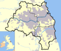
 Leicestershire districts.png 800 × 558; 466 KB
-
 Leicestershire outline map with UK.png 800 × 558; 454 KB
-
 Linco.svg 1,129 × 1,385; 107 KB
-
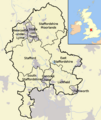
 Lincolnshire districts.png 600 × 714; 373 KB
-
 Lincolnshire outline map with UK.png 600 × 714; 334 KB
-

-
 Mersey.svg 1,129 × 1,385; 107 KB
-
 Merseyside outline map with UK.png 600 × 714; 382 KB
-
 Middlesex map.png 2,569 × 2,729; 160 KB
-
 Morwen-EnglandStamfordshire.png 200 × 254; 24 KB
-
 Norfo.svg 1,129 × 1,385; 107 KB
-
 Norfolk SSSI outline map with UK.jpg 722 × 492; 61 KB
-
 North Yorkshire outline map with UK.png 800 × 558; 359 KB
-
 Northam.svg 1,129 × 1,385; 107 KB
-
 Northamptonshire outline map with UK.png 504 × 600; 178 KB
-
 Northumber.svg 1,129 × 1,385; 107 KB
-
 Northumberland outline map with UK (2009).png 600 × 714; 219 KB
-
 Nott.svg 1,129 × 1,385; 107 KB
-
 Nottinghamshire outline map with UK.png 957 × 1,217; 178 KB
-
 OswestryLlanyblodwelAndPant.png 420 × 505; 11 KB
-
 Oxfo.svg 1,129 × 1,385; 107 KB
-
 Oxfordshire outline map with UK.png 600 × 714; 296 KB
-
 Rutland outline map with UK.png 800 × 558; 235 KB
-
 Shropshire outline map with UK (2009).png 504 × 549; 141 KB
-
 Slystyn Chambridgeshire.png 600 × 714; 385 KB
-
 Slystyn Leicestershire.png 800 × 558; 466 KB
-
 Slystyn Lincolnshire.png 600 × 714; 374 KB
-
 Slystyn Staffordshire.png 600 × 714; 297 KB
-
 S-York.svg 1,129 × 1,385; 107 KB
-
 South Yorkshire outline map with UK.png 800 × 558; 423 KB
-
 Staffordshire districts.png 600 × 714; 297 KB
-
 Staffordshire outline map with UK.png 600 × 714; 256 KB
-
 Suffolk outline map with UK.png 800 × 558; 176 KB
-
 Surrey outline map with UK.png 1,275 × 1,078; 253 KB
-
 Tyne and wear Ceremonial county locator map.png 200 × 247; 16 KB
-
 Tyne and Wear outline map with UK.png 600 × 500; 519 KB
-
 Uk-avon.png 200 × 293; 10 KB
-
 Uk-berks.png 145 × 173; 6 KB
-
 Uk-cheshire.png 145 × 173; 6 KB


.png)


.png)

.png)


.png)


.svg)


_Boundaries_with_Bromsgrove_(Hereford_%26_Worcester)%22.png)


.png)


.png)


.svg)
.svg)
.svg)
.svg)
.svg)