Category:Maps of Greater Manchester
Jump to navigation
Jump to search
Wikimedia category | |||||
| Upload media | |||||
| Instance of | |||||
|---|---|---|---|---|---|
| Category combines topics | |||||
| Greater Manchester | |||||
metropolitan county in North West England .jpg)    | |||||
| Instance of |
| ||||
| Location | North West England, England | ||||
| Head of government |
| ||||
| Inception |
| ||||
| Population |
| ||||
| Area |
| ||||
| Different from | |||||
 | |||||
Subcategories
This category has the following 10 subcategories, out of 10 total.
Media in category "Maps of Greater Manchester"
The following 70 files are in this category, out of 70 total.
-
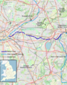
 Greater Manchester UK locator map 2010.svg 1,108 × 1,345; 302 KB
-
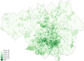
 African Greater Manchester 2011 census.png 23,870 × 17,493; 17.72 MB
-
 Arab Greater Manchester 2011 census.png 23,790 × 17,435; 17.49 MB
-
 Ashton Canal Map.png 982 × 1,254; 1.86 MB
-
 Asian Greater Manchester 2011 census.png 23,790 × 17,434; 27.75 MB
-
 Bangladeshi Greater Manchester 2011 census.png 23,870 × 17,493; 27.11 MB
-
 Black Greater Manchester 2011 census.png 23,790 × 17,434; 25.56 MB
-
 Bridgewater Canal map.png 1,582 × 1,072; 2.14 MB
-
 British Greater Manchester 2011 census.png 23,791 × 17,434; 24.65 MB
-
 Buddhism Greater Manchester 2011 census.png 23,870 × 17,493; 28.77 MB
-
 Caribbean Greater Manchester 2011 census.png 23,948 × 17,551; 27.44 MB
-
 Chinese Greater Manchester 2011 census.png 23,949 × 17,551; 28.05 MB
-
 Christianity Greater Manchester 2011 census.png 23,790 × 17,435; 26.88 MB
-
 England Greater Manchester numbered.svg 414 × 308; 9 KB
-
 England Greater Manchester.svg 414 × 308; 8 KB
-
 England Police Forces (Greater Manchester).svg 1,108 × 1,345; 312 KB
-
 EnglandGreaterManchester Numbered.PNG 200 × 151; 13 KB
-
 EnglandGreaterManchester.PNG 200 × 247; 17 KB
-
 EnglandPoliceGreaterManchester.png 2,165 × 2,670; 87 KB
-
 GMBUA2011.png 1,200 × 1,000; 378 KB
-
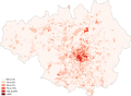
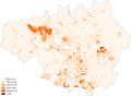
 Greater Manchester & Warrington population density map, 2011 census.png 4,727 × 3,324; 14.96 MB
-
 Greater Manchester 2011 Census Kurdish ethnicity.svg 1,425 × 993; 864 KB
-
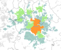
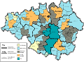
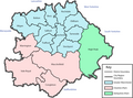
 Greater Manchester Boroughs and Conurbation.png 1,280 × 893; 118 KB
-
 Greater Manchester County (2).png 3,358 × 2,443; 620 KB
-
 Greater Manchester County (3) - no key.png 3,358 × 2,443; 674 KB
-
 Greater Manchester County (3).png 3,358 × 2,443; 713 KB
-
 Greater Manchester County - no key - greyscale.png 3,358 × 2,443; 340 KB
-
 Greater Manchester County - reduced colour.png 3,358 × 2,443; 674 KB
-
 Greater Manchester County numbered.png 3,358 × 2,443; 627 KB
-
 Greater Manchester County.png 3,358 × 2,443; 687 KB
-
 Greater Manchester County.svg 691 × 503; 838 KB
-
 Greater Manchester Lieutenancy area.png 1,821 × 3,089; 995 KB
-
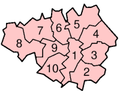
 Greater Manchester numbered districts.svg 1,425 × 993; 684 KB
-
 Greater Manchester outline map with England, G-Man.png 800 × 558; 337 KB
-
 Greater Manchester outline map.png 1,280 × 893; 623 KB
-
 Greater Manchester UK constituency map (blank).svg 1,425 × 993; 1.03 MB
-
 Greater Manchester UK district map (blank).svg 1,425 × 993; 860 KB
-
 Greater Manchester UK location map 2.svg 1,425 × 993; 1.73 MB
-
 Greater Manchester UK location map.svg 1,425 × 993; 1.49 MB
-
 Greater Manchester UK parish map (blank).svg 1,425 × 993; 963 KB
-
 Greater Manchester UK relief location map.jpg 1,999 × 1,393; 332 KB
-
 Greater Manchester UK ward map (blank).svg 1,425 × 993; 1.79 MB
-
 Greater Manchester Urban Area 2001.png 800 × 558; 428 KB
-
 Greater Manchester Urban Area 2001.svg 1,425 × 993; 1.97 MB
-
 Greater Manchester with former districts.png 3,550 × 2,474; 789 KB
-
 GreaterManchesterEnglishCounties1974.png 2,165 × 2,670; 94 KB
-
 Hinduism Greater Manchester 2011 census.png 23,870 × 17,493; 27.85 MB
-
 Indian Greater Manchester 2011 census.png 23,790 × 17,435; 27.94 MB
-
 Irish Greater Manchester 2011 census.png 23,790 × 17,435; 28.27 MB
-
 LiverpoolManchesterMegalopolis2011.png 1,217 × 850; 1.86 MB
-
 Location map Manchester.jpg 2,043 × 1,931; 1.31 MB
-
 M61 motorway junctions map.svg 409 × 500; 1.93 MB
-
 Manchester City Region.png 2,766 × 2,053; 423 KB
-
 Manchester Congestion Charge.png 2,000 × 1,394; 1.13 MB
-
 Manchester OSM 01.png 776 × 863; 1.26 MB
-
 Manchester OSM 02.png 776 × 863; 1.68 MB
-
 Manchester Ship Canal Landsat.jpg 605 × 441; 462 KB
-
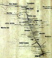
 Manchester Telephone Exchange names, 1965.jpg 2,362 × 1,604; 3.5 MB
-
 Ordnance Survey 1-250000 - SD.jpg 4,000 × 4,000; 7.12 MB
-
 Ordnance Survey 1-250000 - SE.jpg 4,000 × 4,000; 8.57 MB
-
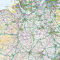 Ordnance Survey 1-250000 - SJ.jpg 4,000 × 4,000; 9.38 MB
-
 Ordnance Survey Quarter-inch sheet 10 North Wales and Lancashire, published 1957.jpg 9,689 × 8,871; 8.96 MB
-
 Parishes of Greater Manchester.png 800 × 558; 489 KB
-
 Salford hundred map.png 2,000 × 1,966; 449 KB
-
 Salfordshire.png 680 × 534; 417 KB
-
 Turnpikes of greater manchester.svg 7,744 × 7,695; 54 KB
-
 WiganBUA.png 1,618 × 850; 1.82 MB
-
 Worsley Braided Interchange map.svg 620 × 731; 98 KB
-
 Worsley mine tunnel map.jpg 866 × 959; 205 KB
-
 WP-GM-LOGO3.png 1,280 × 893; 426 KB


.svg)


.png)
_-_no_key.png)
.png)


.svg)
.svg)
.svg)
.svg)