Category:Maps of Tampa, Florida
Jump to navigation
Jump to search
- 100 most populous cities of the United States
- 1–25
- Austin
- Boston
- Charlotte
- Chicago
- Columbus
- Dallas
- Denver
- El Paso
- Fort Worth
- Houston
- Indianapolis
- Jacksonville
- Los Angeles
- Nashville
- New York City
- Oklahoma City
- Philadelphia
- Phoenix
- Portland
- San Antonio
- San Diego
- San Francisco
- San Jose
- Seattle
- Washington, D.C.
- 26–50
- Arlington
- Atlanta
- Bakersfield
- Colorado Springs
- Detroit
- Fresno
- Kansas City
- Las Vegas
- Long Beach
- Louisville
- Memphis
- Miami
- Minneapolis
- Oakland
- Omaha
- Raleigh
- Sacramento
- Tucson
- Tulsa
- 51–75
- Anaheim
- Anchorage
- Cincinnati
- Cleveland
- Corpus Christi
- Durham
- Greensboro
- Honolulu
- Irvine
- Jersey City
- Lexington
- Lincoln
- Newark
- New Orleans
- Orlando
- Pittsburgh
- Plano
- Saint Paul
- Santa Ana
- St. Louis
- Tampa
- 76–100
- Boise
- Buffalo
- Chesapeake
- Chula Vista
- Fort Wayne
- Laredo
- Lubbock
- Madison
- Norfolk
- Richmond
- Santa Clarita
- Scottsdale
- St. Petersburg
- Spokane
- Toledo
- Winston-Salem
Wikimedia category | |||||
| Upload media | |||||
| Instance of | |||||
|---|---|---|---|---|---|
| Category combines topics | |||||
| Tampa | |||||
city in Florida, United States     | |||||
| Instance of | |||||
| Location | Hillsborough County, Florida | ||||
| Head of government |
| ||||
| Inception |
| ||||
| Population |
| ||||
| Area |
| ||||
| Elevation above sea level |
| ||||
| Different from | |||||
| official website | |||||
 | |||||
Subcategories
This category has the following 2 subcategories, out of 2 total.
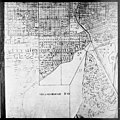
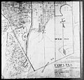
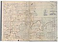
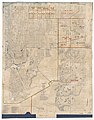
Media in category "Maps of Tampa, Florida"
The following 40 files are in this category, out of 40 total.
-

-
-
-
-

-

-
-
-
-
-

-

-
-

-
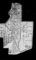
 FL11 109.gif 634 × 378; 31 KB
-
 FLMap-doton-Tampa.PNG 300 × 295; 12 KB
-
 Florida -Hamilton County - Sarasota County (part)- - NARA - 17474775 (page 187).jpg 3,823 × 6,810; 3.95 MB
-
 Florida -Hamilton County - Sarasota County (part)- - NARA - 17474775 (page 233).jpg 1,633 × 2,732; 568 KB
-
 Florida -Hamilton County - Sarasota County (part)- - NARA - 17474775 (page 234).jpg 2,732 × 2,254; 613 KB
-
 Florida -Hamilton County - Sarasota County (part)- - NARA - 17474775 (page 241).jpg 4,808 × 3,464; 2.43 MB
-
 Florida -Hamilton County - Sarasota County (part)- - NARA - 17474775 (page 242).jpg 4,776 × 3,432; 2.55 MB
-
 Florida -Hamilton County - Sarasota County (part)- - NARA - 17474775 (page 249).jpg 4,760 × 3,448; 2.57 MB
-
 Florida -Hamilton County - Sarasota County (part)- - NARA - 17474775 (page 250).jpg 5,179 × 3,851; 3.38 MB
-
 Florida -Hamilton County - Sarasota County (part)- - NARA - 17474775 (page 251).jpg 5,237 × 3,946; 3.05 MB
-

-

-
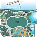
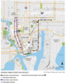 Invision Tampa Street Car Project.png 1,180 × 1,478; 651 KB
-
 Map of Florida highlighting Tampa.svg 450 × 429; 1.16 MB
-
 National Weather Service Tampa, Florida county warning area.svg 7,342 × 7,321; 331 KB
-
 Race and ethnicity 2010- Tampa (5559870035).png 3,009 × 3,009; 3.62 MB
-
 Tampa - St. Petersburg Urbanized Area Map.pdf 1,650 × 1,275; 1.18 MB
-

-

-
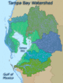 Tampa Bay watershed USGS.gif 382 × 500; 55 KB
-
 Tampa florida map.jpg 544 × 663; 168 KB
-
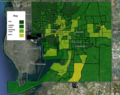 Tampa Stratification Map.png 1,017 × 805; 1.14 MB
-
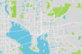 Tampa, FL.png 1,234 × 813; 361 KB
-
 Tampa-St. Petersburg, Florida 1955 Yellow Book.jpg 800 × 888; 157 KB
-
 Tampastpeteflua.gif 575 × 425; 46 KB
-
 Waterworks 360.jpg 360 × 360; 90 KB

.jpg)
.jpg)
.jpg)
.jpg)
.jpg)
.jpg)
.jpg)
.jpg)
_-_Pinellas_County_-_Vicinity_of_St._Petersburg_-_ED_52-1_to_3,_7_to_14,_17_to_19,_51_to_76,_92_-_NARA_-_81114423_(page_1).jpg)
_-_Pinellas_County_-_Vicinity_of_St._Petersburg_-_ED_52-1_to_3,_7_to_14,_17_to_19,_51_to_76,_92_-_NARA_-_81114423_(page_2).jpg)
_-_Pinellas_County_-_Vicinity_of_St._Petersburg_-_ED_52-1_to_3,_7_to_14,_17_to_19,_51_to_76,_92_-_NARA_-_81114423_(page_3).jpg)
_-_Pinellas_County_-_Vicinity_of_St._Petersburg_-_ED_52-1_to_3,_7_to_14,_17_to_19,_51_to_76,_92_-_NARA_-_81114423_(page_4).jpg)
_-_Pinellas_County_-_Vicinity_of_St._Petersburg_-_ED_52-1_to_3,_7_to_14,_17_to_19,_51_to_76,_92_-_NARA_-_81114423_(page_5).jpg)


-_-_NARA_-_17474775_(page_187).jpg)
-_-_NARA_-_17474775_(page_233).jpg)
-_-_NARA_-_17474775_(page_234).jpg)
-_-_NARA_-_17474775_(page_241).jpg)
-_-_NARA_-_17474775_(page_242).jpg)
-_-_NARA_-_17474775_(page_249).jpg)
-_-_NARA_-_17474775_(page_250).jpg)
-_-_NARA_-_17474775_(page_251).jpg)


.png)
.png)


