Category:Maps of St. Petersburg, Florida
Jump to navigation
Jump to search
Wikimedia category | |||||
| Upload media | |||||
| Instance of | |||||
|---|---|---|---|---|---|
| Category combines topics | |||||
| St. Petersburg | |||||
city in Pinellas County, Florida, United States     | |||||
| Instance of | |||||
| Named after |
| ||||
| Location | Pinellas County, Florida | ||||
| Head of government | |||||
| Inception |
| ||||
| Population |
| ||||
| Area |
| ||||
| Elevation above sea level |
| ||||
| Different from | |||||
| official website | |||||
 | |||||
Subcategories
This category has the following 2 subcategories, out of 2 total.
Media in category "Maps of St. Petersburg, Florida"
The following 15 files are in this category, out of 15 total.
-
-
-
-

-
-

-
-
 Diocese of St. Petersburg map 1.png 495 × 468; 40 KB
-
 FLMap-doton-SaintPetersburg.PNG 300 × 295; 12 KB
-
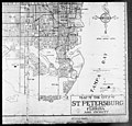
 Florida -Hamilton County - Sarasota County (part)- - NARA - 17474775 (page 1373).jpg 10,344 × 3,784; 4.44 MB
-
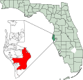 Map of Florida highlighting St Petersburg.svg 450 × 429; 1.23 MB
-
-
 Tampa-St. Petersburg, Florida 1955 Yellow Book.jpg 800 × 888; 157 KB
-
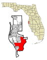
 Tampa-Stpb.png 400 × 374; 18 KB
-
 US 19A (FL) map.svg 1,180 × 688; 1.47 MB
.jpg)
.jpg)
.jpg)
.jpg)
.jpg)
.jpg)
.jpg)


_map.svg)
-_-_NARA_-_17474775_(page_1373).jpg)