Category:Maps of Dallas, Texas
Jump to navigation
Jump to search
- 100 most populous cities of the United States
- 1–25
- Austin
- Boston
- Charlotte
- Chicago
- Columbus
- Dallas
- Denver
- El Paso
- Fort Worth
- Houston
- Indianapolis
- Jacksonville
- Los Angeles
- Nashville
- New York City
- Oklahoma City
- Philadelphia
- Phoenix
- Portland
- San Antonio
- San Diego
- San Francisco
- San Jose
- Seattle
- Washington, D.C.
- 26–50
- Arlington
- Atlanta
- Bakersfield
- Colorado Springs
- Detroit
- Fresno
- Kansas City
- Las Vegas
- Long Beach
- Louisville
- Memphis
- Miami
- Minneapolis
- Oakland
- Omaha
- Raleigh
- Sacramento
- Tucson
- Tulsa
- 51–75
- Anaheim
- Anchorage
- Cincinnati
- Cleveland
- Corpus Christi
- Durham
- Greensboro
- Honolulu
- Irvine
- Jersey City
- Lexington
- Lincoln
- Newark
- New Orleans
- Orlando
- Pittsburgh
- Plano
- Saint Paul
- Santa Ana
- St. Louis
- Tampa
- 76–100
- Boise
- Buffalo
- Chesapeake
- Chula Vista
- Fort Wayne
- Laredo
- Lubbock
- Madison
- Norfolk
- Richmond
- Santa Clarita
- Scottsdale
- St. Petersburg
- Spokane
- Toledo
- Winston-Salem
- >100 (former top 50 and still over 100.000)
- Cambridge
- Grand Rapids
- Hartford
- Lowell
- Providence
- Rochester
- Syracuse
- Worcester
Wikimedia category | |||||
| Upload media | |||||
| Instance of | |||||
|---|---|---|---|---|---|
| Category combines topics | |||||
| Dallas | |||||
city in Texas, United States       | |||||
| Instance of | |||||
| Part of | |||||
| Location |
| ||||
| Located in or next to body of water | |||||
| Legislative body |
| ||||
| Head of government |
| ||||
| Inception |
| ||||
| Population |
| ||||
| Area |
| ||||
| Elevation above sea level |
| ||||
| Different from | |||||
| official website | |||||
 | |||||
English: Maps of Dallas, Texas
Español: Mapas de Dallas, Texas
Subcategories
This category has the following 2 subcategories, out of 2 total.
Media in category "Maps of Dallas, Texas"
The following 69 files are in this category, out of 69 total.
-
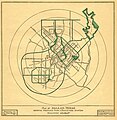
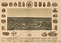
 Cram Dallas, Texas 1890 UTA.jpg 3,201 × 4,176; 4.85 MB
-
 1910Parks.jpg 1,326 × 1,357; 1.24 MB
-
 2015 Dallas mayoral election results map by precinct.svg 2,888 × 2,824; 763 KB
-
 2016 Oklahoma seismic hazard map.gif 606 × 837; 59 KB
-
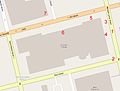 2016 shooting of Dallas police officers map.jpg 804 × 608; 56 KB
-
 2019 Dallas mayoral runoff election results map by precinct.svg 2,888 × 2,824; 763 KB
-
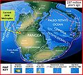 237 mya continental collision.JPG 429 × 387; 55 KB
-
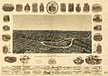
 55BookDetail.jpg 319 × 525; 36 KB
-
 Areacode214.svg 400 × 355; 2 MB
-
 Cretaceous Formations of Texas.JPG 711 × 386; 71 KB
-
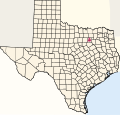
 Dallas County Texas Incorporated Areas Dallas highlighted.svg 1,050 × 600; 248 KB
-
 Dallas Fort Worth.png 923 × 685; 876 KB
-
 Dallas ft worth map.jpg 1,319 × 767; 429 KB
-
 Dallas Horseshoe project map.png 1,103 × 1,023; 756 KB
-
 Dallas Map - Wikivoyage.svg 2,800 × 3,000; 72 KB
-
 Dallas Mixmaster pre-Project Horseshoe.png 1,097 × 1,021; 500 KB
-
 Dallas, Texas 1955 Yellow Book.jpg 800 × 943; 264 KB
-
 Dallas, Texas downtown map 1871.jpg 1,903 × 2,842; 1.46 MB
-
 Dallas, Texas map - Arts District.svg 1,000 × 1,000; 235 KB
-
 Dallas, Texas map - Bluff View.svg 1,000 × 1,000; 84 KB
-
 Dallas, Texas map - Cedars.svg 1,000 × 1,000; 112 KB
-
 Dallas, Texas map - City Center District.svg 1,000 × 1,000; 235 KB
-
 Dallas, Texas map - Convention Center District.svg 1,000 × 1,000; 235 KB
-
 Dallas, Texas map - Downtown.svg 1,000 × 1,000; 65 KB
-
 Dallas, Texas map - Far North Dallas.svg 1,024 × 1,024; 282 KB
-
 Dallas, Texas map - Farmers Market District.svg 1,000 × 1,000; 235 KB
-
 Dallas, Texas map - Government District.svg 1,000 × 1,000; 235 KB
-
 Dallas, Texas map - Lake Highlands.svg 1,000 × 1,000; 62 KB
-
 Dallas, Texas map - Lake Park Estates.svg 1,000 × 1,000; 126 KB
-
 Dallas, Texas map - Main Street District.svg 1,000 × 1,000; 234 KB
-
 Dallas, Texas map - North Dallas.svg 1,024 × 1,024; 276 KB
-
 Dallas, Texas map - Northwest Dallas.svg 1,000 × 1,000; 63 KB
-
 Dallas, Texas map - Oak Lawn.svg 1,000 × 1,000; 62 KB
-
 Dallas, Texas map - Reunion District.svg 1,000 × 1,000; 235 KB
-
 Dallas, Texas map - West Dallas.svg 1,000 × 1,000; 61 KB
-
 Dallas, Texas map - West End Historic District.svg 1,000 × 1,000; 235 KB
-
 Dallas, Texas Map 1905.jpg 5,072 × 6,981; 11.35 MB
-
 Dallas, Texas map.svg 1,000 × 1,000; 60 KB
-
 Dallas, Texas road map.svg 1,000 × 1,000; 322 KB
-
-
 Dallas, TX.png 1,230 × 789; 466 KB
-
 Dallas-map.jpg 1,654 × 1,165; 313 KB
-
 Dallasmap downtown.svg 1,850 × 1,388; 77 KB
-
 Dallasmap westdallas.svg 2,000 × 800; 107 KB
-
 DallasMunicipalCenterPlan1946.jpg 1,006 × 820; 125 KB
-
 DallasPedestrianNetwork.jpg 1,189 × 760; 205 KB
-
 DealeyPlaza-fr.svg 600 × 500; 21 KB
-
 DFW Comanchean Gulfian Series.JPG 643 × 358; 64 KB
-
 FoodDeserts - Flickr - USDAgov.jpg 3,560 × 2,444; 5.58 MB
-
 Geology map of Dallas.jpg 767 × 623; 222 KB
-
 Hicks Airfield Map.jpg 506 × 392; 27 KB
-
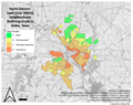 Home Owners' Loan Corp. (HOLC) Neighborhood Redlining Grade in Dallas, Texas.png 2,130 × 1,681; 3.29 MB
-
 Junius Heights.jpg 1,213 × 1,800; 745 KB
-
 Lakewood Heights, Dallas, Texas USA.svg 417 × 600; 113 KB
-
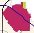
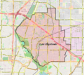 Location map of Lake Highlands, Dallas.png 732 × 652; 660 KB
-
 Map Dallas.jpg 2,089 × 1,826; 1.03 MB
-
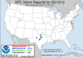 May 15, 2013 tornado outbreak map.png 582 × 408; 16 KB
-
 Old map-Dallas-1872.jpg 7,674 × 5,590; 11.85 MB
-
 Old map-Dallas-1892.jpg 9,000 × 6,354; 15.64 MB
-
 Old Preston Hollow.JPG 1,758 × 1,288; 927 KB
-
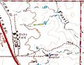
 Oliver Farms Airport Map.jpg 272 × 333; 16 KB
-
 Preston Hollow Boundaries.jpg 1,187 × 867; 973 KB
-
 Race and ethnicity Dallas.png 3,009 × 3,009; 2.11 MB
-
 Saginaw Airport Map.jpg 356 × 307; 14 KB
-
 SOUTHEAST dALLAS 2 TITLED 19.jpg 814 × 640; 261 KB
-
 Texas map - Dallas.svg 4,002 × 3,804; 856 KB
-
 VAR.png 4,059 × 2,959; 11.7 MB
-
 Whispering Hills LH2.png 565 × 551; 45 KB
-
 Weichsel & Co 1919 Map and Guide of Dallas & Suburbs UTA.jpg 6,513 × 8,753; 18.45 MB


_Neighborhood_Redlining_Grade_in_Dallas,_Texas.png)


