Category:Maps of Scotland
Jump to navigation
Jump to search
Constituent countries of the United Kingdom: England · Northern Ireland · Scotland · Wales – British Crown dependencies: Bailiwick of Guernsey · Isle of Man · Jersey
British overseas territories: Akrotiri and Dhekelia · Anguilla · Bermuda · British Antarctic Territory · British Indian Ocean Territory · British Virgin Islands · Cayman Islands · Falkland Islands · Gibraltar · Pitcairn Islands · Saint Helena, Ascension and Tristan da Cunha · South Georgia and the South Sandwich Islands · Turks and Caicos Islands
British overseas territories: Akrotiri and Dhekelia · Anguilla · Bermuda · British Antarctic Territory · British Indian Ocean Territory · British Virgin Islands · Cayman Islands · Falkland Islands · Gibraltar · Pitcairn Islands · Saint Helena, Ascension and Tristan da Cunha · South Georgia and the South Sandwich Islands · Turks and Caicos Islands
Wikimedia category | |||||
| Upload media | |||||
| Instance of | |||||
|---|---|---|---|---|---|
| Category combines topics | |||||
 | |||||
Subcategories
This category has the following 50 subcategories, out of 50 total.
- Maps of Scotland by year (1 F)
!
*
A
B
D
- Drainage basin maps of Scotland (49 F)
F
- Flag maps of Scotland (6 F)
G
- Glen Tilt - maps (2 F)
H
L
- Location maps of Scotland (11 F)
M
- Maps of Eigg (8 F)
- Maps of River Clyde (22 F)
- Maps of River Forth (12 F)
- Maps of Solway Firth (17 F)
- Maps of Staffa (island) (8 F)
- Maps of the Firth of Tay (12 F)
- Maps of mountains of Scotland (1 P, 94 F)
N
O
- OpenStreetMap maps of Scotland (56 F)
P
- Postcode maps covering Scotland (24 F)
R
S
- Siccar Point - maps (4 F)
T
Pages in category "Maps of Scotland"
The following 2 pages are in this category, out of 2 total.
Media in category "Maps of Scotland"
The following 200 files are in this category, out of 275 total.
(previous page) (next page)-
 Scotland map-en.jpg 2,400 × 3,450; 2.17 MB
-
 Scotland map-fr.jpg 2,400 × 3,450; 2.21 MB
-
 Scotland topographic map-en.jpg 2,400 × 3,450; 2.29 MB
-
 Scotland topographic map-fr.jpg 2,400 × 3,450; 2.29 MB
-
 054 schottland (1905).png 1,187 × 1,789; 1.45 MB
-

-
-
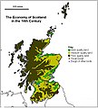 14thC Scottish Economy.jpg 632 × 702; 80 KB
-

-
 2018-01-01-00 00 2018-01-01-23 59 CORINE Land Cover Corine Land Cover (22).jpg 1,024 × 528; 247 KB
-

-

-

-

-

-
 A fauna of the Tay Basin and Strathmore (1906) (14564967880).jpg 2,340 × 3,616; 684 KB
-
 A fauna of the Tay Basin and Strathmore (1906) (14728635056).jpg 2,404 × 3,672; 813 KB
-

-
 A9 Scotland.jpg 1,780 × 2,300; 1.4 MB
-
 A92 Scotland.png 960 × 1,380; 1.45 MB
-
 A93 Scotland.png 1,080 × 1,553; 1.75 MB
-
 A94 Scotland.png 1,080 × 1,553; 1.75 MB
-
 Admiralty Chart Catalogue 1967 Page 020 Index C.jpg 8,584 × 6,824; 8.07 MB
-
 Admiralty Chart Catalogue 1967 Page 023 Index C1.jpg 8,576 × 6,829; 9.33 MB
-
 Admiralty Chart No 245 Scotland to Iceland, Published 1960.jpg 9,872 × 6,797; 15.28 MB
-
 Admiralty Chart No 246 Scotland to Greenland Published 1961.jpg 9,856 × 6,808; 17.28 MB
-
 Admiralty Chart No 2770 Sound of Barra, 1945, Originally published 1863.jpg 11,160 × 16,299; 26.62 MB
-
 Anglo-Scottish.border.modern.png 600 × 592; 586 KB
-
 Annals of Scottish natural history (17791855844).jpg 1,934 × 2,932; 1.01 MB
-
 Baldorran.jpg 1,280 × 513; 473 KB
-
 Basic Population Distribution of Scotland.png 1,048 × 1,664; 158 KB
-

-
 Battle of Pinkie sketch, 1547.jpg 774 × 1,273; 414 KB
-
 BIThumbMap SCO.png 663 × 1,069; 112 KB
-
 Blaeu - Atlas of Scotland 1654 - GLOTTIANA PRÆFECTVRA INFERIOR - Lower Clydesdale.png 2,879 × 1,630; 6.61 MB
-
 BoarseyMap.png 6,480 × 6,480; 18.05 MB
-
 Boat of Garten Elgin, Keith & Portessie RJD 38.JPG 2,688 × 1,719; 756 KB
-
 Bothwell-kart.jpg 191 × 247; 9 KB
-
 BrideiCamp.jpg 830 × 1,154; 214 KB
-
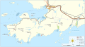
 Britische Hauptlinien Eisenbahn-Diagramm Waverley Line.png 698 × 933; 303 KB
-
 British and Irish Isles after Scottish independence.png 4,765 × 6,618; 2.38 MB
-
 Brochs from Canmore (all).png 700 × 700; 198 KB
-
 Brochs from Canmore (excluding possibles).png 700 × 700; 192 KB
-
 CambuslangMap1923.jpg 743 × 580; 102 KB
-
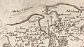
 Carte of Scotlande.jpg 404 × 319; 117 KB
-
 Cartina Scozia Nord Est.png 584 × 771; 323 KB
-
 Celtic countries.svg 547 × 979; 242 KB
-
 Chambers's encyclopædia; a dictionary of universal knowledge (1868) (14756158886).jpg 2,266 × 2,398; 690 KB
-
 Chwe Chenedl Geltaidd syml gyda Baneri.svg 360 × 711; 210 KB
-
 Chwe Chenedl Geltaidd syml.png 360 × 711; 12 KB
-
 Chwe Chenedl Geltaidd.png 430 × 711; 12 KB
-
 ClanMacaulay-map-lochbroom01.png 692 × 1,340; 101 KB
-
 Clyde.catchment.Scotland.jpg 826 × 1,307; 205 KB
-
 Clyde.tributaries.jpg 1,300 × 1,600; 328 KB
-
 Corrieyairack Pass Map.png 982 × 651; 27 KB
-
 Council areas Scotland.gif 455 × 720; 49 KB
-
 COVID-19 Map of Scotland.png 1,345 × 1,668; 273 KB
-
 Cowal peninsula landsat.jpg 948 × 1,280; 340 KB
-
 Cowal peninsula landsat.png 948 × 1,280; 2.19 MB
-
 Cruachan horseshoe2.jpg 1,128 × 693; 103 KB
-
 Cumbrae locale.jpg 300 × 283; 51 KB
-
 D179- N° 347. Basse Ecosse. - liv3-ch08.png 1,432 × 2,006; 674 KB
-
 Delvine och Tay samt högland Kopia.png 740 × 400; 13 KB
-
 Dhùn Bheagan.svg 1,334 × 1,424; 1.56 MB
-
 Dumbuck-OS-map-1864.jpg 1,112 × 674; 168 KB
-
 Dumfriesshire County.svg 690 × 1,039; 1,004 KB
-
 Early Medieval Economy.jpg 632 × 702; 80 KB
-
 Early Medieval Scotland - Zones.png 794 × 969; 1.44 MB
-
 Ecosse carte physique.png 300 × 400; 34 KB
-
 Edinburgh Zoo location.png 240 × 216; 32 KB
-
 Eileach an Naoimh.png 4,320 × 4,320; 8.47 MB
-
 EMRS Map.png 369 × 534; 52 KB
-
 EMRSmap.jpg 1,830 × 2,512; 743 KB
-
 Europe location SCO 2.png 1,600 × 1,200; 567 KB
-
 Europe location SCO 3.png 1,600 × 1,200; 519 KB
-
 Europe location SCO2.png 1,594 × 1,194; 558 KB
-
 Farm Medium.jpg 436 × 600; 39 KB
-
 Fife coastal path map.jpg 954 × 790; 409 KB
-
 Fionnla Dubh mac Gillechriosd (map).png 785 × 719; 805 KB
-
 Firthofclydemap.png 541 × 611; 18 KB
-
 FirthofLornmap.png 538 × 573; 17 KB
-
 Fullarton estate 1828.jpg 4,256 × 3,184; 1.52 MB
-
 Galloway.modern.names.Ptolemy.map.png 1,200 × 913; 41 KB
-
 Galloway.rivers.towns.jpg 2,467 × 1,568; 296 KB
-
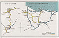
 Garve to Ullapool Railway Sketch Map.jpg 610 × 599; 135 KB
-
 Glasgow map.png 220 × 326; 8 KB
-
 Hebridesmap.png 935 × 1,450; 61 KB
-
 Highland PICT Map.jpg 446 × 440; 42 KB
-
 Highland towns.gif 360 × 390; 43 KB
-
 Highlands costa occidentale 3000000 best.png 498 × 833; 224 KB
-
 Highlands location.png 647 × 766; 683 KB
-
 Highlands lowlands fr.png 584 × 768; 179 KB
-
 Highlands nord.png 686 × 717; 269 KB
-
 Houghton F 6649.20 - James Anderson, Hebrides and Scotland, 1785.jpg 1,921 × 2,293; 1.74 MB
-

-
 Isles 1266.jpg 706 × 1,176; 339 KB
-
 ITV network microregions in Scotland map 2015.svg 486 × 791; 255 KB
-
 Kincardine and Deeside.svg 1,023 × 1,345; 2.82 MB
-
 Kingdom of Man and the Isles map (island groups).png 1,065 × 1,805; 1.82 MB
-
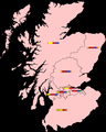
 Kingdom of Scotland Location Map.PNG 556 × 436; 65 KB
-
 Kingdom of Scotland Map.PNG 552 × 432; 65 KB
-
 Kyle and Carrick.svg 1,023 × 1,345; 2.82 MB
-
 La2-demis-scotland.png 639 × 782; 128 KB
-
 Laid 1.gif 347 × 500; 158 KB
-
 Leod Macgilleandrais (map).png 786 × 692; 711 KB
-
 Lieux de L'Abbé, de Walter Scott.png 1,224 × 714; 39 KB
-
 Ljótólfr (map).png 555 × 743; 128 KB
-
 Location of Auchencairn.png 692 × 684; 122 KB
-
 Location of the Beecraigs Country Park.jpg 916 × 621; 388 KB
-
 LocationScotland.png 250 × 115; 6 KB
-
 LocationScotland.svg 1,000 × 500; 1.43 MB
-
 LocationUKScotland.svg 1,000 × 500; 2.76 MB
-
 Scotland Map (Loch Fyne Detail) Loch Fyne.png 250 × 158; 14 KB
-
 Loch Lomond Map c 1800.jpg 3,616 × 5,072; 3.82 MB
-
 Lochalsh sketch map.jpg 909 × 634; 199 KB
-
 Lochalsh.jpg 922 × 655; 52 KB
-
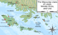 Macaulay of Lewis map.png 1,290 × 800; 1.09 MB
-
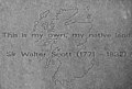 Makars' Court, Sir Walter Scott.jpg 4,347 × 2,927; 2.37 MB
-
 Map of Celtic Nations (alternate).svg 675 × 1,300; 90 KB
-
 Map of Celtic Nations.svg 675 × 1,300; 97 KB
-
 Map of Loch Ryan.png 530 × 758; 321 KB
-

-
 Map of Oswald distribution in Scotland 1690-1800.jpg 454 × 692; 165 KB
-
 Map of Scotland, with rites in archaeology. Wellcome M0002544.jpg 1,345 × 1,583; 302 KB
-
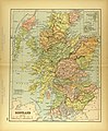 Map of Scotland.jpg 2,936 × 3,550; 2.59 MB
-
 Map of Speir's school.jpg 3,776 × 2,960; 2.55 MB
-
 Map of the Almondell & Calderwood Country Park.jpg 915 × 608; 557 KB
-
 MapOfAyrshire.png 302 × 326; 29 KB
-
 MapOfAyrshire.svg 300 × 323; 21 KB
-
 Mapping a group pool, revisited (4382146079).png 584 × 568; 208 KB
-
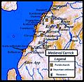 Medieval carrick.jpg 720 × 696; 136 KB
-
 Melrose map.jpg 191 × 247; 9 KB
-
-
 Moll - The South Part of the Shire of Air.jpg 2,098 × 1,609; 1,016 KB
-
-
 Muckhart Mill Holiday home Brochure page 4.jpg 960 × 650; 97 KB
-
 NHS Health Boards.PNG 420 × 546; 15 KB
-
 Olvir Rosta article map.png 795 × 1,235; 1 MB
-
 Ordnance Survey One-Inch Sheet 29 Elgin & Keith, Published 1929.jpg 12,344 × 9,346; 38.35 MB
-
 Ordnance Survey One-Inch Sheet 29 Elgin, Published 1959.jpg 8,230 × 9,917; 9.76 MB
-
 Ordnance Survey Sheet NT 86 Published 1954.jpg 4,948 × 6,172; 3.55 MB
-
 Outerhebridesharris.png 1,500 × 1,562; 109 KB
-
 Page 23 from Tomaso Porcacchi Castilione's 'L'Isole piu Famose del Mondo', Venice 1572.jpg 3,024 × 4,032; 3.16 MB
-
 Paul Mactire map.png 845 × 503; 524 KB
-
 Perth and Kinross 1999.svg 596 × 747; 820 KB
-
 Perth Burghs Constituency 1707-1832.svg 323 × 449; 2.11 MB
-
 Perthshire County.svg 690 × 1,039; 1,004 KB
-
 Pictish kingdoms with Fidach.png 230 × 285; 50 KB
-
 Pont 9 Findhorn.jpg 1,069 × 596; 235 KB
-
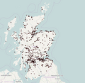
 Population density map in Scotland from the 2011 census.png 11,578 × 17,178; 13.84 MB
-
 Provinces of South-West Scotland.jpg 975 × 762; 179 KB
-
 RCHAMSInventories.png 400 × 457; 51 KB
-
 Regions2011.png 1,000 × 1,245; 150 KB
-
 Renfrewshire map.png 220 × 326; 8 KB
-
 RenfrewshireCraigends.png 200 × 149; 6 KB
-
 Revised Royal Regiment of Scotland recruiting areas.png 2,551 × 1,912; 224 KB
-
 Revised Royal Regiment of Scotland recruiting areas2.png 2,551 × 1,912; 226 KB
-
 Revised Royal Regiment of Scotland recruiting areas4.png 5,728 × 5,136; 762 KB
-
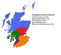 Revised Royal Regiment of Scotland recruiting areas5.jpg 5,728 × 5,136; 1.11 MB
-
 Rhins of Galloway Map.png 1,206 × 2,230; 1.11 MB
-
 Rhu Peninsula map 1 location legend.svg 2,199 × 1,005; 1.18 MB
-
 Rhu Peninsula map 1.svg 1,805 × 1,005; 329 KB
-
 River Forth course 3.png 2,000 × 806; 981 KB
-
 Roman Catholicism in Scotland.png 1,128 × 1,483; 315 KB
-
 Ross-shire County.svg 690 × 1,039; 1,003 KB
-
 Roxburghshire - Scotland.svg 690 × 1,039; 1,003 KB
-

-
 Royal Regiment of Scotland recruiting areas.png 2,551 × 1,912; 155 KB
-
 SCOport-fr-parts.png 1,200 × 1,200; 193 KB
-
 Scotch regions.png 498 × 383; 10 KB
-
 Scotch regions.svg 700 × 700; 61 KB
-
 Scotland (0 Shetland) council areas.png 2,305 × 2,799; 721 KB
-
 Scotland (core) council areas.png 1,420 × 1,153; 265 KB
-
 Scotland Administrative 2009 Blank.png 1,000 × 1,625; 457 KB
-
 Scotland Administrative Map 1947.png 2,001 × 3,480; 2.32 MB
-
 Scotland ayres and language.jpg 779 × 1,024; 310 KB
-
 Scotland blank map (central belt).png 508 × 353; 219 KB
-
 Scotland blank map (small belt).png 273 × 118; 46 KB
-
 Scotland blank map.png 717 × 920; 439 KB
-
 Scotland council areas.gif 500 × 770; 38 KB
-
 Scotland grevskap.jpg 800 × 994; 105 KB
-

-
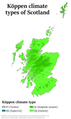 Scotland Köppen.png 5,400 × 9,062; 414 KB
-
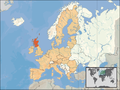 Scotland Location EU.PNG 1,600 × 1,200; 580 KB
-
 Scotland Location UK.PNG 578 × 430; 70 KB
-

-
-
 Scotland locator map 2 September 2007 - equidistant cylindrical.png 905 × 732; 96 KB
-

-
 Scotland locator map 23 August 2007 - bordered island.png 431 × 656; 70 KB
-
 Scotland locator map 23 August 2007 - comparison.png 553 × 933; 186 KB
-
 Scotland locator map 23 August 2007 - island.png 431 × 656; 70 KB
-
 Scotland Map (Firth of Clyde Detail).png 250 × 158; 15 KB
-
 Scotland map blank.png 2,500 × 2,500; 379 KB
-
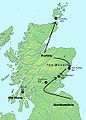
 Scotland map of whisky distilleries-de.png 2,401 × 2,712; 5.93 MB
-
 Scotland map of whisky distilleries-fr.jpg 2,400 × 3,455; 1.43 MB
-
 Scotland map.png 253 × 372; 30 KB
-
 Scotland Map.png 1,120 × 770; 23 KB
-
 Scotland North.png 1,045 × 830; 157 KB
-
 Scotland region map (ru).svg 2,308 × 3,207; 1.09 MB


.png)
_..._In_two_volumes.)%27_(11002920234).jpg)
.jpg)

_..._In_two_volumes.)%27_(11002811774).jpg)
.jpg)
.jpg)
.jpg)
%27_(11161027416).jpg)
.jpg)
_(14770777115).jpg)
_(14564967880).jpg)
_(14728635056).jpg)
_(14595605839).jpg)


.jpg)

.jpg)


.png)
.png)


_(14756158886).jpg)


.png)


.jpg)


.png)


.png)

.png)


_Loch_Fyne.png)


.svg)


.png)


.png)


,_excerpt_of_Carnach_region.jpg)

.jpg)


_council_areas.png)
_council_areas.png)


_(14579648869).jpg)


.png)


.svg)
.png)
.png)