Category:Locator maps of Scotland
Jump to navigation
Jump to search
This is a repository of location maps for settlements and places of interest in Scotland, for use both in articles themselves and as the map image in the Scottish Infobox. The template files are shown below, as are the general listing of location maps. The Hi-Res templates should be used unless there is a good reason not too.
Template Maps[edit]
-
 Low-Res Template Clean
 -
 Low Res Template Dot
 -
 Hi-Res Template Clean
 -
 Hi-Res Template Dot
_Template.png)
_Template_(with_dot).png)
_Template_(HR).png)
_Template_(HR)_(with_dot).png)
Subcategories
This category has the following 7 subcategories, out of 7 total.
!
*
I
L
R
Media in category "Locator maps of Scotland"
The following 189 files are in this category, out of 189 total.
-
 Aberdeen map.png 220 × 326; 8 KB
-
 Aberdeen-Hospitals 1200 1600.jpg 1,401 × 1,372; 413 KB
-
 Aberdeenshire council map.png 220 × 326; 8 KB
-
 Airdrie-Scotland (Location).png 553 × 933; 177 KB
-
 Angus council map.png 220 × 326; 8 KB
-
 Angus-Montrose.jpg 1,000 × 982; 162 KB
-
 Arbroath-Scotland (Location).png 553 × 933; 177 KB
-
 Argyll and Bute council map.png 220 × 326; 8 KB
-
 Argyll and Bute, East Dunbartonshire, West Dunbartonshire 1999.svg 596 × 747; 820 KB
-
 ArinagourScotland.png 1,154 × 1,535; 630 KB
-
 Armadale-Scotland (Location).png 553 × 933; 177 KB
-
 Auldburn ward.PNG 418 × 342; 11 KB
-
 Ayr-Scotland (Location).png 553 × 933; 177 KB
-
 Ayrshire.svg 690 × 1,039; 1,003 KB
-
 Banff and Buchan.svg 1,023 × 1,345; 2.82 MB
-
 Banff-Scotland (Location).png 553 × 933; 177 KB
-
 Banffshire County.svg 690 × 1,039; 1,004 KB
-
 Bedehouses 1200-2000 Wiki.jpg 1,653 × 2,338; 564 KB
-
 Berwickshire County.svg 690 × 1,039; 1,004 KB
-
 Borders Location.png 400 × 457; 64 KB
-
 Brechin-Scotland (Location).png 553 × 933; 177 KB
-
 British Isles Scotland Map.PNG 968 × 646; 77 KB
-
 British Isles Scotland.png 2,000 × 3,496; 476 KB
-
 Brodick Scotland (Location).png 553 × 933; 182 KB
-
 Buteshire - Scotland.svg 690 × 1,039; 1,004 KB
-
 CelticNationsMap.jpg 464 × 678; 58 KB
-
 Central Scotland Location.png 400 × 457; 63 KB
-
 City of Edinburgh 2011.svg 599 × 746; 809 KB
-
 Clackmannanshire, Stirling 1999.svg 596 × 747; 820 KB
-
 Clackmannanshire, Stirling 2011.svg 599 × 746; 809 KB
-
 Clackmannanshire, Stirling.svg 603 × 753; 671 KB
-
 Clacks.png 400 × 457; 72 KB
-
 Clova.png 240 × 236; 42 KB
-
 Coatbridge (Location).png 553 × 933; 177 KB
-
 Cromartyshire - Scotland.svg 690 × 1,039; 1,003 KB
-
 Cuillin Hills Locator Map.jpg 580 × 327; 40 KB
-
 Cumnock and Doon Valley.svg 1,023 × 1,345; 2.82 MB
-
 Cunninghame.png 191 × 261; 3 KB
-
 Dankeld Scotland (Location).png 553 × 933; 182 KB
-
 Devolved areas of the United Kingdom.png 4,765 × 6,618; 2.01 MB
-
 Dingwall - Highland dot.png 1,802 × 2,589; 189 KB
-
 Division of Brand 2021 Map.svg 875 × 1,250; 353 KB
-
 Division of Burt 2021 Map.svg 875 × 1,250; 353 KB
-
 Division of Cowan 2021 Map.svg 875 × 1,250; 353 KB
-
 Division of Curtin 2021 Map.svg 875 × 1,250; 353 KB
-
 Division of Fremantle 2021 Map.svg 875 × 1,250; 353 KB
-
 Division of Hasluck 2021 Map.svg 875 × 1,250; 353 KB
-
 Division of Moore 2021 Map.svg 875 × 1,250; 353 KB
-
 Division of Pearce 2021 Map.svg 875 × 1,250; 353 KB
-
 Division of Perth 2021 Map.svg 875 × 1,250; 353 KB
-
 Division of Swan 2021 Map.svg 875 × 1,250; 353 KB
-
 Division of Tangney 2021 Map.svg 875 × 1,250; 353 KB
-
 Dufftown (Location).png 451 × 600; 156 KB
-
 Dumfries e Galloway locazione.png 400 × 457; 64 KB
-
 Dumfries-Scotland (Location).png 553 × 933; 177 KB
-
 Dundee (Location).png 553 × 933; 177 KB
-
 Dundee 1999.svg 596 × 747; 820 KB
-
 Dunfermline (Location).png 553 × 933; 177 KB
-
 East Dunbartonshire map.png 220 × 326; 8 KB
-
 East Lothian, Midlothian, Scottish Borders 1999.svg 596 × 747; 820 KB
-
 East Lothian, Midlothian, Scottish Borders 2011.svg 599 × 746; 809 KB
-
 East Renfrewshire, Inverclyde, Renfrewshire 2011.svg 599 × 746; 809 KB
-
 East Renfrewshire, Inverclyde, Renfrewshire.svg 603 × 753; 671 KB
-
 Europe location SCO.png 1,600 × 1,200; 711 KB
-
 Europe-location-SCO alt.png 300 × 225; 19 KB
-
 Evanton Scotland (Location).png 296 × 500; 231 KB
-
 Falkirk 1999.svg 596 × 747; 820 KB
-
 Falkirk 2011.svg 599 × 746; 809 KB
-
 Falkirk council area.svg 603 × 753; 671 KB
-
 Falkirk-Scotland (Location).png 553 × 933; 177 KB
-
 Fife 1999.svg 596 × 747; 820 KB
-
 Fife 2011.svg 599 × 746; 809 KB
-
 Fife council area.svg 603 × 753; 675 KB
-
 Fife location.png 400 × 457; 66 KB
-
 Forfar-Scotland (Location).png 553 × 933; 177 KB
-
 Galashiels Scotland (Location).png 553 × 933; 182 KB
-
 ScotlandGallowayCounties.png 2,096 × 2,348; 152 KB
-
 Galloway.svg 690 × 1,039; 1,003 KB
-
 Girvan-Scotland (Location).png 553 × 933; 177 KB
-
 Glasgow and Clyde Valley City Region.svg 603 × 753; 675 KB
-
 Glasgow City.svg 603 × 753; 671 KB
-
 Gordon.svg 1,023 × 1,345; 2.82 MB
-
 Gowrie.png 191 × 261; 3 KB
-
 Grampian location.png 400 × 457; 65 KB
-
 Grampian Map Balindalloch Castle.png 150 × 132; 2 KB
-
 Grampian Map Brodie Castle.png 150 × 132; 2 KB
-
 Grampian Map Drum Castle.png 150 × 132; 2 KB
-
 Greenock (Location).png 553 × 933; 192 KB
-
 Highland 2011.svg 599 × 746; 809 KB
-
 Highland council.svg 603 × 753; 671 KB
-
 Hillfoots (Location).png 553 × 933; 177 KB
-
 Inner Hebrides.png 2,733 × 3,411; 212 KB
-
 Iona location.png 553 × 933; 177 KB
-
 Ireland and Western Scotland Locator.jpg 383 × 477; 56 KB
-
 Irvine-Scotland (Location).png 553 × 933; 177 KB
-
 Jedburgh Scotland (Location).png 553 × 933; 182 KB
-
 Kilwinning-Scotland (Location).png 553 × 933; 182 KB
-
 Kincardineshire - Scotland.svg 690 × 1,039; 1,004 KB
-
 Kingdom of Scotland.PNG 1,218 × 1,245; 39 KB
-
 Kintyre.PNG 199 × 218; 4 KB
-
 Kirkcudbright-Scotland (Location).png 553 × 933; 177 KB
-
 Kirkcudbrightshire - Scotland.svg 690 × 1,039; 1,004 KB
-
 Kirkwall-Scotland (Location.png 553 × 933; 177 KB
-
 Kyle (district).PNG 368 × 456; 17 KB
-
 Lanarkshire - Scotland.svg 690 × 1,039; 1,004 KB
-
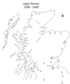 Leper Houses 1200-1600.png 1,590 × 1,911; 626 KB
-
 Linn ward.PNG 418 × 342; 11 KB
-
 Loc.lockerbie.png 400 × 533; 119 KB
-
 Location of the Kingdom of Scotland.PNG 250 × 115; 5 KB
-
 Lockerbie (Location).png 355 × 599; 119 KB
-
 Lothian County.svg 690 × 1,039; 1,003 KB
-
 Lothian location.png 400 × 457; 65 KB
-
 Lowland League.png 726 × 561; 297 KB
-
 Map of Scotland within the United Kingdom.svg 616 × 955; 125 KB
-
 Mapa dg achadh nan càrn.jpg 2,004 × 1,363; 599 KB
-
 Members of Clan Chattan.jpg 1,732 × 789; 237 KB
-
 Montrose-Scotland (Location).png 553 × 933; 177 KB
-
 Morayshire - Scotland.svg 690 × 1,039; 1,004 KB
-
 Na h-Eileanan an Iar council area.svg 603 × 753; 679 KB
-
 Na h-Eileanan Siar 2011.svg 599 × 746; 809 KB
-
 Newton Stewart-Scotland (Location).png 553 × 933; 177 KB
-
 NHSforthvalley.png 2,733 × 3,411; 218 KB
-
 North Ayrshire council area.svg 603 × 753; 675 KB
-
 North Berwick Scotland (Location).png 553 × 933; 182 KB
-
 North Lanarkshire, South Lanarkshire 1999.svg 596 × 747; 820 KB
-
 North Lanarkshire, South Lanarkshire 2011.svg 599 × 746; 809 KB
-
 Notable locations of MacPhail records ver 3.jpg 628 × 818; 69 KB
-
 Oban2 Scotland (Location).png 553 × 933; 182 KB
-
 Paisley Scotland (Location).png 553 × 933; 182 KB
-
 Perth-Scotland (Location).png 553 × 933; 177 KB
-
 Pittenweem Scotland (Location).png 553 × 933; 182 KB
-
 Port an Eilean Mhoir map.png 774 × 447; 56 KB
-
 Portpatrick-Scotland (Location).png 553 × 933; 177 KB
-
 Prestwick Location.PNG 1,154 × 1,535; 678 KB
-
 RenfrewshireBridgeOfWeir.png 200 × 149; 6 KB
-
 SCO UK EU map.PNG 2,048 × 1,720; 597 KB
-
 Scot loc gla big test.png 553 × 933; 178 KB
-
 Scot loc white surround test.png 553 × 933; 178 KB
-
Scotland (Location) Template (HR) (with dot).png 553 × 933; 177 KB
-
Scotland (Location) Template (HR).png 553 × 933; 178 KB
-
Scotland (Location) Template (with dot).png 144 × 250; 30 KB
-
Scotland (Location) Template.png 144 × 250; 30 KB
-
 Scotland (Location) Template.xcf 553 × 933; 435 KB
-
 Scotland location map - Central Belt.png 684 × 899; 150 KB
-
 Scotland location map.jpg 4,698 × 6,181; 1.69 MB
-

-
-
 Scotland locator map 2 September 2007 - equidistant cylindrical.png 905 × 732; 96 KB
-

-
 Scotland Mainland (Location) Template (HR).png 467 × 602; 161 KB
-
 Scotland Map (Firth of Clyde Detail) Holy Loch.png 250 × 158; 15 KB
-
 Scotland Map (Firth of Lorn Detail) Loch Leven.png 250 × 158; 13 KB
-
 Scotland Map British Isles.PNG 968 × 646; 78 KB
-
 Scotland map modern.png 2,500 × 2,500; 1.61 MB
-
 Scotland-Ben Nevis-Fort William (Location).png 553 × 933; 177 KB
-
 ScotlandAberdeenshireBanffBuchan.png 191 × 261; 4 KB
-
 ScotlandAngus.png 200 × 230; 4 KB
-
 ScotlandCaithnessTrad.png 200 × 229; 32 KB
-
 ScotlandCentral1974.png 200 × 229; 23 KB
-
 ScotlandGrampians1974.png 200 × 229; 23 KB
-
 ScotlandInvernessLieut.png 200 × 229; 23 KB
-
 ScotlandLothian1974.png 200 × 229; 23 KB
-
 ScotlandTayside1974.png 200 × 229; 23 KB
-
 Scottish infobox template map.png 1,154 × 1,535; 661 KB
-
 St Andrews (Location).png 553 × 933; 177 KB
-
 Stac Lee Location.PNG 648 × 584; 11 KB
-
 Staffa-Scotland (Location).png 144 × 250; 30 KB
-
 Stirling (Location).png 553 × 933; 177 KB
-
 Stirlingshire - Scotland.svg 690 × 1,039; 1,004 KB
-
 Stornoway (Location).png 553 × 933; 191 KB
-
 Stranraer-Scotland (Location).png 553 × 933; 177 KB
-
 Strathclyde Location in Scotland.png 400 × 457; 65 KB
-
 Sutherlandmap.png 2,095 × 2,351; 173 KB
-
 Tayside Location.png 400 × 457; 66 KB
-
 Thurso-Scotland (Location).png 553 × 933; 177 KB
-
 Turnberry kart.jpg 191 × 247; 9 KB
-
 Tweeddale.svg 690 × 1,039; 1,003 KB
-
 UK scotland.png 290 × 396; 10 KB
-
 UKScotland.jpg 120 × 148; 16 KB
-
 UKScotland.png 200 × 246; 7 KB
-
 West Lothian 1999.svg 596 × 747; 820 KB
-
 Westlothian.png 1,800 × 2,232; 136 KB
-
 Westlothiancountymap.png 1,800 × 2,232; 136 KB
-
 Whithorn-Scotland (Location).png 553 × 933; 177 KB
-
 Wick - Highland dot.png 1,802 × 3,001; 196 KB
-
 Wick Scotland.png 553 × 933; 168 KB
-
 Wick-Scotland (Location).png 553 × 933; 177 KB
-
 Wigtown-Scotland (Location).png 553 × 933; 177 KB
-
 Wigtownshire - Scotland.svg 690 × 1,039; 1,004 KB


.png)


.png)


.png)

.png)


.png)


.png)


.png)


.png)


.png)


.png)

.png)
.png)

.png)


.png)


.png)


.png)
.png)


.png)


.png)


.png)


.png)
.png)
.png)


.png)


.PNG)


.png)


.png)


.png)


.png)


.png)
.png)
.png)
.png)

.png)


_Template_(HR).png)
_Holy_Loch.png)
_Loch_Leven.png)


.png)


.png)

.png)
.png)

.png)
.png)


.png)


.png)


.png)
.png)
