Category:Geological maps of Scotland
Jump to navigation
Jump to search
Subcategories
This category has the following 11 subcategories, out of 11 total.
!
*
D
- Drainage basin maps of Scotland (49 F)
G
L
- Lewisian Gneiss - maps (4 F)
M
- Moine Supergroup - maps (4 F)
Media in category "Geological maps of Scotland"
The following 66 files are in this category, out of 66 total.
-
 100 of 'Pitman's Commercial Geography of the World' (11246951775).jpg 1,936 × 1,312; 557 KB
-
 165 of 'Pitman's Commercial Geography of the World' (11247131434).jpg 1,936 × 1,312; 682 KB
-
 Ballachullish District Geological Map Bailey 1960 Page073.jpg 4,810 × 3,836; 5.83 MB
-
 Carboniferous rocks Greig 1971 Page079.jpg 3,623 × 2,204; 874 KB
-
 Clough Glen Coe Geological Map, published 1909.tif 2,921 × 2,158; 4.46 MB
-
 Eartquake Map Scotland Stevenson 1889.png 2,397 × 3,128; 1.59 MB
-
 EB1911 Scotland - geological map.jpg 863 × 1,502; 400 KB
-
 Eday geology.png 744 × 1,022; 133 KB
-
 Fault Map Northern Highlands Phemister.jpg 3,697 × 2,849; 758 KB
-
 Geo map.jpg 2,362 × 1,690; 2.78 MB
-
 Geological Map Canonbie Peach 1903.png 6,625 × 4,392; 4.21 MB
-
 Geological Map Durness Callaway 1881 Quarterlyjourna371881geol 0294.jpg 2,101 × 2,181; 1.17 MB
-
 Geological Map Northern Highlands Phemister.jpg 3,738 × 2,827; 777 KB
-

-
 Geological Map of Stackaberg Thrust Fetlar, Published 1931.jpg 1,776 × 2,826; 428 KB
-
 Geological Survey Map of Great Britain, Sheet 1 North.jpg 12,212 × 9,663; 11.83 MB
-
 Geological Survey Map of Great Britain, Sheet 1 North.tiff 12,212 × 9,663; 221.36 MB
-
 Geology of Mull.png 3,452 × 3,004; 934 KB
-
 Geomapjoined.jpg 3,969 × 3,036; 10.41 MB
-
 Glencoul Thrust, 1923, key landscape.png 5,544 × 2,188; 8.07 MB
-
 Glencoul Thrust, 1923, key.svg 683 × 4,167; 10.57 MB
-
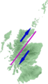 Great glen fault.png 144 × 250; 7 KB
-
 Harker Geological Map Isle of Rum 1903.jpg 2,405 × 2,578; 447 KB
-
 Hebridean Terrane.png 1,218 × 1,350; 553 KB
-
 Institute of Geological Sciences Geological Map of Arran Solid, Published 1972.jpg 11,764 × 13,888; 41.17 MB
-
 Islay Geology.png 747 × 917; 126 KB
-
 JHutton map.jpg 672 × 485; 57 KB
-
 JHutton map2.jpg 852 × 460; 51 KB
-
 Judd 1873 Geological Map Moray Firth Quarterlyjourna291873geol 0248.jpg 2,005 × 2,319; 321 KB
-
 Judd Geological Map Inner Hebrides 1878.jpg 2,822 × 4,745; 837 KB
-
 Kildonan Dykes OS Sheet NS 02.jpg 3,248 × 2,348; 1,002 KB
-
 Lower Glen Creran Geological Map Bailey 1960 Page083.jpg 4,799 × 3,800; 5.69 MB
-
 MacGregor Midland Valley Scotland Plate 4.jpg 3,959 × 2,866; 1.44 MB
-
 MacGregor Midland Valley Scotland Plate 5.jpg 3,175 × 2,864; 1.43 MB
-
 MacGregor Midland Valley Scotland Plate 6.jpg 3,074 × 2,840; 781 KB
-
 MacGregor Midland Valley Scotland Plate 8.jpg 2,128 × 2,866; 653 KB
-
 MainlandMoineOutcrop.png 744 × 1,052; 217 KB
-

-
 Moffat series Greig 1971 Page050.jpg 1,973 × 3,345; 1.12 MB
-
 Murchison Geological Map of Scotland, Published 1865, p31.jpg 2,944 × 3,699; 3.6 MB
-
 Old red sandstone Greig 1971 Page066.jpg 2,854 × 1,940; 1,008 KB
-
 Orcadian Basin extent.png 1,609 × 1,548; 296 KB
-
 OrkneyGeologyMap.png 709 × 840; 158 KB
-
 Peach Jura Geological Sketch Map Fig 5 1911.png 1,759 × 2,647; 599 KB
-
 Pringle Page046 Dob's Linn.jpg 2,900 × 1,816; 536 KB
-
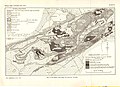
 Pringle Page102 Sketch map.jpg 3,300 × 2,900; 850 KB
-
 PSM V20 D372 Plan of the dissected vulcano of mull inner hebrides.jpg 1,437 × 1,601; 378 KB
-
 Quarterlyjourna341878geol 0413 Lapworth Plate XI.jpg 3,331 × 2,354; 1.5 MB
-
 Quarterlyjourna341878geol 0417 Lapworth Plate XII.jpg 2,288 × 3,497; 946 KB
-
 Quarterlyjourna341878geol 0421 Lapworth PLate XIII.jpg 3,169 × 1,683; 970 KB
-
 Read Page022 Islay Colonsay Jura.jpg 1,356 × 1,389; 185 KB
-
 Read Page058 Southern Highlands.jpg 3,749 × 2,868; 897 KB
-
 Richey Geological Map Scotland Dykes.jpg 671 × 1,086; 126 KB
-
 Richey tertiary igneous complex Ardnamurchan.jpg 3,842 × 2,837; 1.39 MB
-
 Richey tertiary igneous complex Mull.jpg 2,955 × 2,830; 771 KB
-
 Richey tertiary plateau lavas Mull.jpg 2,668 × 2,846; 758 KB
-
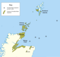
 Scotland (Location) Named (HR).png 455 × 759; 191 KB
-
 Scotland metamorphic zones EN.svg 1,300 × 900; 220 KB
-
 Scotland metamorphic zones NL.svg 1,300 × 900; 221 KB
-
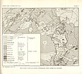
 Scotland.central.geological.jpg 1,000 × 973; 152 KB
-
 Shetland geology map.png 2,465 × 3,543; 741 KB
-
 Skye Geology.png 971 × 1,068; 296 KB
-
 The Quarterly journal of the Geological Society of London (13368873795).jpg 2,005 × 2,319; 568 KB
-
 The Quarterly journal of the Geological Society of London (1904) (14598497078).jpg 1,788 × 2,570; 479 KB
-
 The Quarterly journal of the Geological Society of London (1904) (14598619667).jpg 1,974 × 3,158; 791 KB
-
 Wyville-Thomson Ridge Location map.png 1,081 × 807; 458 KB
.jpg)
.jpg)


_Named_(HR).png)


.jpg)
_(14598497078).jpg)
_(14598619667).jpg)
