Category:Maps of Andhra Pradesh
Jump to navigation
Jump to search
States of India: Andhra Pradesh · Arunachal Pradesh · Assam · Bihar · Chhattisgarh · Goa · Gujarat · Haryana · Himachal Pradesh · Jharkhand · Karnataka · Kerala · Madhya Pradesh · Maharashtra · Manipur · Meghalaya · Mizoram · Nagaland · Odisha · Punjab · Rajasthan · Sikkim · Tamil Nadu · Telangana · Tripura · Uttar Pradesh · Uttarakhand · West Bengal
Union territories: Andaman and Nicobar Islands · Chandigarh · Dadra and Nagar Haveli and Daman and Diu · Delhi · Jammu and Kashmir · Ladakh · Lakshadweep · Puducherry
Former states of India: Jammu and Kashmir ·
Former union territories: Dadra and Nagar Haveli district · Daman and Diu ·
Union territories: Andaman and Nicobar Islands · Chandigarh · Dadra and Nagar Haveli and Daman and Diu · Delhi · Jammu and Kashmir · Ladakh · Lakshadweep · Puducherry
Former states of India: Jammu and Kashmir ·
Former union territories: Dadra and Nagar Haveli district · Daman and Diu ·
Wikimedia category | |||||
| Upload media | |||||
| Instance of | |||||
|---|---|---|---|---|---|
| Category combines topics | |||||
| Andhra Pradesh | |||||
state in South India, India   Imazene da satełite de łe fozi de l Godavari e del Krišna  .svg) | |||||
| Pronunciation audio | |||||
| Instance of | |||||
| Part of | |||||
| Named after | |||||
| Location | India | ||||
| Capital | |||||
| Legislative body | |||||
| Executive body |
| ||||
| Official language | |||||
| Anthem |
| ||||
| Head of state |
| ||||
| Head of government |
| ||||
| Inception |
| ||||
| Population |
| ||||
| Area |
| ||||
| Replaces | |||||
| Different from | |||||
| official website | |||||
 | |||||

Subcategories
This category has the following 20 subcategories, out of 20 total.
!
*
B
- Blank maps of Andhra Pradesh (6 F)
C
D
E
M
- Maps of Vijayawada (1 F)
O
R
- Maps of Rayalaseema (9 F)
T
Pages in category "Maps of Andhra Pradesh"
This category contains only the following page.
Media in category "Maps of Andhra Pradesh"
The following 24 files are in this category, out of 24 total.
-
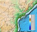 Andhra Pradesh and Telangana Physical.jpeg 2,598 × 2,244; 796 KB
-
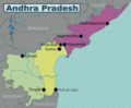
 Andhra Pradesh and Telangana.png 909 × 867; 53 KB
-
 Andhra Pradesh deu.png 842 × 777; 1.03 MB
-
 Andhra Pradesh outline shape.svg 300 × 300; 167 KB
-
 Andhra Pradesh topo leer.png 842 × 777; 1.03 MB
-
 Andhra Pradesh WV.png 2,773 × 2,292; 1.11 MB
-
 Andhra pradesh.png 1,200 × 1,366; 173 KB
-
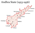 Andhra State (1953 - 1956).png 5,000 × 4,735; 1.19 MB
-
 AndhraPradesh state map.jpg 1,053 × 1,011; 155 KB
-
 AP 2019 AC Result-en.pdf 1,785 × 1,458; 111 KB
-
 AP 2019 AC Result-te.pdf 2,481 × 1,754; 166 KB
-
 Geology Elgundel Circar.jpg 946 × 597; 332 KB
-
 Guntur, Krishna, Part of West Godavari areas in Krishna River basin.png 296 × 358; 130 KB
-
 IN-AP small.png 181 × 181; 15 KB
-
 IN-AP small.svg 450 × 450; 166 KB
-
 Kavali railway.png 250 × 233; 37 KB
-
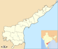 Location map India Andhra Pradesh.png 878 × 747; 136 KB
-
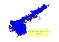
 Municipal Corporations in Andhra Pradesh.png 7,874 × 6,693; 819 KB
-
 Municipalities Map in Andhra Pradesh.jpg 3,508 × 2,480; 1.42 MB
-
 Nagilla.png 705 × 600; 120 KB
-
 Penner Penna river south Andhra Pradesh.jpg 449 × 441; 115 KB
-
 Tondai Nadu (INRS).jpg 500 × 620; 93 KB
-
 Tondai Nadu AP + TN (INRS).png 850 × 1,041; 277 KB
-
 Tondai Nadu AP+TN (NRS).jpg 1,080 × 1,439; 669 KB


.png)


.jpg)
.png)
.jpg)