Category:Blank maps of Andhra Pradesh
Jump to navigation
Jump to search
Media in category "Blank maps of Andhra Pradesh"
The following 6 files are in this category, out of 6 total.
-
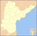 Blank map Andhra Pradesh state and districts (before 2014).png 923 × 881; 136 KB
-
 Blank map Andhra Pradesh state and districts.png 923 × 881; 146 KB
-
 India Andhra Pradesh location map (current).svg 1,027 × 849; 358 KB
-
 India Andhra Pradesh location map (until 2014).svg 2,716 × 2,531; 421 KB
-
 Location map India Andhra Pradesh (1956-2014).png 643 × 600; 105 KB
-
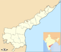 Location map India Andhra Pradesh.png 878 × 747; 136 KB
.svg)
.svg)
.png)

.png)