Category:Maps of Amersfoort
Jump to navigation
Jump to search
Wikimedia category | |||||
| Upload media | |||||
| Instance of | |||||
|---|---|---|---|---|---|
| Category combines topics | |||||
| Amersfoort | |||||
municipality in the province of Utrecht, the Netherlands  Koppelpoort i Amersfoort   .svg) | |||||
| Spoken text audio | |||||
| Instance of |
| ||||
| Location | Utrecht, Netherlands | ||||
| Located in or next to body of water | |||||
| Capital | |||||
| Executive body |
| ||||
| Head of government |
| ||||
| Inception |
| ||||
| Significant event |
| ||||
| Population |
| ||||
| Area |
| ||||
| Elevation above sea level |
| ||||
| official website | |||||
 | |||||
Subcategories
This category has the following 6 subcategories, out of 6 total.
Pages in category "Maps of Amersfoort"
This category contains only the following page.
Media in category "Maps of Amersfoort"
The following 25 files are in this category, out of 25 total.
-
 2013-Amersfoort.jpg 2,377 × 2,307; 3.6 MB
-
 2015BirktTopo.jpg 1,600 × 1,200; 1.4 MB
-
 2015BirktTopoHoogte.jpg 1,550 × 1,006; 1.19 MB
-
 20160422-E3 - Plattegrond De Nieuwe Stad, Amersfoort.jpg 2,878 × 4,345; 3.7 MB
-
 Amersfoort - NARA - 100306879.jpg 14,528 × 12,060; 44.21 MB
-
 Amersfoort Midden svg.png 625 × 575; 35 KB
-
 Amersfoort Noord svg.png 625 × 575; 42 KB
-
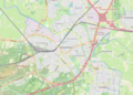 Amersfoort OSM 01.png 824 × 589; 429 KB
-
 Amersfoort OSM 02.png 824 × 589; 639 KB
-
 Amersfoort Zuid svg.png 625 × 575; 37 KB
-
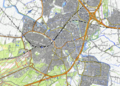
 Amersfoort-centrum-OpenTopo.jpg 4,983 × 3,674; 6.82 MB
-
 Amersfoort-plaats-OpenTopo.jpg 2,538 × 3,053; 4.91 MB
-
 Amersfoort-stad-2014Q1.jpg 2,538 × 3,053; 4.67 MB
-
 Amersfoort-topografie.jpg 1,778 × 2,458; 3.33 MB
-
 BAG woonplaatsen - Gemeente Amersfoort.png 2,419 × 2,419; 797 KB
-
 Coelhorst plattegrond.jpg 1,181 × 883; 287 KB
-
 Dutch Municipality Amersfoort 2006.png 280 × 130; 9 KB
-
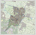
 Gem-Amersfoort-2014Q1.jpg 4,584 × 4,524; 9.77 MB
-
 Gem-Amersfoort-OpenTopo.jpg 5,453 × 5,514; 5.9 MB
-
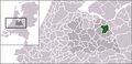 Locatie Amersfoort.png 270 × 130; 9 KB
-
 LocatieAmersfoort.png 280 × 130; 9 KB
-
 Location Map Netherlands Amersfoort.png 928 × 807; 1.31 MB
-
 Map - NL - Amersfoort (2009).svg 625 × 575; 1.99 MB
-
 NL - locator map municipality code GM0307 (2016).png 2,125 × 1,417; 612 KB
-
 Plattegrond wijk Oliemolenkwartier - Eemkwartier - De Nieuwe Stad - Amersfoort.JPG 1,869 × 1,222; 437 KB


.svg)
.png)
