Category:Old maps of Amersfoort
Jump to navigation
Jump to search
Subcategories
This category has only the following subcategory.
M
Media in category "Old maps of Amersfoort"
The following 22 files are in this category, out of 22 total.
-
 1035 of 'Atlas, etc' (11167750526).jpg 2,256 × 1,518; 892 KB
-

-
 Amersfoort Thomkins 1846.jpg 4,724 × 3,124; 7.74 MB
-
 Amersfoort Van Vooren en Wagemaker 1888.jpg 3,135 × 2,203; 5.13 MB
-
 Amersfoort.png 1,607 × 1,395; 248 KB
-
 Berg en Dal, Olij Molen en Rivier de Eem - uitsnede uit Thomkins 1846.png 1,328 × 1,080; 2.54 MB
-
 Dool om Bergh 1001 041.jpg 468 × 1,000; 178 KB
-
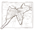
 Historische Ruimtelijke Waarderingskaart 1 - Amersfoort - 20008966 - RCE.jpg 1,200 × 905; 186 KB
-
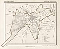
 Historische Waarderingskaart - Amersfoort - 20008965 - RCE.jpg 1,200 × 887; 218 KB
-
 Hoogland.png 1,572 × 1,423; 294 KB
-

-

-
 KAARTEN SGD - Wijziging van de grens tusschen de gemeenten Amersfoort en Leusden.jpeg 5,472 × 1,871; 788 KB
-
 Lambert-van-den-Bos-Lieuwe-van-Aitzema-Historien-onses-tyds MGG 0404.tif 4,121 × 3,556; 41.96 MB
-
 Lambert-van-den-Bos-Schauplatz-des-Krieges MG 9492.tif 5,316 × 3,276; 49.86 MB
-
 Netherlands, Amersfoort, map of 1865.JPG 2,369 × 1,951; 942 KB
-

-

-
 Plattegrond naar tekening - Amersfoort - 20008945 - RCE.jpg 1,200 × 1,184; 290 KB
-
 Plattegrond te beschermen stadsgezicht - Amersfoort - 20008967 - RCE.jpg 1,200 × 898; 187 KB
-

-
 Plattegrond van de stad naar uitgave A.N.W.B. - Amersfoort - 20008944 - RCE.jpg 1,200 × 894; 311 KB
.jpg)


.png)
