<nowiki>Category:Maps of Oudewater; categoría de Wikimedia; kategori Wikimedia; Wikimedia category; د ويکيمېډيا وېشنيزه; Vikimedya kategorisi; ویکیمیڈیا زمرہ; kategória projektov Wikimedia; категорія проєкту Вікімедіа; 维基媒体分类; Wikimedia-Kategorie; kategorie na projektech Wikimedia; Wikimedia-Kategorie; विकिपीडिया:श्रेणी; page de catégorie de Wikimedia; kategorija na Wikimediji; विकिपीडिया वर्ग; категорија на Викимедији; Wikimedia-Kategorie; Wikimedia-kategori; kategori Wikimédia; تصنيف ويكيميديا; pajenn rummata eus Wikimedia; Wikimedia:ကဏ္ဍခွဲခြင်း; 維基媒體分類; Wikimedia категориясы; categoría de Wikimedia; Wikimedia-categorie; Wikimedia-Kategorie; tudalen categori Wikimedia; kategori e Wikimedias; Վիքիմեդիայի նախագծի կատեգորիա; 维基媒体分类; Wikimedia-kategori; ვიკიპედია:კატეგორიზაცია; ウィキメディアのカテゴリ; categoria Wikimedia; تصنيف بتاع ويكيميديا; විකිමීඩියා ප්රභේද පිටුව; categoria Vicimediorum; Vikipidiya:Shopni; Wikimedia-luokka; Wikimedia category; guruhi Vikimedia; катэгорыя ў праекце Вікімэдыя; Викимедиа проектындагы төркем; catigurìa di nu pruggettu Wikimedia; หน้าหมวดหมู่วิกิมีเดีย; Wikimedia:Kategorija; Wikimedia-Kategorie; Wikimedia:Klassys; категория на Уикимедия; categorie a unui proiect Wikimedia; categurìa 'e nu pruggette Wikimedia; Wikimedia-kategori; kawan Wikimèdia; гурӯҳи Викимедиа; 위키미디어 분류; Wikimedia-bólkur; kategorio en Vikimedio; kategori Wikimedia; categoría de Wikimedia; উইকিমিডিয়া বিষয়শ্রেণী; kategori Wikimedia; 维基媒体分类; וויקימעדיע קאַטעגאָריע; kategorija w projektach Wikimedije; thể loại Wikimedia; Wikimedia projekta kategorija; Wikimedia-kategorie; categoria de um projeto da Wikimedia; Wikimedia category; категорияд Ангилал; Wikimedia-kategori; kategori Wikimedia; پۆلی ویکیمیدیا; Wikimedia category; Vikimédia ñemohenda; Wikimédia-kategória; વિકિપીડિયા શ્રેણી; Wikimediako kategoria; категория в проекте Викимедиа; Wikimedia-Kategorie; катэгорыя ў праекце Вікімедыя; Wikimedia-kategorie; Wîkîmediya:Kategorî; विकिमिडिया श्रेणी; Wikimedia-Kategorie; קטגוריה במיזמי ויקימדיה; Викимедиа проектындагы төркем; 维基媒体分类; विकिमिडिया श्रेणी; jamii ya Wikimedia; Wikimedia-kategoriija; гурӯҳи Викимедиа; 維基媒體分類; Wikimedia:Ronnaghys; Wikimedia-categorie; categoria di un progetto Wikimedia; Wikimedia-categorie; 维基媒体分类; 維基媒體分類; Wikimedia kategooria; Wikimedia-Kategorie; Wikimedia-kategory; kategorya ng Wikimedia; 維基媒體分類; ẹ̀ka Wikimedia; Викимедиина категорија; categoria de um projeto da Wikimedia; kategorija na Wikimediji; ردهٔ ویکیپدیا; tumbung Wikimedia; kategoria ti Wikimedia; kategorija Wikimedije; Wikimedia proyektındağı törkem; Викимедиа категорияһы; categoria de Wikimedia; kategori Wikimedia; kategoria w projekcie Wikimedia; വിക്കിമീഡിയ വർഗ്ഗം; 維基媒體分類; kategori Wikimedia; விக்கிமீடியப் பகுப்பு; زمرو:وڪيپيڊيا زمرا بندي; Viciméid catagóir; categoría de Wikimedia; Kategoriya ning Wikimedia; κατηγορία εγχειρημάτων Wikimedia; विकिमीडिया श्रेणी</nowiki>
Subcategories
This category has the following 3 subcategories, out of 3 total.


.png)

 2013-Oudewater.jpg 1,906 × 1,757; 2.52 MB
 Dutch Municipality Oudewater 2006.png 280 × 130; 9 KB
 Gem-Oudewater-2014Q1.jpg 3,687 × 3,539; 7.37 MB
 Gem-Oudewater-OpenTopo.jpg 4,100 × 4,017; 2.92 MB
 LocatieOudewater.png 270 × 130; 9 KB
 Map - NL - Oudewater (2009).svg 625 × 575; 1.51 MB
 Montfoort Willeskop Oude Kaart Ojerslust.jpg 937 × 565; 90 KB
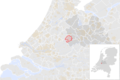 NL - locator map municipality code GM0589 (2016).png 2,125 × 1,417; 557 KB
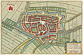 Oudewater 1649 Blaeu 1 van 4.jpg 750 × 503; 178 KB
 Oudewater-centrum-OpenTopo.jpg 2,834 × 2,726; 2.51 MB
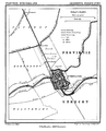 Oudewater.png 1,300 × 1,604; 323 KB

 Plattegrond van van Deventer - Oudewater - 20179568 - RCE.jpg 1,200 × 864; 358 KB
 Ysselstein +3 1649 Blaeu.jpg 750 × 530; 166 KB


.svg)


