Category:Maps of 14th-century Europe
Jump to navigation
Jump to search
| Preceded by: Maps of 13th-century Europe |
Maps of 14th-century Europe 1301 AD-1400 AD |
Succeeded by: Maps of 15th-century Europe |
Subcategories
This category has the following 11 subcategories, out of 11 total.
E
- Maps of 14th-century England (8 F)
F
- Maps of 14th-century France (48 F)
G
I
- Maps of 14th-century Italy (13 F)
M
- Maps of 14th-century Poland (4 F)
O
S
Media in category "Maps of 14th-century Europe"
The following 71 files are in this category, out of 71 total.
-
 Deutscher Orden in Europa 1300.png 2,500 × 1,897; 522 KB
-
 13001350ALBANIANMIGRATIONS.png 519 × 591; 386 KB
-
 Östromerska och osmanska rikena slutet av 1300talet.jpg 2,016 × 1,131; 959 KB
-
 Sweden 1323.png 1,254 × 1,743; 257 KB
-
 South East Europe 1340.gif 1,113 × 854; 363 KB
-
 South Eastern Europe c. 1340.gif 1,113 × 854; 682 KB
-
 South-eastern Europe 1340.svg 2,086 × 1,483; 2.51 MB
-
 Europe en 1350.pdf 1,752 × 1,239; 500 KB
-
 Modern history; Europe (1904) (14765448382).jpg 2,992 × 2,020; 1.83 MB
-
 AtHistEur1360.jpg 1,317 × 1,445; 274 KB
-
 Europe 1360 (cropped).jpg 1,753 × 1,101; 831 KB
-
 Europe 1360.jpg 1,817 × 1,120; 695 KB
-
 Historical atlas of modern Europe 1903 (135895371).jpg 9,187 × 6,948; 64.91 MB
-

-

-
 Diffusion de la peste noire 1347 1351.svg 966 × 1,167; 1.15 MB
-
 Difusió de la gran pesta a Europa.png 483 × 585; 128 KB
-
 Europe in 1328 (cropped).png 508 × 330; 6 KB
-
 Europe in 1328 112619.png 2,150 × 2,337; 208 KB
-
 Europe in 1328-ko.svg 1,075 × 1,168; 160 KB
-
 Europe in 1328.png 2,150 × 2,336; 761 KB
-
 Europe in 1345.png 1,075 × 1,168; 114 KB
-
 Europe in the 14th Century.jpg 1,549 × 1,134; 620 KB
-
 Europe Moyen-âge.jpg 3,543 × 2,577; 2.25 MB
-
 Europe religieuse 1360.jpg 1,433 × 901; 1.06 MB
-
 Europe13eS.jpg 800 × 600; 398 KB
-
 EuropeMap1328-ar.png 1,075 × 1,168; 917 KB
-
 Hanse-Orden.png 1,263 × 753; 210 KB
-
 Holy Roman Empire at the Golden Bull of 1356.png 4,872 × 4,672; 6.36 MB
-
 Imperio de Aragón.png 772 × 252; 34 KB
-
 Kalmarunionen.png 540 × 238; 70 KB
-
 Karel-IV..jpg 912 × 685; 385 KB
-
 Karte Böhmen unter Karl IV.-es.svg 396 × 394; 1.64 MB
-
 Karte Böhmen unter Karl IV.png 823 × 821; 178 KB
-
 Korolivstvo Ruske 13-14 stolittia.png 1,024 × 861; 188 KB
-
-
 Map Bavaria-Straubing - Karte Straubing-Holland.png 1,000 × 984; 256 KB
-
 Map of bohemia 1301.png 1,024 × 1,040; 287 KB
-
 Map of the Crown of Aragon.svg 2,317 × 977; 557 KB
-

-
 Mapa de la Corona d'Aragón.svg 2,317 × 977; 556 KB
-
 Mapa de la Corona de Aragón.svg 2,317 × 977; 555 KB
-
 MAPA HISTORICO DE EUROPA.jpg 1,302 × 1,044; 1.09 MB
-
 Mapa la Corona d'Aragón.svg 2,317 × 977; 556 KB
-
 Medieval Bosnian State Expansion-en.svg 941 × 709; 938 KB
-
 Medieval Bosnian State Expansion-es.svg 2,424 × 1,938; 1.38 MB
-
 Oligarchs in the Kingdom of Hungary 14th century.svg 991 × 778; 334 KB
-
 Ostdeutsche Kolonisation Putzger 1893.jpg 1,385 × 1,908; 2.11 MB
-
 P-tés slaves orientales du Sud-Ouest et vassaux en 1300.png 537 × 754; 170 KB
-
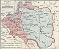 Poland at the end of the 14th century.jpg 575 × 480; 78 KB
-
 Pommern1477.JPG 844 × 606; 98 KB
-

-
 Public Schools Historical Atlas - Europe 14C cropped.jpg 1,465 × 1,177; 881 KB
-
 Public Schools Historical Atlas - Europe 14th century.jpg 2,023 × 1,552; 1.08 MB
-
 Putz32.jpg 2,925 × 1,755; 438 KB
-
 Reiseroute von Johanna von Bayern 1370.png 1,000 × 983; 263 KB
-
 République de Volterra 6.png 478 × 599; 86 KB
-
 Second Bulgarian Empire after 1371-es.svg 845 × 1,120; 1.88 MB
-
 Second Bulgarian Empire after 1371.png 1,451 × 1,997; 681 KB
-
 Shepherd-c-077.jpg 1,539 × 966; 424 KB
-
 South-eastern Europe 1340.jpg 1,122 × 870; 330 KB
-
 Southeastern Europe in the 14th century.jpg 384 × 444; 131 KB
-
 Spatmittelalter.jpg 1,140 × 857; 1.15 MB
-
 Templerorden in Europa 1300.png 2,500 × 1,906; 668 KB
-
 Vidin 14.jpg 1,000 × 657; 172 KB
-
 War of the Brabantian Succession (1355–1357) locator map.svg 2,813 × 3,602; 388 KB
-
 Історія України-Русі. 1912. Карта Східньої та Північньої Европи початком XIV століття.jpg 2,381 × 1,823; 2.48 MB
-
 Аквилейский-патриархат-1378.png 700 × 547; 358 KB
-
 Карта Богемии при Карле IV ру.png 1,646 × 1,642; 285 KB
-
 МК1360.jpg 672 × 462; 86 KB
-
 查理四世时期的波西米亚地图.png 823 × 821; 224 KB


_(14765448382).jpg)

.jpg)

.jpg)
.jpg)
)%27_(11149347693).jpg)


.png)


.jpg)


_locator_map.svg)


