Category:Maps of 14th-century Asia
Jump to navigation
Jump to search
Subcategories
This category has the following 4 subcategories, out of 4 total.
I
O
P
Media in category "Maps of 14th-century Asia"
The following 24 files are in this category, out of 24 total.
-
 Östromerska och osmanska rikena slutet av 1300talet.jpg 2,016 × 1,131; 959 KB
-
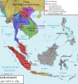 Southeastasia 1317 map de.svg 1,070 × 1,150; 12.63 MB
-
 Southeastasia 1380 map de.png 2,500 × 2,687; 2.67 MB
-
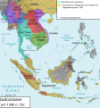 Südostasien 1380.svg 1,070 × 1,150; 12.62 MB
-
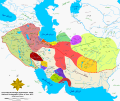 Iran-anarchy era.svg 3,618 × 3,042; 1.39 MB
-

-
 Asia in 1345.svg 1,100 × 837; 1.02 MB
-
 Iran-anarchy era-es.svg 3,618 × 3,042; 3.67 MB
-
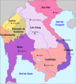 Laos - Reiaume de Lan Xang.png 783 × 874; 179 KB
-
 Majapahit Empire de.svg 512 × 297; 520 KB
-
 Majapahit Empire id.svg 512 × 297; 546 KB
-
 Majapahit Empire-es.svg 1,380 × 800; 2.12 MB
-
 Majapahit Empire-pt.svg 512 × 297; 613 KB
-
 Majapahit Empire-sr.svg 512 × 297; 525 KB
-
 Majapahit Empire-zh-hans.svg 512 × 297; 520 KB
-
 Majapahit Empire.svg 512 × 297; 524 KB
-
 Map-of-southeast-asia 1400 CE km.PNG 791 × 1,114; 291 KB
-
 Mongolia XVII.png 954 × 532; 736 KB
-
 Southeastasia 1317 map de.png 2,501 × 2,688; 2.58 MB
-
 Trebizond1300.png 552 × 392; 67 KB
-
 Índico e rota da Seda século XIV.png 800 × 800; 357 KB
-
 Índico e rota da Seda século XIV.svg 800 × 800; 690 KB
-
 Инджуиды.png 620 × 429; 29 KB
-
 Турецькі бейлики XIV століття..png 1,080 × 535; 471 KB


