Category:Locator maps of boroughs and census areas of Alaska
Jump to navigation
Jump to search
States of the United States: Alabama · Alaska · Arizona · Arkansas · California · Colorado · Connecticut · Delaware · Florida · Georgia · Hawaii · Idaho · Illinois · Indiana · Iowa · Kansas · Kentucky · Louisiana · Maine · Maryland · Massachusetts · Michigan · Minnesota · Mississippi · Missouri · Montana · Nebraska · Nevada · New Hampshire · New Jersey · New Mexico · New York · North Carolina · North Dakota · Ohio · Oklahoma · Oregon · Pennsylvania · Rhode Island · South Carolina · South Dakota · Tennessee · Texas · Utah · Vermont · Virginia · Washington · West Virginia · Wisconsin · Wyoming
| NO WIKIDATA ID FOUND! Search for Locator maps of boroughs and census areas of Alaska on Wikidata | |
| Upload media |
English: Locator maps for boroughs and census areas in Alabama.
Media in category "Locator maps of boroughs and census areas of Alaska"
The following 52 files are in this category, out of 52 total.
-
 Alaska divided for stubs.png 955 × 541; 45 KB
-
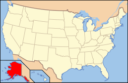
 Alaska Locator Map with US.PNG 738 × 501; 36 KB
-
 Aleutians West Census Area.jpg 726 × 549; 44 KB
-
 Anchorage Metropolitan Area.png 955 × 541; 43 KB
-
 AnchorageMetro.png 575 × 425; 19 KB
-
 Bethel Census Area.jpg 677 × 546; 84 KB
-
 Dillingham Census Area.jpg 721 × 541; 63 KB
-
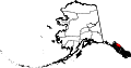
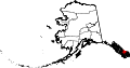
 Map of Alaska highlighting Aleutians East Borough.svg 1,470 × 777; 338 KB
-
 Map of Alaska highlighting Aleutians West Census Area.svg 1,470 × 777; 338 KB
-
 Map of Alaska highlighting Anchorage Municipality.svg 1,470 × 777; 338 KB
-
 Map of Alaska highlighting Bethel Census Area.svg 1,470 × 777; 338 KB
-
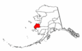
 Map of Alaska highlighting Bristol Bay Borough.svg 1,470 × 777; 370 KB
-
 Map of Alaska highlighting Chugach Census Area.svg 1,470 × 777; 402 KB
-
 Map of Alaska highlighting Copper River Census Area.svg 1,470 × 777; 373 KB
-
 Map of Alaska highlighting Denali Borough.svg 1,470 × 777; 338 KB
-
 Map of Alaska highlighting Dillingham Census Area.svg 1,470 × 777; 338 KB
-
 Map of Alaska highlighting Fairbanks North Star Borough.svg 1,470 × 777; 338 KB
-
 Map of Alaska highlighting Haines Borough.svg 1,470 × 777; 338 KB
-
 Map of Alaska highlighting Hoonah-Angoon Census Area.svg 1,470 × 777; 584 KB
-
 Map of Alaska highlighting Juneau City and Borough.svg 1,470 × 777; 338 KB
-
 Map of Alaska highlighting Kenai Peninsula Borough.svg 1,470 × 777; 338 KB
-
 Map of Alaska highlighting Ketchikan Gateway Borough in 2000.svg 1,470 × 777; 338 KB
-
 Map of Alaska highlighting Ketchikan Gateway Borough.svg 1,470 × 777; 411 KB
-
 Map of Alaska highlighting Kodiak Island Borough.svg 1,470 × 777; 338 KB
-
 Map of Alaska highlighting Kusilvak Census Area.svg 1,470 × 777; 338 KB
-
 Map of Alaska highlighting Lake and Peninsula Borough.svg 1,470 × 777; 338 KB
-
 Map of Alaska highlighting Matanuska-Susitna Borough.svg 1,470 × 777; 338 KB
-
 Map of Alaska highlighting Nome Census Area.svg 1,470 × 777; 338 KB
-
 Map of Alaska highlighting North Slope Borough.svg 1,470 × 777; 338 KB
-
 Map of Alaska highlighting Northwest Arctic Borough.svg 1,470 × 777; 338 KB
-
 Map of Alaska highlighting Petersburg Census Area.svg 1,470 × 777; 428 KB
-
 Map of Alaska highlighting Prince of Wales-Hyder Census Area.svg 1,470 × 777; 475 KB
-
 Map of Alaska highlighting Prince of Wales-Outer Ketchikan Census Area.svg 1,470 × 777; 338 KB
-
 Map of Alaska highlighting Sitka City and Borough.png 300 × 186; 5 KB
-
 Map of Alaska highlighting Sitka City and Borough.svg 1,470 × 777; 338 KB
-
 Map of Alaska highlighting Skagway City and Borough.svg 1,470 × 777; 372 KB
-
 Map of Alaska highlighting Skagway-Hoonah-Angoon Census Area.svg 1,470 × 777; 338 KB
-
 Map of Alaska highlighting Southeast Fairbanks Census Area.svg 1,470 × 777; 338 KB
-
 Map of Alaska highlighting the Unorganized Borough.svg 1,470 × 777; 420 KB
-
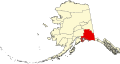 Map of Alaska highlighting Valdez-Cordova Census Area.svg 1,470 × 777; 416 KB
-
 Map of Alaska highlighting Wade Hampton Census Area.png 300 × 186; 6 KB
-
 Map of Alaska highlighting Wrangell City and Borough.svg 1,470 × 777; 412 KB
-
 Map of Alaska highlighting Yakutat City and Borough.svg 1,470 × 777; 789 KB
-
 Map of Alaska highlighting Yukon-Koyukuk Census Area.svg 1,470 × 777; 338 KB
-
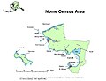 Nome Census Area.jpg 696 × 536; 52 KB
-
 Prince of Wales-Outer Ketchikan Census Area.jpg 659 × 552; 79 KB
-
 Skagway-Hoonah-Angoon Census Area.jpg 622 × 541; 60 KB
-
 Southeast Fairbanks Census Area.jpg 663 × 521; 58 KB
-
 Valdez-Cordova Census Area.jpg 620 × 534; 102 KB
-
 Wade Hampton Census Area.jpg 639 × 535; 73 KB
-
 Wrangell-Petersburg Census Area.jpg 642 × 528; 72 KB
-
 Yukon-Koyukuk Census Area.jpg 651 × 535; 97 KB


