Category:Locator maps of counties of Delaware
Jump to navigation
Jump to search
States of the United States: Alabama · Alaska · Arizona · Arkansas · California · Colorado · Connecticut · Delaware · Florida · Georgia · Hawaii · Idaho · Illinois · Indiana · Iowa · Kansas · Kentucky · Louisiana · Maine · Maryland · Massachusetts · Michigan · Minnesota · Mississippi · Missouri · Montana · Nebraska · Nevada · New Hampshire · New Jersey · New Mexico · New York · North Carolina · North Dakota · Ohio · Oklahoma · Oregon · Pennsylvania · Rhode Island · South Carolina · South Dakota · Tennessee · Texas · Utah · Vermont · Virginia · Washington · West Virginia · Wisconsin · Wyoming
| NO WIKIDATA ID FOUND! Search for Locator maps of counties of Delaware on Wikidata | |
| Upload media |
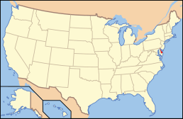
English: Locator maps for counties in Delaware.
Subcategories
This category has only the following subcategory.
Media in category "Locator maps of counties of Delaware"
The following 3 files are in this category, out of 3 total.
-
 Map of Delaware highlighting Kent County.svg 6,483 × 15,432; 11 KB
-
 Map of Delaware highlighting New Castle County.svg 6,483 × 15,432; 11 KB
-
 Map of Delaware highlighting Sussex County.svg 6,483 × 15,432; 11 KB


