Category:Houses in Cornwall
Jump to navigation
Jump to search
Ceremonial counties of England: Bedfordshire · Berkshire · Buckinghamshire · Cambridgeshire · Cheshire · Cornwall · Cumbria · Derbyshire · Devon · Dorset · Durham · East Riding of Yorkshire · East Sussex · Essex · Gloucestershire · Greater London · Greater Manchester · Hampshire · Herefordshire · Hertfordshire · Isle of Wight · Kent · Lancashire · Leicestershire · Lincolnshire · Merseyside · Norfolk · North Yorkshire · Northamptonshire · Northumberland · Nottinghamshire · Oxfordshire · Rutland · Shropshire · Somerset · South Yorkshire · Staffordshire · Suffolk · Surrey · Tyne and Wear · Warwickshire · West Midlands · West Sussex · West Yorkshire · Wiltshire · Worcestershire
City-counties: Bristol · City of London
Former historic counties: Huntingdonshire · Westmorland ·
Other former counties:
City-counties: Bristol · City of London
Former historic counties: Huntingdonshire · Westmorland ·
Other former counties:
Wikimedia category | |||||
| Upload media | |||||
| Instance of | |||||
|---|---|---|---|---|---|
| |||||
Subcategories
This category has the following 32 subcategories, out of 32 total.
- Detached houses in Cornwall (102 F)
*
B
- Bar Lodge, Porthleven (13 F)
- Brooks, Boconnoc (3 F)
C
D
- Duckpool Cottage, Cornwall (2 F)
F
- Houses in Fowey (17 F)
H
- Houses in Hayle (22 F)
L
- Houses in Launceston, Cornwall (12 F)
M
- Houses in Marazion (9 F)
P
- Houses in Penryn (131 F)
- Place House, St Anthony (12 F)
S
T
- Houses in Torpoint (7 F)
- Trevarno House (4 F)
W
- White houses in Cornwall (54 F)
Media in category "Houses in Cornwall"
The following 200 files are in this category, out of 387 total.
(previous page) (next page)-
 'Old School House', Mylor Bridge - geograph.org.uk - 125381.jpg 640 × 426; 115 KB
-
 'The Boathouse' - geograph.org.uk - 1422986.jpg 640 × 480; 90 KB
-
 'Wild Acres' holiday accommodation - geograph.org.uk - 125399.jpg 640 × 426; 149 KB
-

-
 A funky house - geograph.org.uk - 342417.jpg 640 × 480; 93 KB
-
 A house at Hawkers Cove - geograph.org.uk - 1466420.jpg 640 × 421; 99 KB
-
 A Red House at Lower Treluswell - geograph.org.uk - 161367.jpg 640 × 423; 128 KB
-
 Antony Passage.jpg 3,373 × 2,616; 3.01 MB
-
 Apartments on The Truro River - geograph.org.uk - 100351.jpg 640 × 453; 84 KB
-
 Approaching Garras crossroads - geograph.org.uk - 384961.jpg 640 × 480; 78 KB
-
-
 Boconnoc (9333527339).jpg 4,608 × 2,592; 3.07 MB
-
 Boscastle Harbour, Cornwall - panoramio (5).jpg 2,048 × 1,535; 1.12 MB
-
 Boscundle Manor - geograph.org.uk - 1349634.jpg 640 × 480; 100 KB
-
 Bosigran Count House - geograph.org.uk - 971082.jpg 640 × 480; 213 KB
-
 Boslowen - geograph.org.uk - 3179132.jpg 640 × 480; 50 KB
-
 Bosvigo Road, Truro - geograph.org.uk - 551787.jpg 445 × 640; 83 KB
-
 Boswednack Manor - geograph.org.uk - 1483669.jpg 640 × 480; 97 KB
-
 Bridge - geograph.org.uk - 189328.jpg 640 × 425; 109 KB
-
 British Isles urban Cornwall 2007 (496602270).jpg 2,048 × 1,371; 540 KB
-
 British Isles urban Cornwall 2007 (496602762).jpg 2,048 × 1,371; 543 KB
-
 Building at Boswednack Farm - geograph.org.uk - 1483662.jpg 640 × 480; 96 KB
-
 Buildings at Tregonebris - geograph.org.uk - 1379353.jpg 640 × 427; 93 KB
-
 Buryas Bridge.jpg 3,024 × 4,032; 4.86 MB
-
 Calstock, Danesbrook Valley House - geograph.org.uk - 673399.jpg 640 × 427; 178 KB
-
 CamelfordStationMastersHouseCornwall.jpg 640 × 462; 108 KB
-
 Cape Cornwall - geograph.org.uk - 216204.jpg 640 × 480; 119 KB
-
 Cape Cornwall - geograph.org.uk - 604913.jpg 640 × 480; 78 KB
-
 Carclew House.jpg 400 × 252; 13 KB
-
 Chapel Town, Summercourt - geograph.org.uk - 228306.jpg 640 × 427; 88 KB
-
 Church Hill, Helston, August 2022 (1).jpg 4,032 × 3,024; 9.09 MB
-
 Churchyard and Houses in Sheviock - geograph.org.uk - 370038.jpg 640 × 473; 113 KB
-
 Chykembro house - geograph.org.uk - 1483646.jpg 640 × 480; 80 KB
-
 Corner Cottage - panoramio.jpg 4,320 × 3,240; 3.04 MB
-
 Cornwall 2007 (496538859).jpg 2,048 × 1,371; 901 KB
-
 Cornwall 2007 (496633383).jpg 2,048 × 1,371; 580 KB
-
 Creekside house at Polpenwith - geograph.org.uk - 1132054.jpg 640 × 427; 60 KB
-
 Crewenna Road housing estate, Praze-an-Beeble, July 2021.jpg 4,032 × 3,024; 10.36 MB
-
 Crockers stile. - panoramio.jpg 4,000 × 3,000; 5.13 MB
-
 Danescombe Valley - geograph.org.uk - 1062169.jpg 480 × 640; 63 KB
-
 Doc Martin's surgery - geograph.org.uk - 561080.jpg 640 × 480; 128 KB
-
 Downgate - geograph.org.uk - 376376.jpg 640 × 425; 115 KB
-
 East Trevillies - geograph.org.uk - 1555622.jpg 640 × 428; 99 KB
-
 Elspeth and Chris's place on Bodmin Moor, 30 Sept. 2010 - Flickr - PhillipC.jpg 4,288 × 2,848; 2.3 MB
-
 Farmhouse at Buttsbear Cross - geograph.org.uk - 714625.jpg 640 × 480; 56 KB
-
 Firstandlasthouse.jpg 4,000 × 3,000; 4.88 MB
-
 Ford at Tregidden - geograph.org.uk - 369165.jpg 640 × 480; 141 KB
-
 Forda House near Thurdon - geograph.org.uk - 421221.jpg 640 × 426; 95 KB
-

-
 Fulmar Close. - panoramio.jpg 4,000 × 2,672; 5.48 MB
-
 Gemeinde Wildschönau, Austria - panoramio (14).jpg 4,176 × 2,784; 4.61 MB
-
 GlendurganHouse.jpg 800 × 600; 100 KB
-
 Goonbell - geograph.org.uk - 68899.jpg 640 × 400; 60 KB
-
 Goonbell - geograph.org.uk - 68903.jpg 640 × 474; 99 KB
-
 GrahamHouseMadron.jpg 1,200 × 1,600; 281 KB
-
 Great trevisker.jpg 382 × 251; 56 KB
-
 Gwealfolds Road, Helston, August 2022.jpg 4,032 × 3,024; 9.58 MB
-
 Gwel-an-Mor, Trenance - geograph.org.uk - 50461.jpg 640 × 480; 98 KB
-
 Hallane House - geograph.org.uk - 1148384.jpg 480 × 640; 78 KB
-
 Halzephron House 01.jpg 2,234 × 2,022; 959 KB
-
 Harry's Court. - panoramio.jpg 3,000 × 4,000; 4.9 MB
-
 Hatches Green - geograph.org.uk - 1383049.jpg 640 × 480; 77 KB
-
 Hauseingang bei Lamorna Cove - panoramio.jpg 3,240 × 4,320; 5.49 MB
-
 Hazlephron House 02.jpg 2,404 × 1,762; 1.39 MB
-
 Hazlephron House 03.jpg 3,024 × 1,848; 1.56 MB
-
 Henwood - geograph.org.uk - 956050.jpg 640 × 480; 88 KB
-
 Hesselwood House, Harlyn, Cornwall - geograph.org.uk - 4421850.jpg 1,600 × 1,062; 950 KB
-
 Highbury - geograph.org.uk - 697862.jpg 640 × 480; 83 KB
-
 Home at 1 An Coth Eglos, Canon's Town - geograph.org.uk - 169535.jpg 640 × 426; 70 KB
-
 House and buildings at Bojuthnoe - geograph.org.uk - 1580522.jpg 640 × 427; 76 KB
-
 House at Carne - geograph.org.uk - 926722.jpg 640 × 480; 110 KB
-
 House at Roskestal - geograph.org.uk - 1301511.jpg 640 × 427; 77 KB
-
 House at the junction - geograph.org.uk - 926697.jpg 640 × 480; 52 KB
-
 House at Tolvan Cross - geograph.org.uk - 892556.jpg 640 × 480; 88 KB
-
 House at Trevellas - geograph.org.uk - 180857.jpg 640 × 427; 101 KB
-
 House beyond a grass field - geograph.org.uk - 438262.jpg 640 × 427; 113 KB
-
 House by a lane - geograph.org.uk - 912951.jpg 640 × 480; 249 KB
-
 House by junction at Moreton Pound - geograph.org.uk - 3599329.jpg 3,116 × 2,016; 2.73 MB
-
 House by Melbur works road - geograph.org.uk - 997313.jpg 640 × 408; 89 KB
-
 House by the Road, Cross Coombe - geograph.org.uk - 179180.jpg 640 × 459; 108 KB
-
 House in Coverack (8371).jpg 4,288 × 2,848; 6.14 MB
-
 House in Demelza - geograph.org.uk - 1629329.jpg 640 × 480; 84 KB
-
 House on a road junction - geograph.org.uk - 5596722.jpg 1,024 × 768; 215 KB
-
 House on Looe Hill - geograph.org.uk - 208074.jpg 640 × 427; 136 KB
-
 House on the hill (21837680748).jpg 4,000 × 2,667; 2.12 MB
-
 House on the Western Edge of Ponsanooth - geograph.org.uk - 166773.jpg 640 × 427; 104 KB
-
 House, Trevega - geograph.org.uk - 901181.jpg 640 × 424; 144 KB
-
 Housebuilding at Lelant Saltings - geograph.org.uk - 580084.jpg 640 × 427; 123 KB
-
 Houses and tin mining in Cornwall (21837493098).jpg 4,000 × 2,667; 1.71 MB
-
 Houses at Bosullow - geograph.org.uk - 846575.jpg 640 × 480; 97 KB
-
 Houses at Bottoms - geograph.org.uk - 1301585.jpg 640 × 427; 103 KB
-
 Houses at Morvah - geograph.org.uk - 912385.jpg 640 × 480; 253 KB
-
 Houses at Penhallick - geograph.org.uk - 355106.jpg 640 × 427; 96 KB
-
 Houses at St Ive - geograph.org.uk - 414114.jpg 640 × 427; 114 KB
-
 Houses at Treviscoe - geograph.org.uk - 228980.jpg 640 × 427; 74 KB
-
 Houses beyond Looe Harbour - panoramio (1).jpg 4,320 × 3,240; 4.76 MB
-
 Houses beyond Looe Harbour - panoramio.jpg 4,320 × 3,240; 3.78 MB
-
 Houses by the Path - geograph.org.uk - 835164.jpg 640 × 427; 117 KB
-
 Houses by the Road, Trevellas Downs - geograph.org.uk - 181574.jpg 640 × 427; 78 KB
-
 Houses in Bohortha - geograph.org.uk - 1476540.jpg 640 × 480; 91 KB
-
 Houses in Chapel Amble - geograph.org.uk - 4177250.jpg 640 × 480; 156 KB
-
 Houses in Drift Village - geograph.org.uk - 927539.jpg 640 × 427; 103 KB
-
 Houses on Richmond Hill, Truro - geograph.org.uk - 551793.jpg 640 × 480; 73 KB
-
 Houses on the Promenade, Penzance - geograph.org.uk - 291023.jpg 640 × 480; 77 KB
-
 Houses on the Seafront Road - geograph.org.uk - 72934.jpg 640 × 480; 80 KB
-
 Houses on Tregarrek Close, Roche, Cornwall - July 2023.jpg 3,969 × 2,269; 1.25 MB
-
 Houses overlooking the harbour, Mousehole - geograph.org.uk - 778017.jpg 480 × 640; 140 KB
-
 Housing at Bosvigo, Truro - geograph.org.uk - 89228.jpg 640 × 488; 102 KB
-
 Housing Estate, North Country - geograph.org.uk - 98733.jpg 640 × 477; 73 KB
-
 Kiln Cottage - panoramio.jpg 525 × 351; 37 KB
-
 Lamledra - geograph.org.uk - 995397.jpg 640 × 480; 54 KB
-
 Landewednack TR12, UK - panoramio (4).jpg 2,093 × 1,283; 776 KB
-
 Landewednack TR12, UK - panoramio (5).jpg 2,136 × 3,216; 1.46 MB
-
 Landulph Cross - geograph.org.uk - 1616193.jpg 640 × 480; 80 KB
-

-
 Lemon Street, Truro (DSCN0057).jpg 1,632 × 1,224; 969 KB
-
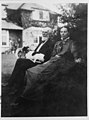 Leonard and Kate Courtney, c1916 (6899218302).jpg 400 × 540; 37 KB
-
 Lethlean House.jpg 1,530 × 1,712; 1 MB
-
 Little Dinnicoombe - geograph.org.uk - 708484.jpg 640 × 481; 154 KB
-
 Lodge at the entrance to Tremough College - geograph.org.uk - 764169.jpg 640 × 480; 127 KB
-
 Lonely house at Porthcurnick Beach - geograph.org.uk - 978096.jpg 640 × 480; 80 KB
-
 Looe Houses - panoramio.jpg 2,736 × 3,648; 1.67 MB
-
 Malaysian house in eden project - panoramio.jpg 3,264 × 2,448; 3.49 MB
-

-
 Marazion Sea Front - geograph.org.uk - 1564946.jpg 640 × 425; 84 KB
-
 Mendennick - geograph.org.uk - 372930.jpg 640 × 480; 124 KB
-
 Merchants manor.jpg 500 × 330; 201 KB
-
 Messack House and St Just Pool - geograph.org.uk - 561861.jpg 640 × 480; 122 KB
-
 Metha Road, St Newlyn East - geograph.org.uk - 185129.jpg 640 × 427; 101 KB
-

-

-

-
 New Housing Development - geograph.org.uk - 99779.jpg 640 × 480; 80 KB
-

-
 Newbridge Lane January 2009 - geograph.org.uk - 1418200.jpg 640 × 427; 82 KB
-
 NewPolzeathAtlanticTerraceCornwall.jpg 640 × 478; 102 KB
-
 Nice house The lost Garden of HELIGAN - panoramio.jpg 2,048 × 1,536; 697 KB
-
 Noon Veor. - panoramio (1).jpg 4,000 × 2,248; 4 MB
-
 Noon Veor. - panoramio.jpg 2,560 × 1,920; 2.97 MB
-
 Old Coastguard Houses. ~ twilight. - panoramio.jpg 4,000 × 2,248; 3.94 MB
-

-
 Old Quarry House, Lamorna Cove - geograph.org.uk - 495628.jpg 640 × 420; 56 KB
-
 Old Sign on Old Building - geograph.org.uk - 1372493.jpg 640 × 480; 110 KB
-
 One house on the moor at Bolventor - geograph.org.uk - 3857810.jpg 5,858 × 3,905; 4.39 MB
-
 Opposite the famous Inn - geograph.org.uk - 919104.jpg 640 × 427; 59 KB
-
 Pentillie Castle Lodge - geograph.org.uk - 338203.jpg 640 × 480; 101 KB
-
 Penzance (2022-07-17) 048.jpg 5,568 × 3,712; 17.71 MB
-
 Penzance (2022-07-17) 049.jpg 3,712 × 5,568; 19.36 MB
-
 Penzance (2022-07-17) 050.jpg 3,712 × 5,568; 19.37 MB
-
 Penzance (2022-07-17) 051.jpg 3,712 × 5,568; 19.93 MB
-
 Penzance (2022-07-17) 052.jpg 5,568 × 3,712; 21.29 MB
-
 Polventon House Trevose.jpg 1,575 × 948; 1.06 MB
-
 Port Isaac - panoramio (25).jpg 3,648 × 2,736; 2.22 MB
-
 Porthloe house - geograph.org.uk - 886048.jpg 640 × 480; 68 KB
-
 Portmellon - geograph.org.uk - 484377.jpg 640 × 480; 95 KB
-
 Rear of houses on Trenwith Lane, St Ives, Cornwall - December 2022.jpg 4,032 × 2,836; 2.03 MB
-
 Red Squirel house. - panoramio.jpg 2,980 × 2,473; 2.19 MB
-
 Redruth Tunnel - fGWR 43010 up train.JPG 1,366 × 910; 701 KB
-
 Roadside Houses - geograph.org.uk - 291848.jpg 640 × 425; 106 KB
-

-
 Roseland House (DSCN0560).jpg 1,632 × 1,224; 969 KB
-
 Rosevidney Manor - geograph.org.uk - 1230350.jpg 640 × 480; 229 KB
-
 2018 at St Austell Viaduct - view from Trenance Road.JPG 1,024 × 1,366; 606 KB
-
 Sands-Ring Homestead - panoramio.jpg 3,648 × 2,639; 3.02 MB
-
 Seaside villas, Trenance - geograph.org.uk - 224303.jpg 640 × 479; 80 KB
-
 Signal House, Penlee Point.jpg 3,408 × 2,784; 3.02 MB
-
-
 Small back room (2220708541).jpg 2,227 × 1,915; 2.57 MB
-
 St Endellion, Port Quin 2 - geograph.org.uk - 849402.jpg 640 × 418; 229 KB
-
 St Ives harbour - geograph.org.uk - 635267.jpg 640 × 480; 73 KB
-
 St John - geograph.org.uk - 372943.jpg 640 × 480; 121 KB
-
 St Mawgan - panoramio.jpg 1,600 × 1,200; 330 KB
-
 St. Michaels Mount 10 March 2005 Cornwall z (278556280).jpg 1,600 × 1,071; 618 KB
-
 Stack Point House (2189848385).jpg 2,560 × 1,712; 2.74 MB
-
 Stately House in Penzance - panoramio.jpg 4,320 × 3,240; 4.08 MB
-
 Steep Steps - geograph.org.uk - 1584868.jpg 640 × 480; 91 KB
-
 Stile ^ Trencrom Row. - panoramio.jpg 2,992 × 2,992; 5.2 MB
-
 Stippy Stappy Lane - geograph.org.uk - 68774.jpg 640 × 480; 154 KB
-
 Stone house at Carne - geograph.org.uk - 411774.jpg 640 × 480; 86 KB
-
 Tencreek, Newquay - geograph.org.uk - 127970.jpg 640 × 406; 85 KB
-
 The "last" house in Port Quin - geograph.org.uk - 955538.jpg 640 × 480; 106 KB
-
 The Bothy - geograph.org.uk - 998085.jpg 640 × 480; 104 KB
-
 The Den - geograph.org.uk - 502198.jpg 640 × 480; 144 KB
-
 The Forge, Tresillian - geograph.org.uk - 1235996.jpg 640 × 480; 72 KB
-
 The Green Kingsand - geograph.org.uk - 357393.jpg 640 × 480; 113 KB
-
 The house on the props (496610621).jpg 1,371 × 2,048; 772 KB
-
 The Little House at Trevaylor - geograph.org.uk - 2051461.jpg 640 × 480; 89 KB
-
-
 The Old Millfloor - geograph.org.uk - 742013.jpg 640 × 480; 135 KB
-
 The Old Station House. - panoramio.jpg 4,000 × 2,248; 4.15 MB
-
 The Pixie House - geograph.org.uk - 741889.jpg 640 × 480; 68 KB
-
 The Pixie House Penpethy - geograph.org.uk - 741898.jpg 640 × 480; 107 KB
-
 The post office, Tintagel - geograph.org.uk - 1385380.jpg 640 × 480; 98 KB
-
 The Square, Marazion - geograph.org.uk - 893667.jpg 640 × 424; 98 KB
-
 The Square, Marazion - geograph.org.uk - 923273.jpg 640 × 417; 248 KB
-
 The Square, Penryn (11825517223).jpg 2,525 × 3,552; 7.46 MB
-
 The Square, St Mawes (9549378808).jpg 2,678 × 2,142; 3.29 MB
-
 The trees in April. - panoramio.jpg 4,000 × 2,248; 4.46 MB
-
 The White House, Tregurrian - geograph.org.uk - 936744.jpg 640 × 480; 133 KB
-
 Three Doors (11825045214).jpg 1,604 × 1,270; 1.92 MB


.jpg)
.jpg)


.jpg)
.jpg)


.jpg)


.jpg)
.jpg)


.jpg)


.jpg)


.jpg)


.jpg)


.jpg)


.jpg)
.jpg)


.jpg)
.jpg)


_-_geograph.org.uk_-_1290784.jpg)
_-_geograph.org.uk_-_1290786.jpg)


.jpg)


.jpg)


_048.jpg)
_049.jpg)
_050.jpg)
_051.jpg)
_052.jpg)

.jpg)


.jpg)


.jpg)


.jpg)
.jpg)


.jpg)


.jpg)
.jpg)


.jpg)