Category:Houses in Lincolnshire
Jump to navigation
Jump to search
Ceremonial counties of England: Bedfordshire · Berkshire · Buckinghamshire · Cambridgeshire · Cheshire · Cornwall · Cumbria · Derbyshire · Devon · Dorset · Durham · East Riding of Yorkshire · East Sussex · Essex · Gloucestershire · Greater London · Greater Manchester · Hampshire · Herefordshire · Hertfordshire · Isle of Wight · Kent · Lancashire · Leicestershire · Lincolnshire · Merseyside · Norfolk · North Yorkshire · Northamptonshire · Northumberland · Nottinghamshire · Oxfordshire · Rutland · Shropshire · Somerset · South Yorkshire · Staffordshire · Suffolk · Surrey · Tyne and Wear · Warwickshire · West Midlands · West Sussex · West Yorkshire · Wiltshire · Worcestershire
City-counties: Bristol · City of London
Former historic counties: Huntingdonshire · Westmorland ·
Other former counties:
City-counties: Bristol · City of London
Former historic counties: Huntingdonshire · Westmorland ·
Other former counties:
Wikimedia category | |||||
| Upload media | |||||
| Instance of | |||||
|---|---|---|---|---|---|
| |||||
Subcategories
This category has the following 104 subcategories, out of 104 total.
- Villas in Lincolnshire (5 F)
*
A
- Houses in Appleby, Lincolnshire (17 F)
B
- Houses in Barnetby le Wold (9 F)
- Houses in Billinghay (2 F)
- Houses in Blankney (16 F)
- Houses in Brigg (17 F)
C
- Houses in Caistor (10 F)
D
- Houses in Deeping St James (13 F)
E
- Houses in Eastoft (4 F)
- Houses in Epworth, Lincolnshire (12 F)
F
G
- Houses in Goxhill, Lincolnshire (22 F)
- Houses in Great Coates (6 F)
H
- Houses in Habrough (4 F)
- Haconby House (3 F)
- Houses in Hibaldstow (3 F)
- Houses in Old Bolingbroke (30 F)
- Houses in Scunthorpe (77 F)
I
K
- Houses in Kirton in Lindsey (4 F)
L
M
- Thorpe House (4 F)
- Houses in Market Deeping (10 F)
- Houses in Metheringham (7 F)
- The Mill House, West Deeping (9 F)
N
O
P
- Pink houses in Lincolnshire (2 F)
R
S
- Houses in Saltfleet (8 F)
- Houses in Saxby All Saints (8 F)
- Scopwick Mill (5 F)
- Houses in Skegness (12 F)
- Houses in South Killingholme (5 F)
- Houses in Spilsby (5 F)
- Houses in Surfleet (6 F)
- Houses in Sutterton (10 F)
T
U
W
- Houses in Waddingham (8 F)
- Wesleyan Chapel, Fishtoft (3 F)
- Houses in West Halton (8 F)
- Houses in Whaplode (16 F)
- White houses in Lincolnshire (9 F)
- Houses in Winteringham (9 F)
Media in category "Houses in Lincolnshire"
The following 200 files are in this category, out of 311 total.
(previous page) (next page)-
 36 Market Place, Folkingham, Lincolnshire, UK.jpg 6,578 × 4,385; 21.51 MB
-
 9 and 11 Lindum Terrace.JPG 2,290 × 1,732; 2.37 MB
-
 A White House - geograph.org.uk - 306295.jpg 640 × 480; 100 KB
-
 A161 road (Kings Causeway), Swinefleet to Eastoft, Lincolnshire, with rainbow.JPG 2,560 × 1,920; 3.95 MB
-
 A161 road (Kings Causeway), Swinefleet to Eastoft, Lincolnshire.JPG 2,560 × 1,920; 4.36 MB
-
 Albert Road, Cleethorpes - geograph.org.uk - 279927.jpg 640 × 478; 151 KB
-
 Ancholme House, Bishop Bridge - geograph.org.uk - 5652058.jpg 1,600 × 1,064; 454 KB
-
 Ashtree Court - geograph.org.uk - 412927.jpg 640 × 480; 62 KB
-
 Awaiting Auction - geograph.org.uk - 580878.jpg 640 × 426; 164 KB
-
 Barlings Hall and horses two - geograph.org.uk - 476305.jpg 640 × 455; 145 KB
-
-
 The Old Forge - geograph.org.uk - 705501.jpg 640 × 427; 63 KB
-
 Baumber House - geograph.org.uk - 391313.jpg 640 × 427; 77 KB
-
 Baysgarth Farm, East Halton - geograph.org.uk - 1407949.jpg 640 × 384; 88 KB
-
 Bigby Village - geograph.org.uk - 671558.jpg 640 × 480; 80 KB
-
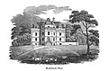 Bloxholm Hall.jpg 815 × 537; 64 KB
-
 Sunningdale Road, Yaddlethorpe - geograph.org.uk - 1757520.jpg 640 × 480; 64 KB
-
 Lodge Gardens - geograph.org.uk - 1074195.jpg 640 × 427; 53 KB
-

-
 Waithe Lane, Brigsley - geograph.org.uk - 873515.jpg 640 × 502; 119 KB
-
 Burton-le-Coggles - geograph.org.uk - 599752.jpg 640 × 427; 82 KB
-
 Canwick Hall - geograph.org.uk - 50201.jpg 640 × 480; 115 KB
-
 Carrington - geograph.org.uk - 109639.jpg 640 × 480; 407 KB
-
 Former Chapel - geograph.org.uk - 709559.jpg 640 × 427; 63 KB
-
 Cleethorpes Country Park Estate - geograph.org.uk - 305070.jpg 640 × 480; 101 KB
-
 Close up of New Row, with literary associations - geograph.org.uk - 1936093.jpg 4,000 × 2,248; 2.18 MB
-
 Corbyglen.jpg 640 × 480; 72 KB
-
 Cornish crescent - geograph.org.uk - 379657.jpg 640 × 460; 75 KB
-
 Cotton Hall, Frampton, Lincs - geograph.org.uk - 195582.jpg 640 × 480; 294 KB
-
 Counthorpe House - geograph.org.uk - 176224.jpg 640 × 480; 101 KB
-
 Countryside between Edenham and Lound - geograph.org.uk - 312131.jpg 640 × 427; 101 KB
-
 Crossroads at Rippingale - geograph.org.uk - 275488.jpg 640 × 427; 59 KB
-
 Former chapel - geograph.org.uk - 917435.jpg 639 × 479; 104 KB
-
 Crowle, Spen Lea House c1906.JPG 1,510 × 954; 740 KB
-
 Deeping St.Nicholas - geograph.org.uk - 364759.jpg 640 × 427; 49 KB
-
 Derelict house - geograph.org.uk - 733476.jpg 640 × 427; 59 KB
-
 Derelict house - geograph.org.uk - 755758.jpg 640 × 427; 61 KB
-
 Beck Street - geograph.org.uk - 1278349.jpg 640 × 426; 94 KB
-
 Beck Street - geograph.org.uk - 1386225.jpg 426 × 640; 93 KB
-
 Digby Beck - geograph.org.uk - 1386236.jpg 640 × 426; 110 KB
-
 Digby Village near Vicarage Close - geograph.org.uk - 1744694.jpg 640 × 429; 86 KB
-
 Distinctive building - geograph.org.uk - 407046.jpg 640 × 414; 86 KB
-
 Playgarth Estate - geograph.org.uk - 1548595.jpg 640 × 480; 82 KB
-
 Main Road, Dunsby, Lincs - geograph.org.uk - 243934.jpg 640 × 480; 284 KB
-
 Skitter Road - geograph.org.uk - 59865.jpg 640 × 480; 92 KB
-
 Exeter Close (geograph 3690057).jpg 4,896 × 3,264; 5.67 MB
-
 Ferry Road West, Scunthorpe - geograph.org.uk - 440379.jpg 640 × 430; 134 KB
-

-
 Ford-Watery Lane-Dunholme-Flckr-433338763.jpg 801 × 488; 309 KB
-
 Former General Stores at South Kyme - geograph.org.uk - 492600.jpg 640 × 480; 70 KB
-
 Former workshop (geograph 3588945).jpg 4,320 × 3,240; 5.54 MB
-
 Long Street, Foston - geograph.org.uk - 301714.jpg 640 × 427; 82 KB
-
 Foston Lodge - geograph.org.uk - 301666.jpg 640 × 427; 100 KB
-
 Gainsborough - houses on Bright Street - geograph.org.uk - 2971843.jpg 1,600 × 1,171; 684 KB
-

-
 Gainsborough roofscape - geograph.org.uk - 3338695.jpg 427 × 640; 111 KB
-
 Geograph-860102-Wykeham-Hall-by-Tim-Heaton.jpg 640 × 480; 70 KB
-
 Georgian House - geograph.org.uk - 120913.jpg 640 × 427; 121 KB
-
 Glenlea - geograph.org.uk - 436741.jpg 640 × 477; 91 KB
-
 Salem Street, Gosberton.jpg 960 × 720; 210 KB
-

-
 Grantham railway station MMB 19 180102.jpg 3,810 × 2,376; 2.62 MB
-
 Great Gonerby, Lincolnshire, England, pre WW1.JPG 1,242 × 662; 364 KB
-
 Gunby, Lincolnshire - geograph.org.uk - 38282.jpg 640 × 480; 89 KB
-
 Gunness village - geograph.org.uk - 1232555.jpg 640 × 480; 50 KB
-
 East Lound - geograph.org.uk - 170927.jpg 640 × 480; 97 KB
-
 School Croft - geograph.org.uk - 170808.jpg 640 × 480; 89 KB
-
 Heydour House - geograph.org.uk - 139860.jpg 640 × 427; 109 KB
-
 High Ferry Lane - geograph.org.uk - 256653.jpg 640 × 427; 59 KB
-
 High Street Walcott - geograph.org.uk - 669713.jpg 640 × 427; 60 KB
-
 HMS Explorer (P164).JPG 2,045 × 1,172; 820 KB
-
 High Street, Holbeach (geograph 4099230).jpg 640 × 640; 126 KB
-
 Holiday Homes - geograph.org.uk - 279305.jpg 640 × 480; 86 KB
-
 Holywell, Lincolnshire - House and road.jpg 4,391 × 3,185; 9.28 MB
-
 House in Horbling with Sundial - geograph.org.uk - 693797.jpg 640 × 427; 58 KB
-
 Hough Road, Frieston - geograph.org.uk - 359675.jpg 480 × 640; 97 KB
-
 Hough Road, Frieston - geograph.org.uk - 359680.jpg 480 × 640; 85 KB
-
 House at a road junction - geograph.org.uk - 589577.jpg 640 × 480; 60 KB
-
 House next to B1180 and River Glen - geograph.org.uk - 436466.jpg 640 × 477; 98 KB
-
 House on Barrier Bank (geograph 2920818).jpg 640 × 480; 50 KB
-
 House on the corner of Belleview Road (geograph 3567803).jpg 640 × 427; 69 KB
-
 House opposite Barr Farm off the A158 - geograph.org.uk - 425814.jpg 640 × 480; 85 KB
-
 House Restoration - geograph.org.uk - 644198.jpg 640 × 480; 68 KB
-

-
 Houses on Drove Road, Freiston Shore - geograph.org.uk - 558331.jpg 640 × 480; 104 KB
-
 Houses on Gorse Lane, Grantham - geograph.org.uk - 113606.jpg 640 × 427; 91 KB
-
 Houses on Riseholme Road - geograph.org.uk - 2989096.jpg 640 × 480; 58 KB
-
 Houses on West Street - geograph.org.uk - 3688287.jpg 4,896 × 3,264; 6.46 MB
-
 HouseSouthKymeLincolnshire.JPG 2,048 × 1,536; 543 KB
-
 Hoylake Close - geograph.org.uk - 2578638.jpg 640 × 480; 79 KB
-
 Illegal Parking - geograph.org.uk - 305151.jpg 640 × 480; 103 KB
-
 Island House - geograph.org.uk - 10065.jpg 640 × 480; 59 KB
-
 Jenny Wren Inn Susworth - geograph.org.uk - 65327.jpg 640 × 480; 93 KB
-
 Keadby riverside estate - geograph.org.uk - 528083.jpg 640 × 432; 75 KB
-
 Keal Hill, Old Bolingbroke - geograph.org.uk - 565797.jpg 640 × 480; 80 KB
-
 War Memorial - geograph.org.uk - 1328068.jpg 640 × 480; 59 KB
-
 Yarborough Road, Keelby - geograph.org.uk - 110293.jpg 640 × 426; 95 KB
-
 Kelstern Hall - geograph.org.uk - 179469.jpg 640 × 427; 75 KB
-
 King's Court, Horncastle - geograph.org.uk - 1725957.jpg 640 × 480; 75 KB
-
 Kings Court, Old Bolingbroke - geograph.org.uk - 616695.jpg 640 × 480; 71 KB
-
 Kyme Eau from the Bridge - geograph.org.uk - 491921.jpg 640 × 480; 107 KB
-
-

-
 Long Sutton 3 Spalding 16 - geograph.org.uk - 1186764.jpg 640 × 480; 86 KB
-
 St Peter's Church, Low Toynton - geograph.org.uk - 99308.jpg 640 × 480; 137 KB
-
 Mill House, Mill Road, Luddington - geograph.org.uk - 508136.jpg 425 × 640; 142 KB
-
 Worlaby Chapel. - geograph.org.uk - 161789.jpg 640 × 480; 417 KB
-
 Main house, The Old Rectory, Hawerby - geograph.org.uk - 425418.jpg 640 × 480; 166 KB
-
 Main line , Sleaford. - geograph.org.uk - 851055.jpg 640 × 480; 104 KB
-
 Cleatham Hall - geograph.org.uk - 138491.jpg 640 × 487; 118 KB
-
 Church Street, Market Deeping - geograph.org.uk - 672654.jpg 628 × 460; 89 KB
-
 Mill Place, Cleethorpes - geograph.org.uk - 1659836.jpg 640 × 480; 285 KB
-
 Mill Place, Cleethorpes - geograph.org.uk - 1659839.jpg 640 × 480; 281 KB
-
 Minster Yard, Lincoln - geograph.org.uk - 46570.jpg 640 × 480; 121 KB
-
 Moulton Chapel Mill, south Lincs - geograph.org.uk - 1482085.jpg 480 × 640; 342 KB
-
 New housing off Fen Lane - geograph.org.uk - 318777.jpg 640 × 427; 70 KB
-
 New Row - geograph.org.uk - 1936081.jpg 4,000 × 2,248; 2.77 MB
-
 Nine Foot River, Sleaford, Lincolnshire.jpg 1,500 × 996; 1.58 MB
-
 No. 59 Fleetgate - geograph.org.uk - 222127.jpg 640 × 534; 147 KB
-
 Normanby Grange - geograph.org.uk - 10560.jpg 640 × 480; 125 KB
-

-
 North Lodge (geograph 3689669).jpg 4,896 × 3,264; 6.12 MB
-
 Old Chapel House - geograph.org.uk - 240352.jpg 640 × 480; 130 KB
-
 The Old Sailor's Home Public House - geograph.org.uk - 669725.jpg 640 × 480; 85 KB
-
 Osgodby Chapel - geograph.org.uk - 124179.jpg 640 × 427; 90 KB
-
 Ostrich House - geograph.org.uk - 672102.jpg 640 × 480; 97 KB
-
 Outmill Bungalows - geograph.org.uk - 1232553.jpg 640 × 480; 31 KB
-
 Outskirts of Welton - geograph.org.uk - 215223.jpg 640 × 480; 111 KB
-
 Pilham Hall - geograph.org.uk - 235595.jpg 640 × 427; 65 KB
-
 Pilham Hall - geograph.org.uk - 355776.jpg 640 × 427; 74 KB
-
 Pilham Hall - geograph.org.uk - 355786.jpg 640 × 427; 89 KB
-
 Pilham Hall garden front - geograph.org.uk - 355783.jpg 640 × 427; 63 KB
-
 Plumtree Drive - geograph.org.uk - 345912.jpg 640 × 480; 91 KB
-
 Pond Cottage, Hareby - geograph.org.uk - 721478.jpg 640 × 480; 118 KB
-
 Barff Road - geograph.org.uk - 425084.jpg 640 × 427; 66 KB
-
 Potterhanworth railway station, Lincolnshire (geograph 3215092).jpg 800 × 600; 122 KB
-
 Residence in Surfleet - geograph.org.uk - 436146.jpg 640 × 477; 97 KB
-
 Restoration project - geograph.org.uk - 458087.jpg 640 × 427; 85 KB
-
 Restoration project - geograph.org.uk - 620517.jpg 640 × 427; 97 KB
-
 River Glen from Pinchbeck West Bridge - geograph.org.uk - 436722.jpg 640 × 477; 62 KB
-
 River Witham in flood - geograph.org.uk - 502375.jpg 640 × 427; 59 KB
-
 Riverside Cottage, Bishop Bridge - geograph.org.uk - 5652059.jpg 1,600 × 1,064; 534 KB
-
 Road puddle at Creeton, Lincolnshire - geograph-289587.jpg 640 × 480; 89 KB
-
 Ropsley1.jpg 640 × 427; 82 KB
-
 Rosedale, Waltham - geograph.org.uk - 599617.jpg 640 × 369; 61 KB
-
 North Street, Roxby - geograph.org.uk - 1160152.jpg 640 × 462; 189 KB
-
 South Street, Roxby - geograph.org.uk - 1296923.jpg 640 × 474; 97 KB
-
 Rural Dereliction - geograph.org.uk - 602761.jpg 480 × 640; 139 KB
-
 Ruskington - Eagle House brickwork detail (geograph 3007347).jpg 1,600 × 1,228; 647 KB
-
 Ruskington - Mafeking Terrace windows (geograph 3007365).jpg 1,600 × 1,175; 614 KB
-
 Saint Oggs - geograph.org.uk - 1017344.jpg 640 × 427; 70 KB
-
 Sapperton, Lincolnshire - geograph.org.uk - 155294.jpg 640 × 427; 99 KB
-
 Saxon House - geograph.org.uk - 453802.jpg 3,888 × 2,592; 7.51 MB
-
 Lidgett Close, Scawby - geograph.org.uk - 1452528.jpg 640 × 480; 74 KB
-
 Scotter Junction - geograph.org.uk - 1306996.jpg 640 × 395; 53 KB
-
 Detached Church Porch - geograph.org.uk - 192169.jpg 640 × 480; 138 KB
-
 Property Renovation, Back Lane, Searby - geograph.org.uk - 889187.jpg 640 × 480; 138 KB
-
 Sewstern Lane near Foston - geograph.org.uk - 301227.jpg 640 × 427; 62 KB
-
 Shivean Gate - geograph.org.uk - 734675.jpg 640 × 427; 63 KB
-
 Shore Road, Freiston Shore - geograph.org.uk - 426731.jpg 640 × 480; 88 KB
-
 Sibsey Fenside - geograph.org.uk - 323562.jpg 640 × 427; 55 KB
-
 Sleaford (34866840543).jpg 4,000 × 3,000; 2.8 MB
-
 Sleaford (35545841131).jpg 4,000 × 3,000; 2.89 MB
-
 South Park - geograph.org.uk - 191524.jpg 640 × 427; 85 KB
-
 Ghost sign and post box at Welland Road, Spalding.jpg 640 × 480; 88 KB
-
 Spalding Water Taxi - geograph.org.uk - 190952.jpg 640 × 480; 102 KB
-

-
 Stamford Museum by Bob Harvey.JPG 3,072 × 2,304; 2.58 MB
-
 Station House, Moulton near Spalding, Lincolnshire (geograph 2900340).jpg 4,320 × 3,240; 5.73 MB
-
 Church and Vicarage - geograph.org.uk - 359345.jpg 640 × 427; 92 KB
-
 Tarragon Way (geograph 3263359).jpg 4,000 × 2,248; 2.7 MB
-
 Former Chapel - geograph.org.uk - 702537.jpg 640 × 427; 55 KB
-

-
 The Beck at Barrow Haven - geograph.org.uk - 1028536.jpg 640 × 480; 99 KB
-
 The Beeches, Croxton - geograph.org.uk - 502794.jpg 640 × 520; 193 KB
-
 The Knoll, Cleethorpes - geograph.org.uk - 279857.jpg 640 × 527; 102 KB
-

-
 The Mill, West Deeping, Lincs - geograph.org.uk - 87499.jpg 640 × 480; 330 KB
-
 The Old Hospital, Lincoln.png 713 × 486; 517 KB
-
 The Old School House - geograph.org.uk - 245264.jpg 427 × 640; 94 KB
-
 The Old School House - geograph.org.uk - 270559.jpg 640 × 638; 142 KB
-
 The Old School House - geograph.org.uk - 448528.jpg 2,816 × 1,880; 3.24 MB
-
 The Ostrich and Cromwell House - geograph.org.uk - 124325.jpg 640 × 427; 112 KB
-
 The Unfortunate Georgian House - geograph.org.uk - 241288.jpg 640 × 613; 164 KB
-
 Thoresway - geograph.org.uk - 141097.jpg 640 × 426; 143 KB
-
 Thoresway Grange - geograph.org.uk - 1232103.jpg 640 × 426; 80 KB
-
 Tones of Gothic - geograph.org.uk - 528623.jpg 640 × 427; 81 KB
-
 Tumby Woodside - geograph.org.uk - 109182.jpg 640 × 480; 450 KB
-

-
 Walk House - geograph.org.uk - 11825.jpg 640 × 480; 107 KB
-
 Weir below bridge in Sleaford town centre-Geograph-1876760-by-Mick-Lobb.jpg 1,500 × 996; 1.66 MB
-
 Houses on Winteringham Lane - geograph.org.uk - 729110.jpg 640 × 425; 66 KB
-
 West Street - geograph.org.uk - 380575.jpg 640 × 427; 51 KB
-
 The Bottle and Glass, Whaplode Drove - geograph.org.uk - 177293.jpg 640 × 566; 58 KB
-
 Whitton - The Old Vicarage - geograph.org.uk - 106783.jpg 640 × 426; 155 KB
-
 Windmill House - geograph.org.uk - 501066.jpg 640 × 480; 132 KB
-
 Wyham Grange - geograph.org.uk - 1426596.jpg 640 × 426; 87 KB
-
 Wyham House - geograph.org.uk - 1028733.jpg 640 × 480; 89 KB
-
 2 Westwood Close - geograph.org.uk - 576034.jpg 640 × 480; 69 KB
-
 A House In Conisholme - geograph.org.uk - 292053.jpg 640 × 480; 99 KB


,_Swinefleet_to_Eastoft,_Lincolnshire,_with_rainbow.JPG)
,_Swinefleet_to_Eastoft,_Lincolnshire.JPG)


.jpg)


.jpg)


.JPG)
.jpg)


.jpg)
.jpg)


.jpg)


.jpg)


.jpg)
.jpg)


.jpg)
.jpg)


.jpg)

.jpg)


