Category:English-language maps of India
Jump to navigation
Jump to search
Countries of Asia: Armenia‡ · Bhutan · Cambodia · People's Republic of China · Egypt‡ · India · Indonesia‡ · Iraq · Japan · Jordan · Kazakhstan‡ · Kyrgyzstan · Laos · Lebanon · Malaysia · Mongolia · Myanmar · Nepal · North Korea · Qatar · Russia‡ · South Korea · Sri Lanka · Tajikistan · Thailand · Turkey‡ · Turkmenistan · Uzbekistan · Yemen
‡: partly located in Asia
‡: partly located in Asia
Subcategories
This category has the following 3 subcategories, out of 3 total.
A
E
- ECHO Daily Maps of India (62 F)
Media in category "English-language maps of India"
The following 35 files are in this category, out of 35 total.
-
 1777 Rennell - Dury Wall Map of Delhi and Agra, India - Geographicus - DelhiAgrah-dury-1777.jpg 6,000 × 6,198; 10.56 MB
-
 Dutch India (Diachronic).png 1,763 × 1,527; 265 KB
-
 GDP of Indian states and union territories in 2017.png 3,818 × 4,600; 1.01 MB
-
 Hindi language native speakers.png 1,754 × 1,628; 1.96 MB
-
 Hyderabad Boundaries and Railways - DPLA - cbaf432f34eac65162f01cf00600819d.jpg 4,672 × 3,377; 1.83 MB
-
 India - DPLA - 020a586aa050921cbc75938c9378ba6e.jpg 2,556 × 3,278; 6.03 MB
-
 India - DPLA - 1e1ba78255460b7a87252a83da7a690e.jpg 2,560 × 3,576; 4.58 MB
-
 India - DPLA - 83f4dd5cf823799f3885a2f249e7b207.jpg 2,554 × 3,270; 5.6 MB
-
 India - DPLA - ac96ca7c8499ea883aef5ea2650d7f12.jpg 2,554 × 3,272; 6.02 MB
-
 India - Location Map (2013) - IND - UNOCHA.svg 250 × 250; 554 KB
-
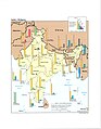
 India - Manganese Ore Shipment - DPLA - f095b54426226115056074e2adec8451.jpg 4,329 × 4,001; 1.92 MB
-
 India - Metallurgical and Refractory Plants - DPLA - 83c3f5949750544cafd899e06bf8af6a.jpg 5,844 × 6,930; 3.96 MB
-
-
 India 2017- Total Fertility Rate (Number of children per woman).png 3,818 × 4,600; 1,007 KB
-
 India decadal growth rate map en.svg 1,639 × 1,852; 876 KB
-
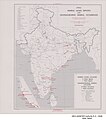
 India Distribution of Muslims, 1941 - DPLA - 516af891ebc6c41e14ad32415c868b6a (page 2).jpg 8,059 × 7,706; 8.48 MB
-
 India Languages - DPLA - 893e20f862c87371733f8494b21da84f.jpg 3,711 × 3,393; 1.8 MB
-
 India Population Density, 2000 (5457621354).jpg 2,507 × 3,265; 800 KB
-
 India TFR regions 2011.png 1,801 × 2,120; 1.31 MB
-
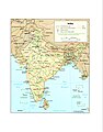
 India Transportation and Political Divisions - DPLA - d87ac45c1eb7048e5a58c5ac83d6c202.jpg 5,072 × 4,994; 2.19 MB
-
 India's Religions - DPLA - d82c5e0d8ad27e87a70a5d26bcd6c51b.jpg 2,554 × 3,280; 5.64 MB
-
 India, Density of population - btv1b53189498w.jpg 7,996 × 7,498; 6.31 MB
-
 India, Nepal and Bhutan - DPLA - adb07a1ee19843ae55ffecb2def43021.jpg 7,908 × 10,692; 8.95 MB
-
 India. 1 - 6 000 000 Publié par la Légation de l'Inde à Berne - btv1b531972208.jpg 7,858 × 7,296; 8.05 MB
-
 India. LOC 98687195.jpg 2,934 × 3,586; 2.8 MB
-
 India. Special strategic map - btv1b53189310m (1 of 2).jpg 11,892 × 7,424; 14.4 MB
-
 India. Special strategic map - btv1b53189310m (2 of 2).jpg 10,116 × 7,120; 8.01 MB
-
 Indian States and Union Territories by HDI 2022.png 3,818 × 4,600; 772 KB
-
 Indian States by TFR.jpg 4,096 × 4,096; 727 KB
-
 Northeast India - DPLA - a07b3ba822beabece29d6a25d1e09d99.jpg 3,256 × 2,546; 2.23 MB
-
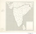 Peninsular India - DPLA - 820bc9ac89e076e9cecdbc5f6e6192a6.jpg 9,000 × 8,723; 7.25 MB
-
 Peninsular India - DPLA - df687d619d056b08fd8b5183a5d49168.jpg 9,000 × 8,727; 7 MB
-
 Separatism in India.svg 1,643 × 1,856; 783 KB
-
 Tehsils of distt. Ganganagar.jpg 1,864 × 1,505; 1.55 MB
-
 William Baffin - Northern India; Mughal Empire - 1625.jpg 4,493 × 3,313; 7.8 MB

.png)


_-_IND_-_UNOCHA.svg)


.png)

.jpg)

.jpg)


.jpg)
.jpg)


