Category:Demographic maps of India
Jump to navigation
Jump to search
Countries of Asia: Afghanistan · Armenia‡ · Azerbaijan‡ · Bangladesh · Bhutan · Cambodia · People's Republic of China · Cyprus‡ · Egypt‡ · Georgia‡ · India · Indonesia‡ · Iran · Iraq · Israel · Japan · Kazakhstan‡ · Kyrgyzstan · Lebanon · Malaysia · Mongolia · Myanmar · Nepal · North Korea · Pakistan · Philippines · Russia‡ · Saudi Arabia · Singapore · South Korea · Sri Lanka · Syria · Tajikistan · Thailand · Turkey‡ · Uzbekistan · Vietnam · Yemen
Limited recognition: Taiwan · State of Palestine
‡: partly located in Asia
Limited recognition: Taiwan · State of Palestine
‡: partly located in Asia
Subcategories
This category has the following 13 subcategories, out of 13 total.
F
- Fertility rate maps of India (5 F)
G
- GDP maps of India (16 F)
H
- HDI maps of India (20 F)
L
- Life expectancy maps of India (11 F)
- Literacy maps of India (13 F)
M
- Maps of ethnic groups in India (34 F)
P
- Postcode maps of India (2 F)
R
W
Media in category "Demographic maps of India"
The following 43 files are in this category, out of 43 total.
-
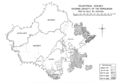 1931 Boundaries of States in Rajputana.png 1,024 × 712; 260 KB
-
 1981nian Yindu Renlei Fazhan Zhishu.png 624 × 704; 59 KB
-
 1991nian Yindu Renlei Fazhan Zhishu.png 624 × 704; 59 KB
-
 2001nian Yindu Renlei Fazhan Zhishu.png 624 × 704; 60 KB
-
 2005nian Yindu Renlei Fazhan Zhishu.png 624 × 704; 111 KB
-
 2006 Human Development Index for India map by states, HDI data by GoI and UNDP India.svg 1,578 × 1,738; 862 KB
-
 2006 India HDI-ar.png 2,669 × 3,005; 1.41 MB
-
 2006 India HDI-ar.svg 1,578 × 1,738; 890 KB
-

-
 2011 Census Scheduled Caste caste distribution map India by state and union territory.svg 1,650 × 1,862; 1.44 MB
-

-
 2011 Census Scheduled Tribes distribution map India by state and union territory.svg 1,500 × 1,615; 1.4 MB
-

-

-
 2011nian Yindu Renlei Fazhan Zhishu.png 624 × 704; 109 KB
-

-

-
-
 Chamar Population by Stae Percentage.png 432 × 468; 24 KB
-
 Chamar Population by State 1.png 432 × 468; 24 KB
-
 Cultural regional areas of India.png 1,199 × 1,153; 364 KB
-
 Culturemapindia.png 624 × 704; 31 KB
-
 Demoindien 2.jpg 290 × 269; 15 KB
-
 FE-India-Map-2014.jpg 852 × 893; 76 KB
-
 Haplogroup F (Y-DNA).PNG 1,144 × 726; 265 KB
-
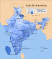 India sex ratio map en.svg 1,639 × 1,852; 874 KB
-
 India TFR data.svg 512 × 583; 161 KB
-
 India Top 10 Biggest Cities.png 803 × 933; 192 KB
-
 India-races.jpg 676 × 1,023; 152 KB
-
 India-states-population.svg 765 × 990; 454 KB
-
 Indian States - HDI MAP.png 624 × 704; 100 KB
-
 Indian states and union territories by population, 2011.png 2,704 × 3,257; 801 KB
-
 Indian tribes between the Indus and the Ganges.jpg 532 × 638; 85 KB
-
 Maps of india1.PNG 530 × 599; 116 KB
-
 Maps of india2.PNG 530 × 599; 117 KB
-
 Maps of india3.PNG 530 × 599; 117 KB
-
 Percent of scheduled tribes in India by tehsils by census 2011.png 4,280 × 4,688; 2.38 MB
-
 Percent of scheduled tribes in India-tehsils-census 2011.svg 2,268 × 2,201; 7.1 MB
-
 Percentage Sikh population, India.png 2,000 × 2,208; 1 MB
-
 Population density of India states and union territories.png 3,349 × 3,902; 668 KB
-
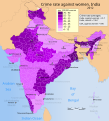
 Rates of sexual offences against women in Indian states - 2015.png 1,595 × 1,869; 230 KB
-
 Saivism-india-advaita.png 100 × 104; 2 KB
-
 Sexual offences against women in Indian cities - 2015.png 1,597 × 1,871; 266 KB


.PNG)


