Category:Demographic maps of Syria
Jump to navigation
Jump to search
Subcategories
This category has the following 2 subcategories, out of 2 total.
E
P
Media in category "Demographic maps of Syria"
The following 21 files are in this category, out of 21 total.
-
 Demographic map of Afrin District - With Legend.png 1,350 × 1,288; 68 KB
-
 Demographic map of Afrin District.png 1,350 × 1,288; 55 KB
-
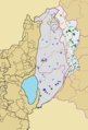
 Demographic map of the Golan Heights - Before 1967 - Legend.png 1,255 × 1,850; 136 KB
-
 Demographic map of the Golan Heights - Before 1967.png 1,255 × 1,850; 106 KB
-
 Demographic map of the Golan Heights - Legend.png 1,255 × 1,850; 140 KB
-

-

-
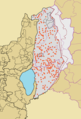
 Demographic map of the Golan Heights.png 1,255 × 1,850; 96 KB
-
 Densidad de Siria.png 1,424 × 1,412; 63 KB
-
 Map detail showing Syrian Kurdistan in 1935.jpg 6,301 × 2,857; 2.27 MB
-
 Map of Location of Settlement of Refugees of Afrin District.png 1,648 × 1,288; 74 KB
-
 ORB-Sy.png 6,070 × 6,750; 1.72 MB
-
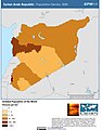
 Population density of Syria governorates.png 5,666 × 4,668; 658 KB
-
 Population map Syria & Liban (1935).jpg 1,200 × 939; 326 KB
-
 Syria pop-ar.png 682 × 615; 91 KB
-
 Syria pop.jpg 682 × 1,002; 86 KB
-
 Syria Population Density, 2000 (5457626472).jpg 2,495 × 3,194; 629 KB
-
 Syria Population Density, 2000 (6171919371).jpg 2,376 × 3,160; 614 KB
-
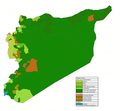 Syria Religion.png 2,029 × 1,873; 232 KB
-
 Syrian localities depopulated during and after the 1967 War - Golan Heights - Legend.png 1,255 × 1,850; 140 KB
-
 Syrian localities depopulated during and after the 1967 War - Golan Heights.png 1,255 × 1,850; 107 KB


.jpg)


.jpg)
.jpg)


