Category:Maps of ethnic groups in India
Jump to navigation
Jump to search
Countries of Asia: Afghanistan · Armenia‡ · Azerbaijan‡ · Cambodia · People's Republic of China · Cyprus‡ · Georgia‡ · India · Iran · Iraq · Israel · Kazakhstan‡ · Kyrgyzstan · Malaysia · Myanmar · Nepal · Pakistan · Russia‡ · Syria · Thailand · Turkey‡ · Uzbekistan · Vietnam · Yemen
Limited recognition: Abkhazia‡ · Taiwan
‡: partly located in Asia
Limited recognition: Abkhazia‡ · Taiwan
‡: partly located in Asia
Media in category "Maps of ethnic groups in India"
The following 34 files are in this category, out of 34 total.
-
 (1882) MAP OF THE TRIBES OF INDIA.jpg 2,634 × 2,158; 1.57 MB
-
 Andamanais-negritos-carte.png 737 × 567; 34 KB
-
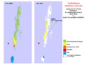 Andamanese comparative distribution.png 737 × 567; 76 KB
-
 Andamanese Indigenous people.svg 927 × 1,118; 392 KB
-
 Area of Bais Rajput.jpg 331 × 323; 8 KB
-
 Brahmin population distribution.svg 1,500 × 1,615; 1.37 MB
-
 Distribution of Gurjars within South Asia.jpg 425 × 321; 44 KB
-
 Ethnien in Pakistan 1980.svg 920 × 891; 263 KB
-
 Ethnien in Pakistan hu.svg 920 × 891; 310 KB
-
 Gondi tribe percent by districts 2011 census.png 1,500 × 1,615; 714 KB
-
 Idioma telugu.png 316 × 368; 6 KB
-
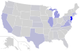
 Indian Jews communities map-de.png 328 × 352; 44 KB
-
 Indian Jews communities map-fr.png 328 × 352; 45 KB
-
 Indian Jews communities map.png 328 × 352; 44 KB
-
 KayasthaPopMap.JPG 578 × 674; 57 KB
-
 KayasthaPopMigration.JPG 591 × 675; 51 KB
-
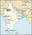
 Mahl origin locator.PNG 513 × 724; 64 KB
-
 Mahl relation locator.png 513 × 724; 64 KB
-
 Major ethnic groups of Pakistan in 1980 borders removed.jpg 960 × 928; 182 KB
-
 Major ethnic groups of Pakistan in 1980-es.svg 920 × 891; 275 KB
-
 Major ethnic groups of Pakistan in 1980.jpg 960 × 928; 153 KB
-
 Major ethnic groups of Pakistan in 1980.svg 920 × 891; 275 KB
-
 MangaloreanCatholicDistribution.JPG 518 × 479; 19 KB
-
 Map India jews communities fr.jpg 330 × 355; 74 KB
-
 Map India jews communities.jpg 330 × 355; 28 KB
-
 Marwari map.PNG 661 × 600; 96 KB
-
 Padhar in gujarat.jpg 1,021 × 783; 83 KB
-
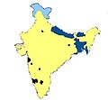
 Percent of scheduled tribes in India by tehsils by census 2011.png 4,280 × 4,688; 2.38 MB
-
 Percent of scheduled tribes in India-tehsils-census 2011.svg 2,268 × 2,201; 7.1 MB
-
 Rajput mahrajas.JPG 435 × 356; 9 KB
-
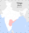
 Spread of Telugu.png 234 × 244; 11 KB
-
 Telugu USC2000 PHS.svg 959 × 593; 174 KB
-
 Teluguspeakers.png 1,000 × 1,138; 132 KB
-
 Volker-Karte der Indischen Welt 1847.jpg 2,954 × 2,420; 2.22 MB
_MAP_OF_THE_TRIBES_OF_INDIA.jpg)


