Category:1890s maps of Bavaria
Jump to navigation
Jump to search
|
Federal states of Germany: |
Media in category "1890s maps of Bavaria"
The following 4 files are in this category, out of 4 total.
-
 Meyers leiner Hand-atlas 1893 (73136660).jpg 9,499 × 6,359; 11.98 MB
-
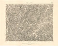 Spezialkarte 4250 Taus und Klattau.jpg 6,976 × 5,524; 27.16 MB
-
 Deutsche Reichskarte Lechrain Ammersee Pfaffenwinkel 1899 1901.jpg 5,966 × 8,846; 77.8 MB
-
 Deutsche Reichskarte Lechrain Ammersee Pfaffenwinkel Südteil 1899.jpg 5,978 × 4,498; 49.71 MB
.jpg)


