Category:1810s maps of Bavaria
Jump to navigation
Jump to search
|
Federal states of Germany: |
Subcategories
This category has the following 3 subcategories, out of 3 total.
- 1811 maps of Bavaria (13 F)
- 1817 maps of Bavaria (1 F)
Media in category "1810s maps of Bavaria"
The following 5 files are in this category, out of 5 total.
-

-
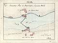 Situationsplan der Baiersdorfer und Kleinseebacher Mühle 1816 1 retusche.jpg 6,010 × 4,490; 10.9 MB
-
 Situationsplan der Baiersdorfer und Kleinseebacher Mühle 1816 1.JPG 6,010 × 4,490; 2.02 MB
-

-

.jpg)


_With_numerous_maps_and_notes%27_(11110900364).jpg)
_Mattes_2022-02-26.jpg)