| |
|

|
Burzenland
|
|
|
|
|
|
|
|
Ţara Bârsei
|
|
|
|
| Română
|
Ţara Bârsei
Ţara Bârsei este o zonă istorică situată în centrul ► României, având centrul istoric, cultural, economic şi social în municipiul Braşov. Denumirea provine de la râul Bârsa (Burzen), care este un afluent al râului Olt. Geografic, Ţara Bârsei este o depresiune dispusă în interiorul arcului Carpatic, delimitată de localităţile Apaţa la nord, Bran la sud, Vlădeni la vest şi Prejmer spre est. Totuşi, prin tradiţie, zona include şi comuna Şercaia. Este străbătută de numeroase râuri şi pârâuri repezi de munte, fiind delimitată pe o bună porţiune de râul Olt.
|
| German
|
Burzenland
Das Burzenland ist eine historische Landschaft im Zentrum Rumäniens, wobei dessen historischer, kultureller, wirtschaftlicher und sozialer Mittelpunkt in Kronstadt liegt. Die Bezeichnung stammt von dem Fluss Burzen, der ein Nebenfluss von Alt ist. Aus geographischer Sicht ist das Burzenland innerhalb des Karpatenbogens ein Tiefland, begrenzt im Norden durch die Ortschaft Geist, im Süden durch die Törzburg, Wladein im Westen und Tartlau im Osten. Traditionell wird auch Schirkanyen hinzugezählt. Die Landschaft wird von zahlreichen Flüssen und Bächen durchflossen und grenzt zu einem bedeutenden Anteil an dem Fluss Alt.
|
| English
|
Burzenland - Burzenland
The Burzenland is a historic and ethnographic area in southeastern Transylvania, ► Romania with a mixed population (German, Romanian, Hungarian). Its limits are: Apaţa village in north, Bran village in south, Perşani and Măgura Codlei Mts. in west and Tărlungeni and Olt rivers in east. Traditionally, the village Şercaia, outside this region, is also part of Burzenland.
|
|
| Short name
|
Burzenland
|
| Official name
|
Burzenland
|
| Status
|
Historical Land inside Romania
|
| Capital
|
Braşov
|
| Population
|
446,000 inhabitants
|
| Area
|
2,872 km²
|
| Major languages
|
Romanian (official), Hungarian (main minority language), German
|
| Major religions
|
Romanian Orthodoxy
|
| More information
|
Burzenland, Geography of Burzenland, History of Burzenland and Politics of Burzenland
|
| More images
|
Burzenland - Burzenland (Category).
|
|


 Apaţa
Apaţa Bod
Bod Bran
Bran Braşov
 Codlea
 Cristian
 Crizbav
 Dumbrăviţa
 Feldioara
 Ghimbav
 Hălchiu
 Hărman
 Holbav
 Măieruş
 Prejmer
 Râşnov
 Săcele
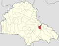 Sânpetru
 Şercaia
 Vulcan
 Zărneşti


 Apaţa
Apaţa Bod
Bod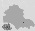 Braşov
 Feldioara
 Prejmer


 Cristian
 Cutuş
Cutuş Dumbrăviţa
 Satu Nou


.png)


.png)


.JPG)
_in_Hungary,_census_1890.jpg)

.jpg)
.JPG)


