User talk:Hellerick
|
Our first steps tour and our FAQ will help you a lot after registration. They explain how to customize the interface (for example the language), how to upload files and our basic licensing policy. You don't need technical skills in order to contribute here. Be bold contributing here and assume good faith for the intentions of others. This is a wiki—it is really easy. More information is available at the community portal. You may ask questions at the help desk, village pump or on IRC channel #wikimedia-commons (direct access). You can also contact an administrator on their talk page. If you have a specific copyright question, ask at Commons talk:Licensing. |
| |
| (P.S. Would you like to provide feedback on this message?) | ||
Herby talk thyme 15:51, 21 June 2008 (UTC)
1917-1928 Soviet Ukraine borders formation.svg[edit]
По поводу Вашей карты. Во-первых, всё очень красиво и ярко, и вообще замечательно. Но я бы хотел обратить внимание вот на что:
- не обозначен российской территорией Дарьино-Ермаковский сельсовет (в 1925 - 1944 в составе РСФСР)
- не обозначена российской территорией северная часть Арабатской стрелки Крыма
- весьма спорной является штриховка Бессарабии как "Land, claimed by USSR/UkrSSR". По крайней мере я не нашёл ни одного подтверждения существования каких-то территориальных претезаний именно УССР на Бессарабию. Известно, что Бессарабия принадлежала РСФСР на раннем этапе и была попытка создания Бессарабской ССР, причём, документально подтверждено, что Бессарабская ССР планировалась как часть РСФСР с дальнейшим статусом отдельной республики (ввиду отсутвия общей границы с остальной РСФСР) с неким видом договорных отношений с РСФСР (покуда СССР еще не было тогда). Некий намёк на якобы претензии УССР имеет штриховка Бессарабии в некоторых советских атласах 1920-х годов, т.е. когда на карте УССР были расскрашены в разные цвета административные единицы этой республики, а Бессарабия при этом штриховалась в цвета Молдавской АССР. Однако, документальных подтверждений наличия претензий УССР нет, видимо, имело место авторское решение составителей атласов именно так обозначать претензии СССР на Бессарабию (т.е. с намеком на молдавский этнос). Речь идет о меньшей части атласов того периода. Причем, словесное описание УССР из них же Бессарабию не затрагивает.
- касательно оспариваемых УССР территорий в 1919 году. Мне кажется, их граница несколько шире отмеченной. Ну, вот в частности: [1], [2]. При этом, насколько картографический материалы отражают действительность - опять-таки вопрос.
- Станицу Луганскую передали в состав УССР в том же 1920, что и Макеевку (только в разные месяцы), их можно было бы штриховать одинаково (кроме восточного аппендикса)
- Штриховка "Land claimed by UkrSSR in 1924" должна распространяться и на Путивль (собственно, это и есть та оспариваемая часть, которая таки была отдана УССР в 1925 как компенсация за восточный Донбасс, что документально подтверждено). А вот насчет того, что они в 1924 году оспаривали территории чуть ли не до Воронежа, это подлежит сомнению. Я знаю, что подобные споры были на более раннем этапе (где-то в 1920) из-за этнического состава населения, тогда же было принято решение, что экономические связи данных территорий с Воронежом слишком сильны, чтобы отдавать их УССР. О продолжении спора в 1924, когда возвращался восточный Донбасс, я не слышал.
- Есть сомнения в необходимости обозначать "границу российских губерний, переданных Украине резолюциями 1917-1919". Границы существования разных украинских образований в тот период, несомненно, интересны. Но их было слишком много, обозначить их все на данной карте невозможно (это ее испортит), а обозначать только одну из них - нелогично. Другое дело, если бы Вы сделали еще одну карту в том же стиле, посвященную временам I м.в., на которой были бы границы с начала войны до конца 1918 года, т.е. границы УНР (заявленные по универсалу и фактические к моменту подписания Брестского мира), Украинской державы, границы Украины в соответствии с решением Временного правительства, советских образований (Украинской советской респ., Донецкой-криворожской республики, Одесской республики), галицких образований (Галицийского генерал-губернаторства, ЗУНР) и т.д.
- Не совсем правильно, что граница Белорусской ССР обозначена сразу по состоянию на 1928 год. Понятно, что карта не о ней, но всё-таки раз карта описывает изменение границ за некий период времени, то не совсем корректно не отрисовать хотя бы границу БССР на момент провозглашения СССР.
--Nicolay Sidorov (talk) 22:17, 13 July 2018 (UTC)
Wikimedia Commons has a specific scope[edit]
Thank you for your contributions. Your image or other content was recently deleted, or will soon be deleted, in accordance with our process and policies, because it was not, or is not, within our scope. Please review our project scope, but in short, Commons is targeted at media files including photographs, diagrams, animations, music, spoken text and video clips. Wikimedia Commons does not contain text articles like encyclopedia articles, textbooks, news, word definitions and such. Each of these other kinds of content have their own projects: Wikipedia, Wikibooks, Wikisource, Wikinews, Wiktionary and Wikiquote.
If the content seems to fit the scope of one of those other projects, please consider contributing it there. If you think that the deletion was in error because the contribution really was in scope, you can appeal it at Commons:Undeletion requests, giving a reason why it fits our scope to help others evaluate the matter. Thank you for your understanding. Herby talk thyme 15:52, 21 June 2008 (UTC)
Fair use[edit]
There is no fair use regulation at Commons. Those pictures are not free and thus not accepted on Commons. -- Cecil (talk) 13:58, 23 July 2008 (UTC)
Please do not recreate deleted images[edit]
Your image or other content was recently deleted in accordance with our process and policies. You have recreated this content after it was deleted. Please do not do that. If you would like to contest the deletion, please visit Commons:Undeletion requests and follow the instructions there to have the deletion reviewed.
Recreating deleted content outside of process is not a good idea, and doing so repeatedly may be cause for you to lose the privilege of contributing here. Thank you for your understanding. →Christian.И 15:52, 24 July 2008 (UTC)
This message was added automatically by Nikbot, if you need some help about it, ask its master (Filnik) or go to the Commons:Help desk. --Filnik 04:39, 29 September 2009 (UTC)
Tricolor Russian Roundel[edit]
Could you review it as your image doesn't match up with the Official Design as the outer edges are 36° when the Offical Design is 38° and the White and Blue bands appear to be two narrow.
Also here's the exact wording in the Decree to assure it's accurate.
Description of the mark of nationality - images five-pointed stars (approved by RF Government Resolution of March 4, 2010 N 127)
Five-pointed star is a red star bordered equidimensional blue and white stripes and a red line on the contour.
The ratio of the width of the blue and white stripes to the diameter of a circle inscribed in red field star is 1:10. The width of the red line along the contour of five-pointed star to the width of the fringing bands is 1:5.
Also here's the Image attached to the Act.
File:Officalnewrussianroundel.png
Note it is NOT a equilateral 5-pointed star. --Thegunkid (talk) 15:28, 1 May 2010 (UTC)
About the Time Zones in the world (in spanish)[edit]
¡Hola Hellerick! Mira el comentario que hice aquí. Cualquier duda que tú y yo tuviéremos, estaremos en contacto. Muchas gracias por anticipado. ¡Adiós! Fonadier ![]() (talk) 00:30, 28 March 2011 (UTC)
(talk) 00:30, 28 March 2011 (UTC)
File:Supranational European Bodies-ru.svg[edit]
Доброго времени суток. Недавно Вы внесли новые изминения в данный шаблон. Не могли бы ли Вы туда также добавить ГУАМ, Бенилюкс и, возможно, Восточное партнёрство.--Artemis Dread (talk) 16:50, 27 September 2013 (UTC)
A barnstar for you![edit]

|
The Original Barnstar |
| You're doing such great work on the Russian regional symbols, thank you! Kintetsubuffalo (talk) 12:13, 30 September 2013 (UTC) |
Symbols of Tuva[edit]
A request to an expert on russian symbols: During the last month, several new emblems of the Tuva republic where drawn by several graphists here. No its about to create a large number of flags and variants of there images, it's only about changing mottos and rearrangeing images. Are you interested in doing that?--Antemister (talk) 14:27, 12 January 2014 (UTC)
Yugoslavia 1941[edit]
Nice work with those maps of the occupation of Yugoslavia! I was just wondering whether you could fix them in a minor detail: can you add the pre-1941 border between Italy and Kingdom of Yugoslavia between the islands in this map? The border is the blue line here. Thanks! --Bojovnik (talk) 18:25, 10 February 2014 (UTC)
- Perfect. Than you very much! --Bojovnik (talk) 18:05, 11 February 2014 (UTC)
- Actually, the biggest island in Kvarner bay - Krk - was not occupied by Italians, it was annexed. So, instead of being striped, it should be the same color as Italy. Regards, --Bojovnik (talk) 18:39, 12 February 2014 (UTC)
Административная карта (б)СССР[edit]
Можете такую административную болванку svg для всего бСССР сделать?--Luboslov Yezykin (talk) 21:51, 14 March 2014 (UTC)
Copyright status: File:Tree secondary components diagram.svg[edit]
| This media may be deleted. |
Thanks for uploading File:Tree secondary components diagram.svg. I notice that the file page either doesn't contain enough information about the license or it contains contradictory information about the license, so the copyright status is unclear.
If you created this file yourself, then you must provide a valid copyright tag. For example, you can tag it with {{self|GFDL|cc-by-sa-all}} to release it under the multi-license GFDL plus Creative Commons Attribution-ShareAlike All-version license or you can tag it with {{PD-self}} to release it into the public domain. (See Commons:Copyright tags for the full list of license tags that you can use.) If you did not create the file yourself or if it is a derivative of another work that is possibly subject to copyright protection, then you must specify where you found it (e.g. usually a link to the web page where you got it), you must provide proof that it has a license that is acceptable for Commons (e.g. usually a link to the terms of use for content from that page), and you must add an appropriate license tag. If you did not create the file yourself and the specific source and license information is not available on the web, you must obtain permission through the VRT system and follow the procedure described there. Note that any unsourced or improperly licensed files will be deleted one week after they have been marked as lacking proper information, as described in criteria for deletion. If you have uploaded other files, please confirm that you have provided the proper information for those files, too. If you have any questions about licenses please ask at Commons:Village pump/Copyright or see our help pages. Thank you. |
No required license templates were detected at this file page. Please correct it, or if you have any questions please contact me on my talk page. Yours sincerely, Jarekt (talk) 14:00, 13 June 2014 (UTC)
svg карты[edit]
Уважаемый коллега, еще раз благодарю за прекрасную работу! Хотелось бы узнать, как вам удалось создать физическую карту и особенно уровни с указанием высоты гор и глубины водоемов, так как хотел бы научиться. Существуют особые инструкции по пользованию программой? Жду ответа и заранее спасибо! --Nastoshka (talk) 11:21, 20 July 2014 (UTC)
- Я бы с радостью, но, честно говоря, это дело требует знания множества мелких приемов, которым можно научиться лишь стоя у меня за спиной или набираясь опыта самостоятельно. Каких-то больших значительных инструкций я не видел, но решение каждой отдельной проблемы обычно можно нагуглить.
- Данные о высотах и глубинах можно брать на свободных источниках в растровых форматах DEM или GeoTIFF. Если не ошибаюсь, файл с данными о глубинах я брал отсюда, а файлы с данными о высотах отсюда (во втором источнике получше масштаб, но там нет данных о морских глубинах). В свободной программе QGIS можно открыть эти файлы и на из основе сформировать векторные файлы с линиями высот в формате Shapefile (Команда Растр > Извлечение > Создать изолинии). Лично я предпочитаю на для каждой высоты формировать отдельный файл — иначе в них потом труднее разобраться. Теоретически всю дальнейшую работу можно проделать здесь же в QGIS, но я не знаю как — программа не очень интуитивная.
- Вместо этого я использую программу Mapthematics Geocart (несвободная, у меня она взломанная), в которой можно легко подобрать нужную картографическую проекцию и конвертировать в нее нужные географические данные. В качестве данных можно использовать файлы изолиний, сгенерированные в QGIS или shapefile, полученные из других источников (множество полезных файлов с границами, побережьями и т.п. можно скачать здесь).
- Из Geocart'а карту можно экспортировать в формат PDF, который открывается в Inkscape или другом векторном редакторе. Дальше в Inkscape приходится заниматься разделением полученных графических данных на понятные слои — муторная работа, для которой мне приходится залезать в Edit > XML editor. Ну а потом наводится марафет по вкусу. Hellerick (talk) 16:01, 20 July 2014 (UTC)
Герб Орловской области 2012[edit]
Здравствуйте. Можно попросить вас доделать изображение герба Орловской области 2012 года? Ваш векторный вариант хорош, но содержит ошибки. Вы поместили в основу герба изображение герба образца 2002 года, а это неправильно. В новом гербе и щит герба другой (описаный в положении о нем) и цвет и форма элементов отличается. https://upload.wikimedia.org/wikipedia/commons/6/6f/Coat_of_arms_of_Oryol_oblast2012.png Да, и нет малого и большого герба области. Вы нарисовали герб 2002 года и 2012 года. Герб 2012 года допускается изображать без регалий только.Sergius (talk) 09:28, 16 September 2014 (UTC)
Dear Hellerick,
may you upload a version with editable text and not text as paths?
By the way: I've translated your File:Roman Tetrarchy map - RU.svg und File:Aerial view of Lenné-Dreieck - RU.svg into german.--Kopiersperre (talk) 19:49, 26 November 2014 (UTC)
I have added black outlines for the letters to make them more readable. Probably you should do the same. Hellerick (talk) 01:15, 1 December 2014 (UTC)
- May you also add the M-Bahn-Trasse to the russian version?--Kopiersperre (talk) 14:28, 1 December 2014 (UTC)
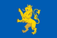
Flags of Saratov, Tomsk and Pskov Oblasts[edit]
Can you convert the flags of Saratov, Tomsk and Pskov Oblasts to svg. 99.230.181.231 14:07, 4 April 2015 (UTC)
- Pskov Oblast still has no official flag. I'll see what I can do for the other two. Hellerick (talk) 14:54, 4 April 2015 (UTC)
- But you can still convert the Pskov flag that is proposed. 99.230.181.231 15:03, 4 April 2015 (UTC)
- Rather than drawing them I found them on the web.


- As for the Pskov flag, it looks simple, so I guess I'll make it later. But I don't like that somebody's trying to pass it for an already adopted flag. Hellerick (talk) 16:01, 4 April 2015 (UTC)
- Here is my version:

- The leopard is taken from the city flag so it looks a bit different. Hellerick (talk) 05:18, 5 April 2015 (UTC)


|
File:Proposed flag of Pskov Oblast.svg has been listed at Commons:Deletion requests so that the community can discuss whether it should be kept or not. We would appreciate it if you could go to voice your opinion about this at its entry.
If you created this file, please note that the fact that it has been proposed for deletion does not necessarily mean that we do not value your kind contribution. It simply means that one person believes that there is some specific problem with it, such as a copyright issue. Please see Commons:But it's my own work! for a guide on how to address these issues. |
Permjak (talk) 15:54, 5 April 2015 (UTC)
- But this is a proposed flag. 99.230.181.231 18:08, 5 April 2015 (UTC)
Lviv and Zaporizhzhya Oblast[edit]
Can you make this file:  less transparent as other files of the flags. Also, make a svg version of this file:
  99.230.181.231 00:57, 8 April 2015 (UTC)
- Here and here:
 .
.- Hellerick (talk) 13:00, 8 April 2015 (UTC)

Не хочу присваивать Ваш труд и выдавать за свой. Разместите пожалуйста векторный герб Запорожской области, он у Вас есть на флаге. см. https://commons.wikimedia.org/wiki/File:Coat_of_arms_of_Zaporizhia_Oblast.png или https://commons.wikimedia.org/wiki/File:Coat_of_Arms_of_Zaporizhzhya_Oblast.png С уважением,--Leonid76 (talk) 12:55, 7 June 2015 (UTC)
- Об авторстве здесь речь не идет — я эти изображения нашел в Сети и лишь немного подправил. Но пожалуйста. Hellerick (talk) 14:17, 7 June 2015 (UTC)

- Спасибо. А не встречали векторный вариант герба Житомирской области? http://commons.wikimedia.org/wiki/File:Coat of Arms of Zhytomyr Oblast.svg. Так не охота отрисовывать его. С уважением, --Leonid76 (talk) 13:03, 8 June 2015 (UTC)
- А вот он:

- Hellerick (talk) 14:19, 8 June 2015 (UTC)

- Да, это он самый и есть. В векторе бы найти такой же. Нет у Вас? С уважением, --Leonid76 (talk) 19:07, 8 June 2015 (UTC)
- Ой, извините, не тот файл прикрепил. Вот SVG-файл:
- Hellerick (talk) 00:45, 9 June 2015 (UTC)
- Спасибо, теперь есть все обласные гербы Украины в векторном формате. Осталось только повнедрять их в страницы. С районными гербами сложнее. Не всегда они есть в нормальном для векторизации качестве, приходиться рисовать самому. С уважением, --Leonid76 (talk) 08:02, 9 June 2015 (UTC)
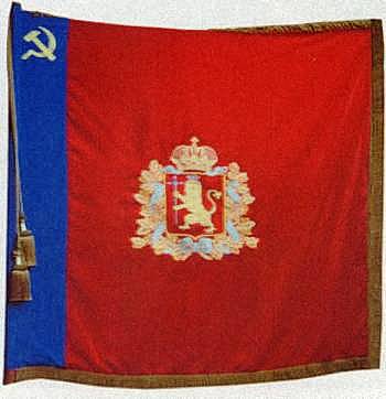
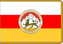
- Доброго времени суток! Видел у Вас флаг Ялты
 в загруженных. Как для вектора 1,97Mb многовато, потом понял почему - там внутри описание и чертёж штандарта. Скажите, а сам ялтинский герб с закругленным внизу щитом и драконами в векторе? Его можно разместить? С уважением, --Leonid76 (talk) 10:09, 19 September 2015 (UTC)
- Да, это он самый и есть. В векторе бы найти такой же. Нет у Вас? С уважением, --Leonid76 (talk) 19:07, 8 June 2015 (UTC)
- Боюсь, что киевские власти удалили материалы крымских официальных сайтов, тогда как российские органичились сканированием официальных документов, и теперь так просто найти векторную основу для изображения не получится. Это изображение всё еще есть у Geraldika.ru, но они за него просят денюжку, да и вообще формально я не могу публиковать здесь их собственность. В принципе задача выглядит не очень трудной, и, наверное, я смогу герб перерисовать — но займусь я этим только в рабочий день, и в первую очередь постараюсь разобраться с версией 2015 года. Hellerick (talk) 14:21, 19 September 2015 (UTC)
- Киевские власти были изгнаны с территории Крыма. Что касается собственности на гербы и флаги, то с момента их утверждения они стают публичной собственностью и даже автор - в нашем случае Сергей Александрович Милокумов - не имеет никаких прав собственности на них, тем более, контора какая-то. С Вашего позволения, разместил перерисованный герб Ялты 2005 года в виде штандарта
 - более полная версия, чем просто квадратный флаг. Далее, герб 2005 года то же отрисовал
  .
.
- Киевские власти были изгнаны с территории Крыма. Что касается собственности на гербы и флаги, то с момента их утверждения они стают публичной собственностью и даже автор - в нашем случае Сергей Александрович Милокумов - не имеет никаких прав собственности на них, тем более, контора какая-то. С Вашего позволения, разместил перерисованный герб Ялты 2005 года в виде штандарта
- Красиво. Я б на вашем месте чуть уменьшил расстояние между буквами Y и A, а также T и A в слове Yalta. А то остальные буквы почти слипаются, а эти отстоят друг от друга. Hellerick (talk) 09:46, 2 October 2015 (UTC)
- Спасибо за замечание, подправил расстояние между буквами
 . Может, что есть из украинских гербов или флагов в векторе? За Крым не говорю, там теперь не разберёшь кто там что утвердил, а кто просто предложил проект символики. С уважением, --Leonid76 (talk) 18:23, 22 October 2015 (UTC)
- Спасибо за замечание, подправил расстояние между буквами


Standards heads of the federal subjects of Russia[edit]
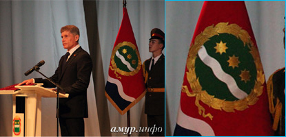
Amur Oblast: http://vexillographia.ru/russia/subjects/amurska.htm and http://cdn5.img22.ria.ru/images/90481/45/904814571.jpg
Chechnya: http://www.vexillographia.ru/russia/subjects/images/chech06.gif and http://www.forumfloristov.ru/images/gallery/img_5db45afd3d7929cc6ff2a492e1400760.JPG
Kaliningrad Oblast: http://www.vexillographia.ru/russia/subjects/images/kalinin7.gif
Karachay-Cherkessia: http://www.vexillographia.ru/russia/subjects/images/kc_pres.gif
Karelia: http://rk.karelia.ru/wp-content/uploads/2014/12/Vstrecha-V.Bulavina-i-A.Hudilajnena-620x399.jpg and http://www.crwflags.com/fotw/images/r/ru-10s1.gif
Nizhny Novgorod: https://upload.wikimedia.org/wikipedia/ru/9/9b/%D0%9F%D0%BE%D1%87%D1%91%D1%82%D0%BD%D1%8B%D0%B9_%D1%88%D1%82%D0%B0%D0%BD%D0%B4%D0%B0%D1%80%D1%82_%D0%93%D1%83%D0%B1%D0%B5%D1%80%D0%BD%D0%B0%D1%82%D0%BE%D1%80%D0%B0_%D0%9D%D0%B8%D0%B6%D0%B5%D0%B3%D0%BE%D1%80%D0%BE%D0%B4%D1%81%D0%BA%D0%BE%D0%B9_%D0%BE%D0%B1%D0%BB%D0%B0%D1%81%D1%82%D0%B8.png and http://ura.ru/images/news/upload/news/155/093/1052155093/019a95ed6dcb7918c17a8534a3b3c3ec.jpg
Novgorod Oblast: http://www.vexillographia.ru/russia/subjects/images/novgorod9.gif
Penza Oblast: http://www.penza.ru/files/www.penza.ru/znam_(11_iz_20).jpg
Perm Krai: http://www.vexillographia.ru/russia/subjects/images/perm96.gif
Rostov Oblast: http://www.vexillographia.ru/russia/subjects/images/rostow98.gif
Ryazan Oblast: http://sovet.geraldika.ru/images/stryaz.gif
Sakha: http://gallery.ykt.ru/galleries/old/komuza/602974.jpg
Saratov Oblast: http://www.vexillographia.ru/russia/subjects/images/sarat05.gif
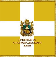
Stavropol Krai: http://www.glava-kbr.ru/images/thumbs/640/images/2014/09/K_stav22.jpg
Vladimir Oblast: http://rvsn.ruzhany.info/27_ra_0/078_02_t.jpg
Yaroslavl Oblast: http://sovet.geraldika.ru/images/styar.gif
Yamalo-Nenets Autonomous Okrug: http://sovet.geraldika.ru/images/meyamash.jpg and http://www.vexillographia.ru/russia/subjects/images/janao6.jpg
99.230.181.231 16:58, 11 April 2015 (UTC)
Standard of Moscow[edit]
http://www.mos.ru/about/symbols/standard/ 174.113.217.132 18:44, 9 July 2015 (UTC)
|
|
File:Flag of the United Socialist States of America (50 stars).svg has been listed at Commons:Deletion requests so that the community can discuss whether it should be kept or not. We would appreciate it if you could go to voice your opinion about this at its entry.
If you created this file, please note that the fact that it has been proposed for deletion does not necessarily mean that we do not value your kind contribution. It simply means that one person believes that there is some specific problem with it, such as a copyright issue. Please see Commons:But it's my own work! for a guide on how to address these issues. |
Keφr (keep talk here) 08:51, 26 July 2015 (UTC)
File tagging File:Sherdor FC logo.svg[edit]
This media was probably deleted.
|
Thanks for uploading File:Sherdor FC logo.svg. This media is missing permission information. A source is given, but there is no proof that the author or copyright holder agreed to license the file under the given license. Please provide a link to an appropriate webpage with license information, or ask the author or copyright holder to send an email with copy of a written permission to VRT (permissions-commons@wikimedia.org). You may still be required to go through this procedure even if you are the author yourself; please see Commons:But it's my own work! for more details. After you emailed permission, you may replace the {{No permission since}} tag with {{subst:PP}} on file description page. Alternatively, you may click on "Challenge speedy deletion" below the tag if you wish to provide an argument why evidence of permission is not necessary in this case.
Please see this page for more information on how to confirm permission, or if you would like to understand why we ask for permission when uploading work that is not your own, or work which has been previously published (regardless of whether it is your own). The file probably has been deleted. If you sent a permission, try to send it again after 14 days. Do not re-upload. When the VRT-member processes your mail, the file can be undeleted. Additionally you can request undeletion here, providing a link to the File-page on Commons where it was uploaded ([[:File:Sherdor FC logo.svg]]) and the above demanded information in your request. |
Well-Informed Optimist (talk) 20:17, 1 August 2015 (UTC)
Dear Hellerick,
may you describe in English, what the letters mean?--Kopiersperre (talk) 08:23, 29 September 2015 (UTC)
- Provided some descriptions. Hellerick (talk) 08:56, 29 September 2015 (UTC)
Can you make an SVG file out of this? Thanks. 174.113.217.132 05:06, 30 September 2015 (UTC)

- Thanks, what about this flag:
 174.113.217.132 03:07, 1 October 2015 (UTC)

- I'm not really sure if it turned out well, but here is my version:

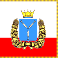
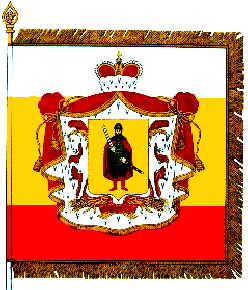
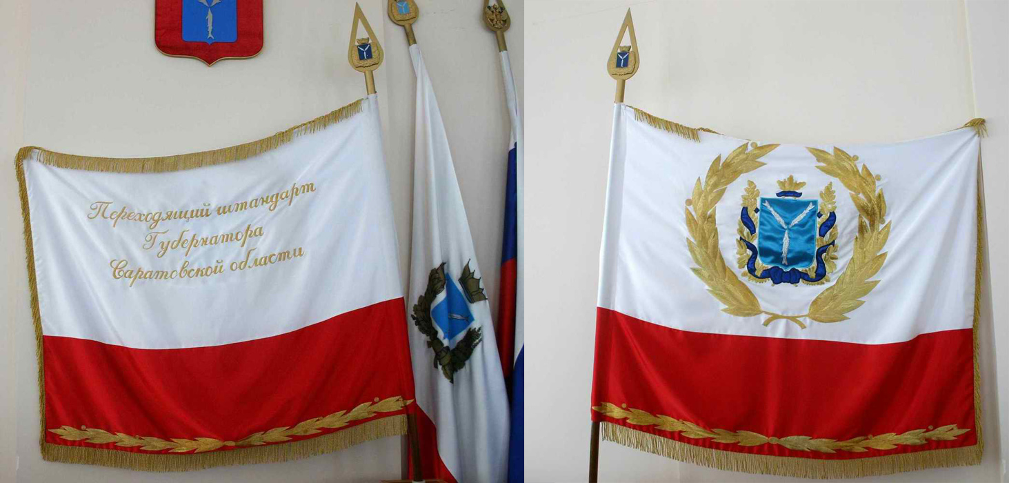
Флаг Саратовской области[edit]
Приветствую, коллега!
Пару лет назад я, сидя на больничном, чтобы убить время, сделал герб моей родной Саратовской области. На днях, снова свалившись с простудой, я вспомнил о том, что тогда нарисовал герб, но так и не добрался до флага. И уже начал его делать, но потом увидел, что вы меня опередили. И это, конечно, отлично, вот только щит и корона там просто векторизированы с не очень удачной репродукции, где стерляди с короной нарисованы криво и примитивно, словно трехлетним ребенком. Так вот, не будете ли вы возражать против того, чтобы скопировать мой герб в ваш флаг? --Kaidor (talk) 18:25, 7 October 2015 (UTC)
- Меня несколько смущает, что ваш щит и мой венок нарисованы в заметно разном стиле — так что придется вам либо перерисовать венок, либо подогнать стиль вашего щита. Попробуйте, конечно. 23:42, 7 October 2015 (UTC)
- Что Вы имеете в виду под разными стилями? В каких стилях сделаны мой и ваши рисунки? --Kaidor (talk) 07:20, 8 October 2015 (UTC)
- У меня — малоцветные изображения с толстыми "чернильными" контурами, у вас — многоцветные изобажения с тонкими контурами. Hellerick (talk) 10:15, 8 October 2015 (UTC)
- И всё? Не вижу в этом вообще никакой проблемы. --Kaidor (talk) 15:09, 8 October 2015 (UTC)
- У меня — малоцветные изображения с толстыми "чернильными" контурами, у вас — многоцветные изобажения с тонкими контурами. Hellerick (talk) 10:15, 8 October 2015 (UTC)
- Что Вы имеете в виду под разными стилями? В каких стилях сделаны мой и ваши рисунки? --Kaidor (talk) 07:20, 8 October 2015 (UTC)
Приветствую ещё раз. Наконец-то одолев лень, я всё-таки сделал этот флаг в тонком, чтобы не сказать изящном стиле. Получилось вот что. Надеюсь теперь у вас не будет возражений. (Кстати, ваш флаг неправильный. Согласно закону ширина герба вместе с венком должна составлять четверть ширины флага, а у вас - треть). --Kaidor (talk) 22:19, 19 January 2016 (UTC)
- Красиво.
- Пожалуй, для флага более подошла бы более малоцветная версия герба, но, полагаю, это уже придирки. Что до размеров герба, то беда в том, что зачастую описанные в законе размеры более нигде не встречаются. Помню, я был вынужден так же уменьшить герб на флаге Красноярского края, хотя на практике такого мелкого герба нигде никогда не использовалось, да и некрасиво это. Hellerick (talk) 02:34, 20 January 2016 (UTC)
- Некрасиво, согласен. Но в данном случае закон - самый авторитетный АИ, ничего не поделаешь. А насчёт не встречаются - вы просто судите по картинкам в интернете. А там либо народное творчество, либо коммерческая отсебятина. А в реале только такой флаг и используется ([3], [4], [5] и т.д.) Вчера ехал по центру и специально обратил внимание. И на областном правительстве, и на мэрии, и на обеих Думах флаг с маленьким гербом. --Kaidor (talk) 09:56, 21 January 2016 (UTC)
Поздравляю вас, коллега. Мы пошли в народ. Люди уже продают изображения нашего флага на стоковых сайтах как свои. Особенно умиляет количество тегов. --Kaidor (talk) 18:57, 23 March 2016 (UTC)
Can you convert this flag to svg? Thanks. 174.113.217.132 02:24, 15 October 2015 (UTC)
- It seems to be obsolete since 2014 and I cannot find the new flag of coat of arms in good resolution. Hellerick (talk) 11:14, 15 October 2015 (UTC)
- Here are some photos: [6], [7] Hellerick (talk) 15:08, 15 October 2015 (UTC)
- Full coat of arms: http://simbolosdelestadoguarico.bloges.org/cache/media/files/00/319/055/2014/06/2551-2835.jpg 174.113.217.132 18:58, 15 October 2015 (UTC)
- Here is the site: http://www.guarico.gob.ve/w/wp-content/uploads/2014/12/ley_de_simbolos_guarico.pdf 174.113.217.132 22:40, 17 October 2015 (UTC)
- Hello? You still here? 174.113.217.132 10:45, 28 October 2015 (UTC)
- Here is the site: http://www.guarico.gob.ve/w/wp-content/uploads/2014/12/ley_de_simbolos_guarico.pdf 174.113.217.132 22:40, 17 October 2015 (UTC)
- Full coat of arms: http://simbolosdelestadoguarico.bloges.org/cache/media/files/00/319/055/2014/06/2551-2835.jpg 174.113.217.132 18:58, 15 October 2015 (UTC)
Standards of heads of of federal subjects[edit]
Can you convert the, to svg?
Altai Krai: Same flag as the krai but with square (11:12)
Altai Republic: Similar to this: http://www.crwflags.com/fotw/images/r/ru-04!).gif but with square (11:12)
Amur Oblast: http://www.vexillographia.ru/russia/subjects/images/amur3.jpg
Chechnya: http://www.vexillographia.ru/russia/subjects/images/chech06.gif
Ingushetia: http://www.vexillographia.ru/russia/subjects/images/ingush14.gif
Kaliningrad Oblast: http://www.vexillographia.ru/russia/subjects/images/kalinin7.gif
Karachay-Cherkessia: http://cherkesk.bezformata.ru/content/image140456738.gif
Karelia: http://www.crwflags.com/fotw/images/r/ru-10s1.gif
Kemerovo Oblast: Same flag as the oblast but with square (11:12)
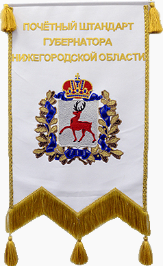
Nizhniy Novgorod Oblast: https://upload.wikimedia.org/wikipedia/ru/9/9b/Почётный_штандарт_Губернатора_Нижегородской_области.png
Novogorod Oblast: http://www.vexillographia.ru/russia/subjects/images/novgorod8.gif
North Ossetia-Alania: Similair to this: http://www.vexillographia.ru/abhazia_osetia/images/sev_os04.gif but with https://upload.wikimedia.org/wikipedia/commons/5/52/Coat_of_Arms_of_North_Ossetia-Alania.png and square (11:12)
Perm Krai: Same flag as the krai but with square (11:12) and fringes surround the standard
Sakha: http://www.crwflags.com/fotw/images/r/ru-14_pz.gif
Rostov Oblast: http://www.crwflags.com/fotw/images/r/ru-61_pz.gif
Ryazan Oblast: http://www.crwflags.com/fotw/images/r/ru-rya2.gif
Saratov Oblast: http://www.vexillographia.ru/russia/subjects/images/sar_znam.jpg
Stravropol Krai: http://www.vexillographia.ru/russia/subjects/images/stavropo.gif
Tomsk Oblast: Same flag but with fringes
Valdimir Oblast: http://rvsn.ruzhany.info/27_ra_0/078_02_t.jpg
Yaroslavl Oblast: http://www.crwflags.com/fotw/images/r/ru-76!q.gif
174.113.217.132 04:00, 15 October 2015 (UTC)
Southern Federal District[edit]

Relief, but apparently no way to make Location map+ for multiple icons

There are two maps of the Southern Federal District:
- "Russia Southern Federal District"= a template(?) for "SouthernRussia.svg"
- and "Relief Map of Southern Federal District.svg".
One has relief and the other allows multiple icons. Is there a way to make multiple icons on a relief map?
NOTE: This code (without the "xxx") did not work on your Commons page:
{xxxx{Location map+|Russia Southern Federal District|width=250px|float=left|relief=1|thumb|caption="Russia Southern Federal District"
Multiple icons, but no relief, even with relief=1
|places=
{xxx{Location map~|Russia Southern Federal District|lat=43.00|long=44.65|mark=Blue-circle.gif|label=Vladakavaz}}
{xxx{Location map~|Russia Southern Federal District|lat=48.70|long=44.52|mark=Blue-circle.gif|label=Volgograd}}
{xxx{Location map~|Russia Southern Federal District|lat=47.50|long=41.00|mark=Pfeil links unten.svg|marksize=12|label=Don River}}
{xxx{Location map~|Russia Southern Federal District|lat=47.23|long=39.70|mark=Pfeil links unten.svg|marksize=12|label=}}
}} Benjamin Trovato (talk) 01:35, 19 January 2016 (UTC)
- I am not sure how it's supposed to be done in the English Wikipedia, but in the Russian in does work like this. Hellerick (talk) 05:21, 19 January 2016 (UTC)
- Sorry for the delay. I have a request in the Graphics Lab/Map Workshop, but they have not replied. Benjamin Trovato (talk) 02:19, 1 February 2016 (UTC)
- Request has been on the Graphics Lab/Map Workshop since 27jan16 and nothing has happened. I guess they know what they are doing. Benjamin Trovato (talk) 05:34, 7 March 2016 (UTC)
- Sorry for the delay. I have a request in the Graphics Lab/Map Workshop, but they have not replied. Benjamin Trovato (talk) 02:19, 1 February 2016 (UTC)
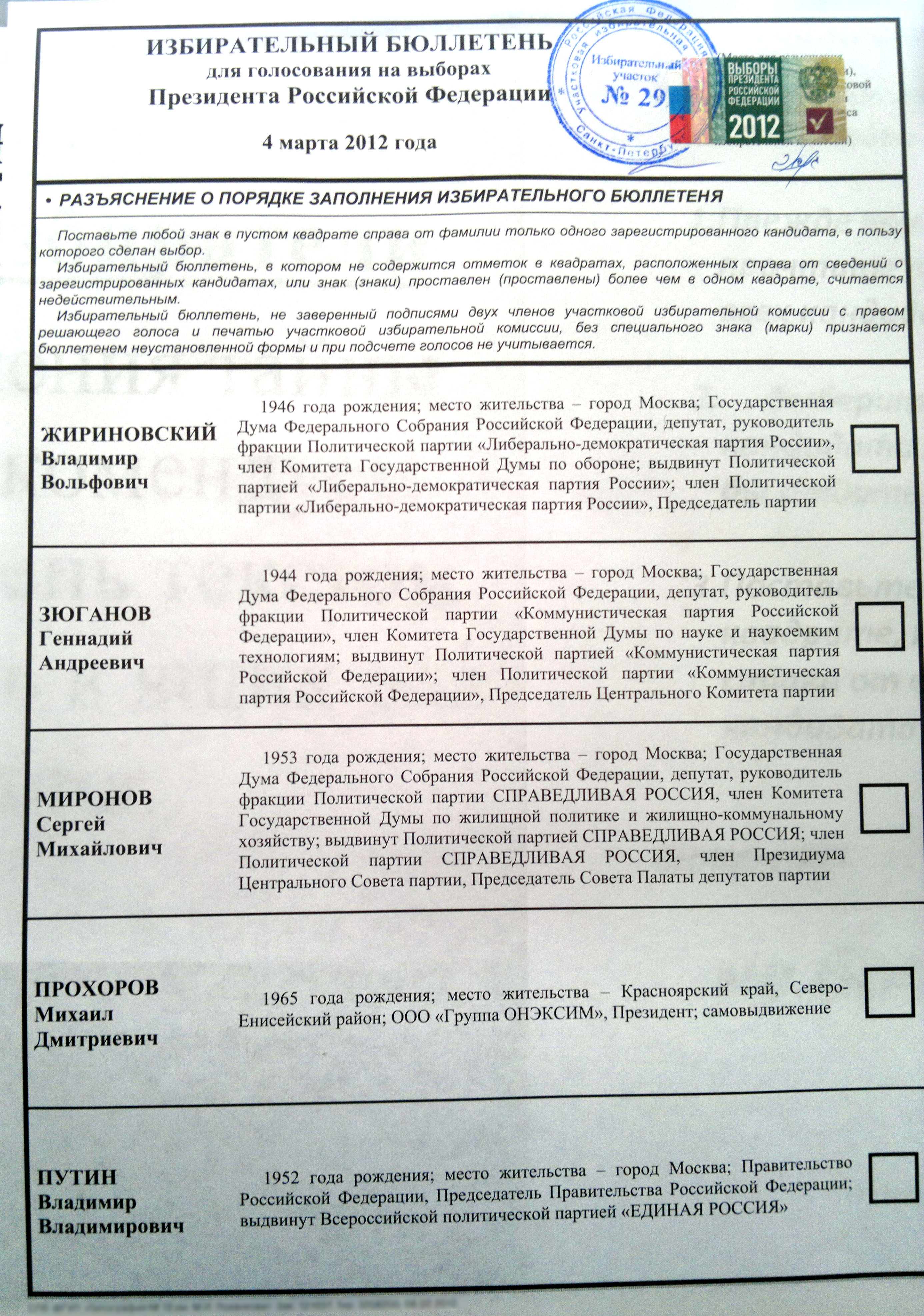
2016 EU Referendum Ballot Paper ru.svg[edit]
Здравствуйте.
Спасибо за быструю правку по переводу одной графы. Однако, я сомневаюсь в идеальном переводе.
Оригинал выглядит так: "Vote only once by putting a cross in the box next to your choice".
Вы перевели так: "Проголосуйте, поставив лишь один крест в квадрате, напротив вашего выбора".
Но даже мне кажется что это не точный перевод, ибо Vote only once означает Проголосуйте один раз а не поставив лишь один крест.
Если вы хорошо знаете английский, или знаете с кем посоветоваться, то тогда переведите эту графу идеально.
Кроме того вы выделили жирным один крест а там подразумевалось один раз проголосовать.
Также должен заметить, что шрифт здорово изменился.
Надеюсь на понимание и исправление ошибок.
-- С уважением, Донор (✉) 15 июня 2016
- На всякий случай переспрошу, но лично мне трудно представить, что еще это могло означать. Hellerick (talk) 15:03, 15 June 2016 (UTC)
- По аналогии с отечественным бюллетенем можно сформулировать так: «Поставьте крестик ☒ в квадрате справа от только того варианта, в пользу которого сделан выбор». Hellerick (talk) 15:45, 15 June 2016 (UTC)
- Вижу что вы сделали новые версии. Пусть будет так. Если кто-то сочтёт что есть более правильный перевод, то наверняка об этом дадут знать. -- С уважением, Донор (✉) 15 июня 2016
- @Hellerick: , вот теперь, по моему, это идеальный перевод. И жирным всё выделено как и подразумевалось в оригинале. Спасибо. Могу ли я оставить заявку на удаление ваших вчерашних версий, чтобы не вводить пользователей в заблуждение не совсем точным переводом? -- С уважением, Донор (✉) 16 июня 2016
- Удалить прошлые версии файла? Плохо понимаю, кому они мешают, но если хотите, удаляйте. Hellerick (talk) 01:01, 17 June 2016 (UTC)
- @Hellerick: , вот теперь, по моему, это идеальный перевод. И жирным всё выделено как и подразумевалось в оригинале. Спасибо. Могу ли я оставить заявку на удаление ваших вчерашних версий, чтобы не вводить пользователей в заблуждение не совсем точным переводом? -- С уважением, Донор (✉) 16 июня 2016
- Вижу что вы сделали новые версии. Пусть будет так. Если кто-то сочтёт что есть более правильный перевод, то наверняка об этом дадут знать. -- С уважением, Донор (✉) 15 июня 2016
|
|
File:Transcaucasia locator map.svg has been listed at Commons:Deletion requests so that the community can discuss whether it should be kept or not. We would appreciate it if you could go to voice your opinion about this at its entry.
If you created this file, please note that the fact that it has been proposed for deletion does not necessarily mean that we do not value your kind contribution. It simply means that one person believes that there is some specific problem with it, such as a copyright issue. Please see Commons:But it's my own work! for a guide on how to address these issues. |
Turnless (talk) 17:56, 18 July 2016 (UTC)
Request[edit]
Greetings.
Turkey and Northern Cyprus have abolished daylight saving and are permanently fixed on en:UTC+3 (en:Further-eastern European Time). See the news and sources.
Can you do these changes for Turkey and Northern Cyprus by copying the latest updates from the File:Time zones of Europe (Crimea disputed).svg except that Crimea must be colored totally in green, for these additional files below? Many cross-Wikipedia articles use these files which are not updated.
Also Crimea, Turkey and Northern Cyprus have not been updated in some of these files reflecting their permanently fixed position on UTC+3. Can you change these files accordingly?
- File:Tzdiff-Europe-winter.png
- File:DaylightSaving-World-Subdivisions.png
- File:UTC hue4map X world Robinson eng.png
- File:Worldwide Time Zones (including DST).png
- File:Standard time zones of the world.png
- File:Standard time zones of the world.svg
- File:Europe time zones map.png
- File:Europe time zones map de.png
- File:Europe time zones map en.png
- File:Europe time zones map fr.png
- File:Europe time zones map tr.png
- File:Europe time zones map tr corrected.png
- File:EUROPE TIME ZONE.png
- File:Europe time zones map multilingüe.jpg
- File:Time Zones of the Middle East.svg
Thank you.
Use Coat of Arms of Guarico[edit]
Good afternoon...
My name is Jose Galindo and I am Venezuelan
I would like to use your Guarico flag to put it in a tourist guide I am doing in English
please tell me what to do to make this possible
Atte Jose Galindo
My mail is jomagadi@yahoo.com --Jomagadi (talk) 16:08, 26 October 2016 (UTC)
Hi! Can you update this image to include the boundary between Kalinga and Apayao and the new province Davao Occidental? I would update it myself but I don't have the skills to do it. Your help would be very appreciated as this image is currently being used as the main location map of the Philippines. Thank you very much! Janbryan (talk) 05:08, 13 January 2017 (UTC)
- Updated as I could understand it.
- I wish I could have a better map to tell where the boundaries are supposed to be. Hellerick (talk) 05:36, 13 January 2017 (UTC)
- Again, thank you very much! Janbryan (talk) 00:49, 14 January 2017 (UTC)
About the time zones map[edit]
Hello! There is an error in the time zones map. The mistake is in Brazil, in the State of Mato Grosso.
All the state adopts the time zone UTC−04:00; but the map is saying that the west of the State adopts the time zone UTC−03:00.
Thanks! (Sorry my english, i'm brazilian).
179.180.17.105 22:31, 24 February 2017 (UTC)
Здравствуйте. Перевел Вашу карту, но, что-то пошло не так). Сможете помочь? --Дагиров Умар (talk) 09:40, 6 June 2017 (UTC)
- Приветствую, @Дагиров Умар: . Как смог подправил карту, но из-за каких-то непонятных "проблем с соединением" не могу заменить ваш файл на откорректированный. Пока что положил файл сюда, попробуйте заменить его сами -- может, у вас получится. Обращайтесь, если что не так. Hellerick (talk) 17:36, 6 June 2017 (UTC)
- Загрузил. Спасибо большое. --Дагиров Умар (talk) 02:03, 7 June 2017 (UTC)
- Кстати, на этих картах Грозный на берегу Терека. --Дагиров Умар (talk) 10:56, 10 June 2017 (UTC)
- @Дагиров Умар: , действительно. Какой-то глюк, который наследуется с самой первой версии карты. Передвинул на Сунжу. Hellerick (talk) 11:16, 10 June 2017 (UTC)
- Еще вопрос. А Prokhladni? Не этот случайно? --Дагиров Умар (talk) 11:40, 10 June 2017 (UTC)
- @Дагиров Умар: Не знаю. И вообще, зачем он тут на карте не знаю. Может, я вместо него Пятигорск нарисую? Он по-чеченски тоже Пятигорск называется? Hellerick (talk) 11:55, 10 June 2017 (UTC)
- Заменил на Пятигорск. Hellerick (talk) 12:20, 10 June 2017 (UTC)
- Да пусть будет Пятигорск. Спасибо большое. --Дагиров Умар (talk) 20:08, 10 June 2017 (UTC)
Добрый день, Hellerick! Если не затруднит, удалите с карты File:Subdivisions_of_the_Russian_Empire_in_1914.svg синее продолговатое ru:Капчагайское водохранилище - его начали заполнять водой только в 1970 году. Спасибо! --Ds02006 (talk) 09:38, 9 July 2017 (UTC)
- Действительно. Заодно Мингечевирское водохранилище удалил. Hellerick (talk) 15:16, 9 July 2017 (UTC)
Здравствуйте. Исправьте, пожалуйста, ошибку на карте - НП в устье реки Сулак назывался Хизроевка, а не Кизроевка. Serzh Ignashevich (talk) 07:24, 7 August 2017 (UTC)
- Да, поправил. Hellerick (talk) 12:43, 7 August 2017 (UTC)
Благодарность[edit]
Спасибо вам большое за File:Greater Bashkiria in 1922.svg Валко (talk) 13:32, 21 November 2017 (UTC)
Просьба[edit]
Добрый день. Можете заняться Картой Башкирской автономной советской республики (Малой Башкирии) в 1919 году с этого источника [8]. Пожалуйста. Валко (talk) 13:40, 11 May 2018 (UTC)
- @Валко: Извиняюсь за позднюю реакцию. Сделал вот такую карту. Hellerick (talk) 15:36, 26 May 2018 (UTC)
@Hellerick: Отлично, спасибо большое. Валко (talk) 15:45, 26 May 2018 (UTC)
Request[edit]
Hello.
Cany put in the Wikipedia articles the up to date file File:DEC31 World Time Zones.png whose title is not restricted according to a certain year, because many Wikipedia articles are using files that are restricted to a certain year and therefore are obsolete (unless these articles indicate the year of these files).
Here are the files that need to be replaced with the above mentioned file:
- File:Standard time zones of the world.png
- File:Standard time zones of the world (2011).svg
- File:Standard time zones of the world (2005).png
- File:Standard time zones of the world (2007).png
- File:Standard time zones of the world (2007-02-20, white bck).svg
- File:Standard time zones of the world (2012) (2).png
- File:Standard time zones of the world (2012) (3).png
The reason I requested this because I live in Turkey, and Wikipedia is completely banned and blocked in Turkey by the Turkish government. If I lived in another country I could have replaced these files myself.
Thank you.
31.200.22.112 15:28, 1 January 2018 (UTC)
Projection of File:Eurasia location map - Political.svg[edit]
Hello Hellerick, could you tell me what projection is used in this map File:Eurasia location map - Political.svg? And if it is a custom projection could provide it in ESRI WKT format? (e.g.GEOGCS["GCS_WGS_1984",DATUM["D_WGS_1984",SPHEROID["WGS_1984",6378137.0,298.257223563]],PRIMEM["Greenwich",0.0],UNIT["Degree",0.0174532925199433],AUTHORITY["EPSG",4326]]) --Ⴂ. ႡႠႪႠႾႠႻႤ★ 10:07, 26 July 2018 (UTC)
- I'm sorry, I don't know ESRI WKT format.
- If I'm not mistaken it's a conical equidistant projection with basic parallel 45°N, and central meridian 85°E. Hellerick (talk) 14:10, 26 July 2018 (UTC)
- Thank you.--Ⴂ. ႡႠႪႠႾႠႻႤ★ 13:36, 28 July 2018 (UTC)
|
|
File:Russia political location map.svg has been listed at Commons:Deletion requests so that the community can discuss whether it should be kept or not. We would appreciate it if you could go to voice your opinion about this at its entry.
If you created this file, please note that the fact that it has been proposed for deletion does not necessarily mean that we do not value your kind contribution. It simply means that one person believes that there is some specific problem with it, such as a copyright issue. Please see Commons:But it's my own work! for a guide on how to address these issues. |
91.142.162.6 10:35, 20 November 2018 (UTC)
File tagging File:Uzbekistan football orden.svg[edit]
This media was probably deleted.
|
Thanks for uploading File:Uzbekistan football orden.svg. This media is missing permission information. A source is given, but there is no proof that the author or copyright holder agreed to license the file under the given license. Please provide a link to an appropriate webpage with license information, or ask the author or copyright holder to send an email with copy of a written permission to VRT (permissions-commons@wikimedia.org). You may still be required to go through this procedure even if you are the author yourself; please see Commons:But it's my own work! for more details. After you emailed permission, you may replace the {{No permission since}} tag with {{subst:PP}} on file description page. Alternatively, you may click on "Challenge speedy deletion" below the tag if you wish to provide an argument why evidence of permission is not necessary in this case.
Please see this page for more information on how to confirm permission, or if you would like to understand why we ask for permission when uploading work that is not your own, or work which has been previously published (regardless of whether it is your own). The file probably has been deleted. If you sent a permission, try to send it again after 14 days. Do not re-upload. When the VRT-member processes your mail, the file can be undeleted. Additionally you can request undeletion here, providing a link to the File-page on Commons where it was uploaded ([[:File:Uzbekistan football orden.svg]]) and the above demanded information in your request. |
Yours sincerely, Jonteemil (talk) 22:38, 27 January 2020 (UTC)
Probably a FAQ[edit]
Hey there! I see you make a lot of .svg files for Wikipedia, and I was wondering what program or tool you use to make 'em. --198.86.247.193 17:02, 25 February 2020 (UTC)
- Inkscape. Free and powerful. Hellerick (talk) 17:12, 25 February 2020 (UTC)
SVG of COA RU[edit]
category:SVG coats of arms of Russian federal oblasts to update User:Hellerick/Vectorization of Russian regional symbols. Sobreira (parlez) 17:37, 16 August 2020 (UTC)
Герб Белоруссии[edit]
Добрый день. Исправьте пожалуйста, девиз на гербе File:Emblem of the Byelorussian SSR (1927-1937).svg.
-
 "Пралятары усiх краiн, злучайцеся!"
 -
 "Пралятары усiх краiн, злучайцеся!"
 -
 "Пралятары усiх краiн, злучайцеся!"
 -
 "Пролятарыi усiх краiн, злучайцеся!"
.jpg)


.svg)
95.110.120.47 13:53, 22 August 2020 (UTC)
Я не знаю, что на что там нужно исправлять. Hellerick (talk) 15:49, 22 August 2020 (UTC)
Девиз на белорусском языке на гербе, обратие внимание. Слева. "Пролятарыi усiх краiн, злучайцеся!". Правильно: "Пралятары усiх краiн, злучайцеся!". Пролятарыi → Пралятары. 95.110.120.47 09:05, 23 August 2020 (UTC)
Заменил "Пролятарыi" → "Пралятары". Hellerick (talk) 12:50, 23 August 2020 (UTC)
Спасибочки. 95.110.120.47 16:44, 23 August 2020 (UTC)
Добрый день. Исправьте пожалуйста, как в БРЭ сделайте, обратите внимание на звезду и стебли колосьев. 37.122.61.73 09:14, 20 January 2021 (UTC)
Изменил. Hellerick (talk) 12:20, 20 January 2021 (UTC)
Спасибо 37.122.61.73 12:25, 20 January 2021 (UTC)
File:Coat of arms of the Russian Federation (1992-1993).svg, наверняка нужно тоже исправить? Там же только название сменили [9]. 37.122.33.114 16:06, 1 February 2021 (UTC)
|
|
File:Flag of the United Kingdom of England, Wales, and Ulster.svg has been listed at Commons:Deletion requests so that the community can discuss whether it should be kept or not. We would appreciate it if you could go to voice your opinion about this at its entry.
If you created this file, please note that the fact that it has been proposed for deletion does not necessarily mean that we do not value your kind contribution. It simply means that one person believes that there is some specific problem with it, such as a copyright issue. Please see Commons:But it's my own work! for a guide on how to address these issues. |
GPinkerton (talk) 19:32, 1 July 2021 (UTC)
Добрый день. Исправьте пожалуйста, как в источнике сделайте File:Coat of Arms of Bashkir ASSR.png, обратите внимание на звезду, стебли колосьев и цвет. 37.122.57.133 18:27, 16 October 2021 (UTC)
Я не вижу разницы. Hellerick (talk) 05:27, 17 October 2021 (UTC)
Как здесь File:Coat of arms of the Russian Soviet Federative Socialist Republic.svg 109.187.4.102 12:15, 17 October 2021 (UTC)
-
 по источнику
 -
 не соответствует источнику


.svg)
.svg)
.svg)
.svg)
![[1]](http://pbs.twimg.com/media/DSQtGc3XkAEyzXa.jpg)
![[2]](http://56.r.photoshare.ru/00561/0055be468c50616a53d83be9de225b640836bf26.jpg)
.jpg)
.svg&action=edit&redlink=1)
.svg)
.svg)
![[3]](http://www.epizodsspace.narod.ru/bibl/engels/engels2.files/engels2-1.jpg)
![[4]](http://artasar.ru/media/ucontent/1000/149/858.jpg)
![[5]](http://russiantourism.ru/netcat_files/userfiles/1605/AVS%20na%206400m%20.jpg)
![[6]](http://2.bp.blogspot.com/-xppjiksYB3c/U17UPO61aJI/AAAAAAAAKz4/QvSHKUdm8eI/s1600/FOTO+005.JPG)
![[7]](http://1.bp.blogspot.com/-jc-MaIl-jwQ/U17UQB-wFUI/AAAAAAAAK0E/4uau9UWX1c4/s1600/FOTO+008.JPG)
.gif)
.svg)
.png)
.svg)
.svg)
.svg)
.svg)
.svg)
.png)
.png&action=edit&redlink=1)
.svg)
_(2).png&action=edit&redlink=1)
_(3).png&action=edit&redlink=1)
.svg)
ИсправьтеFile:Coat of arms of Bashkir ASSR.svg пожалуйста, 109.187.4.102 12:23, 17 October 2021 (UTC)
|
|
File:Christian world map.png has been listed at Commons:Deletion requests so that the community can discuss whether it should be kept or not. We would appreciate it if you could go to voice your opinion about this at its entry.
If you created this file, please note that the fact that it has been proposed for deletion does not necessarily mean that we do not value your kind contribution. It simply means that one person believes that there is some specific problem with it, such as a copyright issue. Please see Commons:But it's my own work! for a guide on how to address these issues. |
37.162.15.61 17:23, 20 November 2021 (UTC)
Малая Башкирия в 1920[edit]
Здравствуйте, сможете сделать? 136.169.169.95 11:52, 2 January 2022 (UTC)
Should Wikipedia indirectly signal that Ukraine has already been divided?[edit]
Please remove the Donbas "socalled" license plates. That area is Ukraine. Nothing else. Those license plates are not any more legal than fake license plates purchased on ali-express. Shame on the editor hiding behind a falsified "disputed territories" argument and adding a politically, non democratic angle to Wikipedia. 85.27.207.185 21:33, 1 June 2022 (UTC)
- These vehicle registration plates are used for vehicle registration, whether nazis like it or not. This simple truth must be reflected in Wikipedia. Hellerick (talk) 06:25, 2 June 2022 (UTC)
В верхней части щита на красном фоне надпись "ВОРКУТА". http://www.heraldicum.ru/russia/subjects/towns/vorkuta.htm Куку Кукуевичъ (talk) 03:10, 30 October 2022 (UTC)
- На сайте городской администрации надпись синяя [10]. Официального документа о гербе города я найти не могу. Hellerick (talk) 06:00, 30 October 2022 (UTC)
- Официального документа о гербе города я тоже найти не могу. Но здесь https://geraldika.ru/s/14959
- Описание:
- В лазуревом щите городского герба изображен прыгающий северный олень на фоне копра над шахтой и угольного террикона. В нижней части герба фрагменты национального орнамента коми (синие на белом), которые символизируют также и реку Воркуту. В верхней части щита на красном фоне надпись "ВОРКУТА". Герб выдержан в цветах государственного флага РСФСР (синий и красный) с добавлением традиционного цвета северных земель - белого.
- Автор герба - Николай Лукьянович Жилин.
Примечание: описание приводится по веб-сайту "Геральдика Республики Коми" (komi.narod.ru) во ссылкой на книгу "Геральдика Земли Коми" (Национальный музей РК, сост. Ананьина Э.А) и Энциклопедию "Республика Коми", КНЦ УрО РАН, Сыктывкар, 1999. В этом в описании указано, что название города приводится на красном фоне
- В верхней части щита на красном фоне надпись "ВОРКУТА". Куку Кукуевичъ (talk) 06:09, 30 October 2022 (UTC)
- http://www.vorcuta.ru/symbols.htm
- В вершине щита наименование города [на серебре]". Куку Кукуевичъ (talk) 06:19, 30 October 2022 (UTC)
- Где тогда описание герба и флаг если это сайт городской администрации? Куку Кукуевичъ (talk) 06:25, 30 October 2022 (UTC)
http://www.vorcuta.ru/symbols.htm Герб на флаге без надписи "ВОРКУТА" Куку Кукуевичъ (talk) 06:23, 30 October 2022 (UTC)
- Все эти взаимопротиворечащие картинки и описания не имеют большого смысла, пока не будет доступен текст официальных документов. Hellerick (talk) 06:36, 30 October 2022 (UTC)
- Согласен. Только где найти текст официальных документов? Куку Кукуевичъ (talk) 06:39, 30 October 2022 (UTC)
Your map Philippines relief location map (square).svg[edit]
Hello Hellerick, I have admired your mapping work on several occasions, and made use of your File:Philippines relief location map (square).svg as a background to my artwork showing General Douglas Macarthur's escape from the Philippines (File:Key locations in Gen MacArthur's escape from the Philippines, 1942.tif).
.svg)
I am contemplating doing similar artwork on a couple of other maps. I would greatly appreciate knowing where I can find maps such as the original map underpinning your file as above. Best wishes, Simon – SCHolar44 (talk) 11:47, 20 July 2023 (UTC)
.svg)
- It's based on data found here: https://www.naturalearthdata.com/downloads/10m-raster-data/ Hellerick (talk) 12:28, 20 July 2023 (UTC)
Political_map_of_the_world_-_Soviet_legacy_color-scheme.svg[edit]
I was looking at the File:Political_map_of_the_world_-_Soviet_legacy_color-scheme.svg file you uploaded, and realized it can be optimized greatly. By running it through svgo I was able to reduce the size from 1.7MB to 650KB. Is it ok with you if I replace the file you uploaded with the optimized version? MiniBill (talk) 14:22, 28 August 2023 (UTC)
- If the result looks okay, go ahead. Hellerick (talk) 14:38, 28 August 2023 (UTC)
- Done --MiniBill (talk) 19:04, 28 August 2023 (UTC)