File:Oklahoma Level IV ecoregions.pdf
Jump to navigation
Jump to search

Size of this JPG preview of this PDF file: 748 × 600 pixels. Other resolutions: 299 × 240 pixels | 599 × 480 pixels | 958 × 768 pixels | 1,277 × 1,024 pixels | 2,553 × 2,048 pixels | 6,675 × 5,354 pixels.
Original file (6,675 × 5,354 pixels, file size: 15.71 MB, MIME type: application/pdf)
Captions
Captions
Add a one-line explanation of what this file represents
Summary[edit]
| Description |
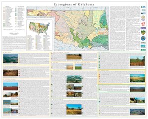
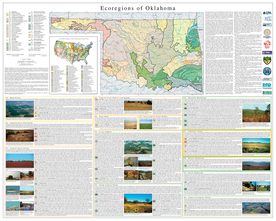
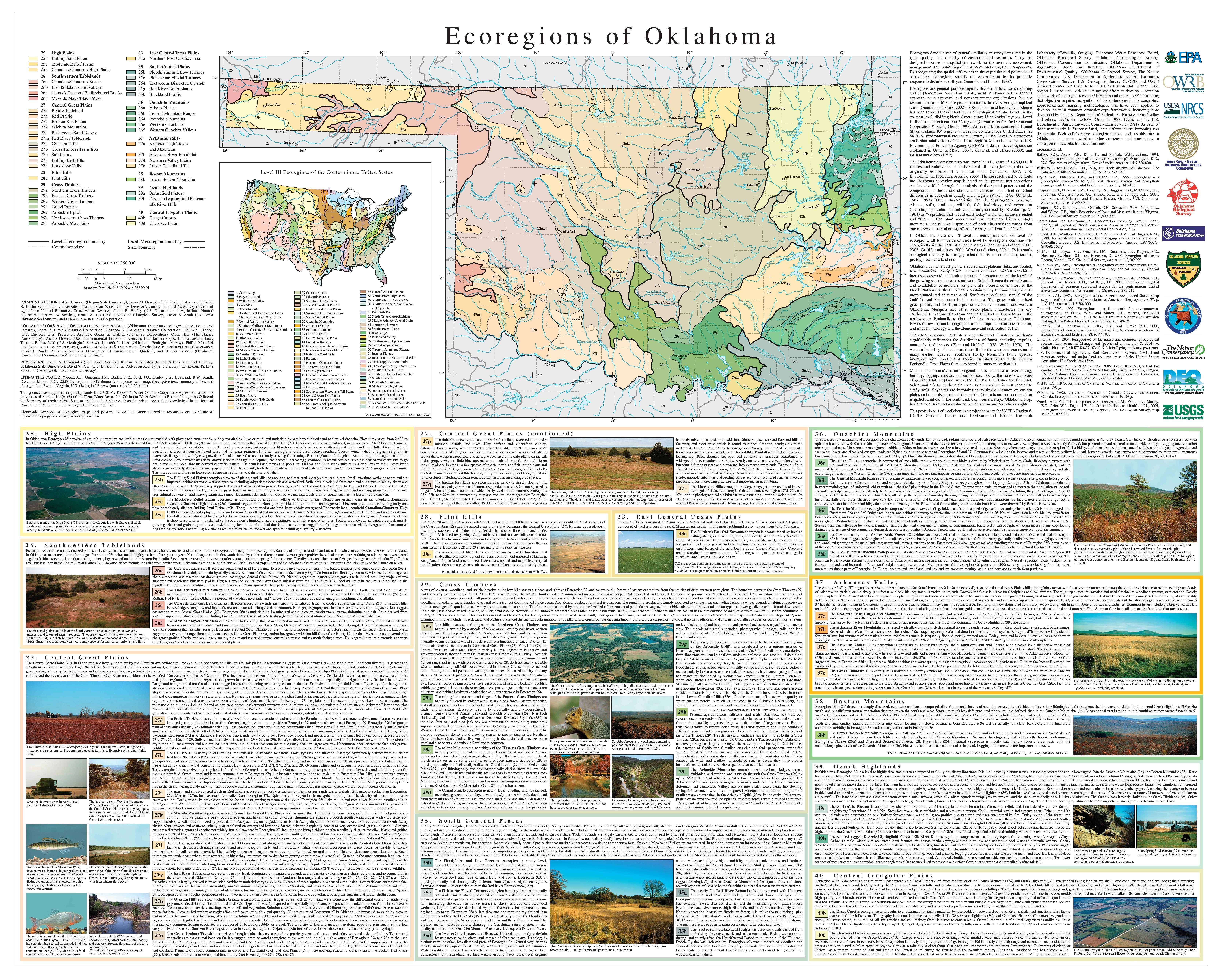
Map of Level III and Level IV ecoregions in the state of Oklahoma, as defined by the U.S. Environmental Protection Agency. Woods, A.J., Omernik, J.M., Butler, D.R., Ford, J.G., Henley, J.E., Hoagland, B.W., Arndt, D.S., and Moran, B.C., 2005, Ecoregions of Oklahoma (color poster with map, descriptive text, summary tables, and photographs): Reston, Virginia, U.S. Geological Survey (map scale 1:1,250,000).
|
|||
| Date | ||||
| Source | https://gaftp.epa.gov/EPADataCommons/ORD/Ecoregions/ok/ok_front.pdf | |||
| Author | Woods, A.J., Omernik, J.M., Butler, D.R., Ford, J.G., Henley, J.E., Hoagland, B.W., Arndt, D.S., and Moran, B.C. |
File history
Click on a date/time to view the file as it appeared at that time.
| Date/Time | Thumbnail | Dimensions | User | Comment | |
|---|---|---|---|---|---|
| current | 12:42, 7 April 2022 |  | 6,675 × 5,354 (15.71 MB) | TimK MSI (talk | contribs) | {{Information |Description=Map of Level III and Level IV ecoregions in the state of Oklahoma, as defined by the U.S. Environmental Protection Agency. Woods, A.J., Omernik, J.M., Butler, D.R., Ford, J.G., Henley, J.E., Hoagland, B.W., Arndt, D.S., and Moran, B.C., 2005, Ecoregions of Oklahoma (color poster with map, descriptive text, summary tables, and photographs): Reston, Virginia, U.S. Geological Survey (map scale 1:1,250,000). {{PD-USGov-USGS}} |Source=https://gaftp.epa.gov/EPADataCom... |
You cannot overwrite this file.
File usage on Commons
There are no pages that use this file.