File:Map of the United States Showing the Range of Missiles - DPLA - 0d2161cef0f232d33ac9370731afd758 (page 2).pdf
Jump to navigation
Jump to search

Size of this JPG preview of this PDF file: 461 × 599 pixels. Other resolutions: 184 × 240 pixels | 369 × 480 pixels | 591 × 768 pixels | 1,200 × 1,560 pixels.
Original file (1,200 × 1,560 pixels, file size: 330 KB, MIME type: application/pdf)
Captions
Captions
Add a one-line explanation of what this file represents
Summary[edit]
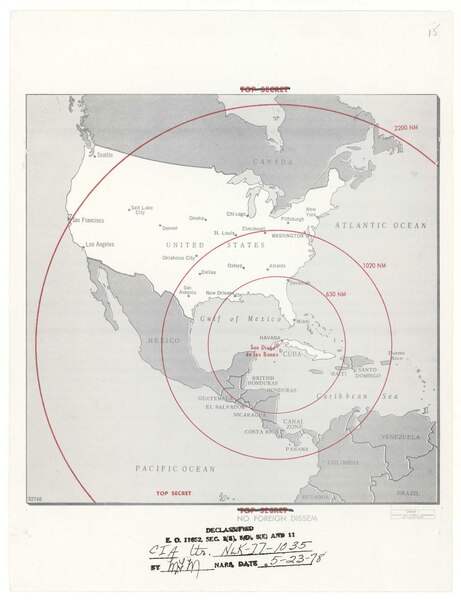
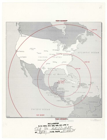
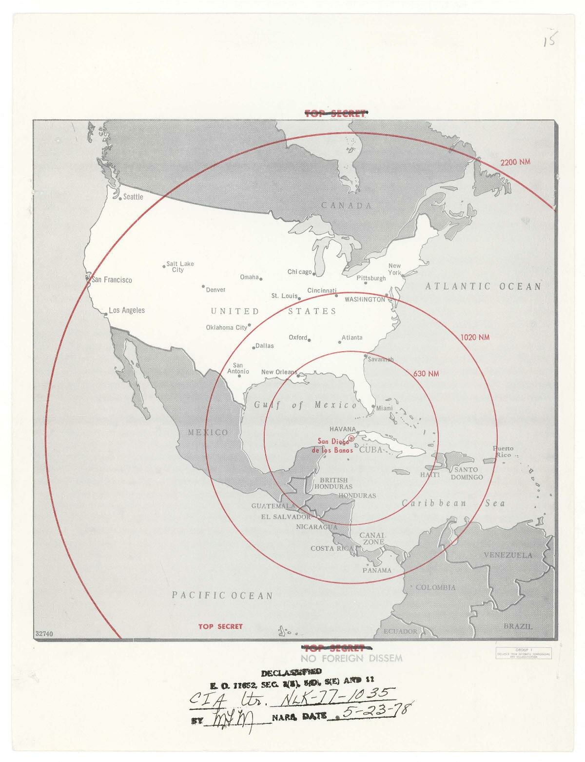
| Map of the United States Showing the Range of Missiles
( |
|||||||||||||||||
|---|---|---|---|---|---|---|---|---|---|---|---|---|---|---|---|---|---|
| Creator | Sorensen, Theodore Chaikin, 1928-2010 | ||||||||||||||||
| Title |
Map of the United States Showing the Range of Missiles |
||||||||||||||||
| Description |
In this map, only the Pacific Northwest is out of missile range. |
||||||||||||||||
| Collection |
|
||||||||||||||||
| Source/Photographer |
|
||||||||||||||||
| Permission (Reusing this file) |
|
||||||||||||||||
| Standardized rights statement |
|
||||||||||||||||


File history
Click on a date/time to view the file as it appeared at that time.
| Date/Time | Thumbnail | Dimensions | User | Comment | |
|---|---|---|---|---|---|
| current | 19:35, 7 March 2023 |  | 1,200 × 1,560 (330 KB) | DPLA bot (talk | contribs) | Uploading DPLA ID dpla:0d2161cef0f232d33ac9370731afd758 |
You cannot overwrite this file.
File usage on Commons
The following page uses this file: