File:Geologic Map and Structure of the 7.5' Los Gatos Quadrangle, Santa Clara and Santa Cruz Counties, California.pdf
Jump to navigation
Jump to search

Size of this JPG preview of this PDF file: 418 × 599 pixels. Other resolutions: 167 × 240 pixels | 335 × 480 pixels | 536 × 768 pixels | 714 × 1,024 pixels | 1,429 × 2,048 pixels | 3,068 × 4,397 pixels.
Original file (3,068 × 4,397 pixels, file size: 4.41 MB, MIME type: application/pdf)
Captions
Captions
Add a one-line explanation of what this file represents
Summary[edit]
| Description |
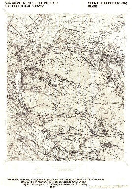
English: A plate map of the 7.5' Los Gatos Quadrangle |
| Date | |
| Source | usgs.gov |
| Author | R.J. McLaughlin, J.C. Clark, E.E. Brabb, and E.J. Helly |
Licensing[edit]
This image is in the public domain in the United States because it only contains materials that originally came from the United States Geological Survey, an agency of the United States Department of the Interior. For more information, see the official USGS copyright policy.
|
File history
Click on a date/time to view the file as it appeared at that time.
| Date/Time | Thumbnail | Dimensions | User | Comment | |
|---|---|---|---|---|---|
| current | 23:39, 2 February 2024 |  | 3,068 × 4,397 (4.41 MB) | Fluffy89502 (talk | contribs) | Uploaded a work by R.J. McLaughlin, J.C. Clark, E.E. Brabb, and E.J. Helly from usgs.gov with UploadWizard |
You cannot overwrite this file.
File usage on Commons
There are no pages that use this file.