Category:September 2009 in the East Riding of Yorkshire
Jump to navigation
Jump to search
Ceremonial counties of England: Bedfordshire · Berkshire · Buckinghamshire · Cambridgeshire · Cheshire · Cornwall · Cumbria · Derbyshire · Devon · Dorset · Durham · East Riding of Yorkshire · East Sussex · Essex · Gloucestershire · Greater London · Greater Manchester · Hampshire · Herefordshire · Hertfordshire · Isle of Wight · Kent · Lancashire · Leicestershire · Lincolnshire · Merseyside · Norfolk · North Yorkshire · Northamptonshire · Northumberland · Nottinghamshire · Oxfordshire · Shropshire · Somerset · South Yorkshire · Staffordshire · Suffolk · Surrey · Tyne and Wear · Warwickshire · West Midlands · West Sussex · West Yorkshire · Wiltshire · Worcestershire
City-counties: Bristol ·
Former historic counties:
Other former counties:
City-counties: Bristol ·
Former historic counties:
Other former counties:
Deutsch: Bilder, die im September 2009 in the East Riding of Yorkshire aufgenommen worden sind. Bitte beachten Sie, dass dies weder das Datum des Uploads noch das Datum des Scannens eines Fotos ist.
English: Images/pictures taken in the East Riding of Yorkshire during September 2009. Note this is not the date of the upload, nor the date a photo was scanned.
Español: Fotografías o imágenes tomadas en the East Riding of Yorkshire durante septiembre 2009. No es la fecha de subida ni escaneo, sino la fecha en que las fotografías o imágenes se crearon.
Esperanto: Bildoj faritaj en the East Riding of Yorkshire en septembro 2009. Tio ne estas la dato, kiam la bildoj estis alŝutitaj aŭ skanitaj.
Français : Photographies ou images prises en the East Riding of Yorkshire durant septembre 2009. Ce n'est pas la date du téléchargement ou du scan.
Galego: Fotografías ou imaxes tomadas en the East Riding of Yorkshire durante setembro 2009. Non é a data de subida nin escaneamento, senón a data na que se crearon as fotografías ou imaxes.
Italiano: Fotografie o immagini scattate a the East Riding of Yorkshire nel settembre 2009. Nota bene: la data non si riferisce né a quella di upload né a quella in cui la foto è stata digitalizzata.
Norsk bokmål: Bilder tatt i the East Riding of Yorkshire i løpet av september 2009. Merk at dette ikke er datoen for opplasting, eller når et bilde har blitt skannet.
Norsk nynorsk: Bilete teke i the East Riding of Yorkshire i løpet av september 2009. Merk at dette ikkje er datoen for opplasting, eller når eit bilete har vorte skanna.
Русский: Изображения, сделанные в the East Riding of Yorkshire в течение сентябрь 2009 (не дата загрузки изображения).
Українська: Зображення, зроблені в the East Riding of Yorkshire протягом вересень 2009. Зауважте, що це не дата завантаження чи дата сканування фотографії.
| September 2008 | ← | September 2009 | → | September 2010 | |||||||
| Jan | Feb | Mar | Apr | May | Jun | Jul | Aug | Sep | Oct | Nov | Dec |
| 148 | 203 | 903 | 767 | 930 | 718 | 783 | 588 | 336 | 712 | 202 | 287 |
|---|---|---|---|---|---|---|---|---|---|---|---|
Subcategories
This category has only the following subcategory.
Media in category "September 2009 in the East Riding of Yorkshire"
The following 200 files are in this category, out of 335 total.
(previous page) (next page)-
 Market Place, South Cave - geograph.org.uk - 1477241.jpg 640 × 480; 83 KB
-
-
 A1033 Ryehill - geograph.org.uk - 1472632.jpg 640 × 480; 36 KB
-
 A164 towards Driffield - geograph.org.uk - 1497269.jpg 640 × 480; 46 KB
-
 A164 towards Driffield - geograph.org.uk - 1497291.jpg 640 × 480; 90 KB
-
 A165 at Beeford looking north - geograph.org.uk - 1483359.jpg 640 × 480; 67 KB
-
 A614 towards Middleton - geograph.org.uk - 1496189.jpg 640 × 480; 51 KB
-
 A614 towards Middleton - geograph.org.uk - 1496224.jpg 640 × 480; 46 KB
-
 A614 towards Middleton - geograph.org.uk - 1496245.jpg 640 × 480; 55 KB
-
 Acres Farm - geograph.org.uk - 1497297.jpg 640 × 480; 94 KB
-
 Across the field to Londesborough - geograph.org.uk - 1474157.jpg 640 × 480; 78 KB
-
 Aike - geograph.org.uk - 1497186.jpg 640 × 480; 59 KB
-
 Aike Lane - geograph.org.uk - 1497180.jpg 640 × 480; 61 KB
-
 All Saints Church Kilnwick 3.jpg 640 × 480; 60 KB
-
 All Saints Church, Easington - geograph.org.uk - 1472544.jpg 640 × 480; 98 KB
-
 All Saints Church, Tunstall - geograph.org.uk - 1507065.jpg 640 × 481; 217 KB
-
 Approaching Leconfield - geograph.org.uk - 1497255.jpg 640 × 480; 53 KB
-
 Arram Station - geograph.org.uk - 1497227.jpg 640 × 480; 67 KB
-
 At the Humber Bridge Viewing Area - geograph.org.uk - 1516191.jpg 640 × 345; 215 KB
-
 Avenue of trees to Boreas Hall - geograph.org.uk - 1473910.jpg 640 × 480; 73 KB
-
 B1248 towards Bainton - geograph.org.uk - 1496359.jpg 640 × 480; 52 KB
-
 B1248 towards Bainton - geograph.org.uk - 1496373.jpg 640 × 480; 53 KB
-
 B1248 towards Bainton - geograph.org.uk - 1496403.jpg 640 × 480; 72 KB
-
 Bale stack off Newlands Lane - geograph.org.uk - 1472820.jpg 640 × 480; 48 KB
-
 Barff Hill Farm - geograph.org.uk - 1497176.jpg 640 × 480; 57 KB
-
 Beach at Spurn Warren - geograph.org.uk - 1472478.jpg 640 × 480; 61 KB
-
 St Leonard's church Beeford (2) - geograph.org.uk - 1483253.jpg 640 × 480; 126 KB
-
 Beeford Cricket Club pavilion - geograph.org.uk - 1483924.jpg 640 × 480; 85 KB
-
 Beeford west end - geograph.org.uk - 1481720.jpg 640 × 480; 87 KB
-
 Bellcroft Lane - geograph.org.uk - 1473881.jpg 640 × 358; 47 KB
-
 Bempton cliffs - geograph.org.uk - 1474478.jpg 640 × 470; 104 KB
-
 Beswick Hall - geograph.org.uk - 1497152.jpg 640 × 480; 86 KB
-
 Beswick Heads - geograph.org.uk - 1497157.jpg 640 × 480; 51 KB
-
 Beswick Heads - geograph.org.uk - 1497158.jpg 640 × 480; 40 KB
-
 Beswick Road - geograph.org.uk - 1497161.jpg 640 × 480; 75 KB
-
 Beverley and Barmston Drain - geograph.org.uk - 1497191.jpg 640 × 480; 71 KB
-
 Beverley and Barmston Drain - geograph.org.uk - 1497200.jpg 640 × 480; 83 KB
-
 Beverley minster from south.jpg 2,048 × 1,536; 650 KB
-
 Beverley Minster from West Pasture.jpg 2,048 × 1,536; 667 KB
-
 Birkhill Wood (geograph 1999638).jpg 2,304 × 1,728; 1.83 MB
-
 Blacktoft Sands RSPB reserve with Ship.JPG 3,008 × 2,000; 1.48 MB
-

-
 Bridge over Winestead Drain - geograph.org.uk - 1472798.jpg 640 × 480; 50 KB
-
 Bridges plus Warter 066.jpg 448 × 336; 40 KB
-
 Bridges plus Warter 067.jpg 448 × 336; 33 KB
-

-
 Bridleway to Aike - geograph.org.uk - 1497193.jpg 640 × 480; 77 KB
-
 Bridleway to Arram - geograph.org.uk - 1497199.jpg 640 × 480; 84 KB
-
 Bridleway, Aike - geograph.org.uk - 1497189.jpg 640 × 480; 66 KB
-
 Bryan Mills Beck - geograph.org.uk - 1497293.jpg 640 × 480; 133 KB
-
 Bryan Mills Farm - geograph.org.uk - 1497296.jpg 640 × 480; 82 KB
-
 Burnby Church - geograph.org.uk - 1473936.jpg 640 × 480; 73 KB
-

-
 Carving of musician.jpg 2,048 × 1,536; 694 KB
-
 Catchwater Drain - geograph.org.uk - 1497233.jpg 640 × 480; 123 KB
-
 Catfoss Drain near Sigglesthorne - geograph.org.uk - 1497643.jpg 426 × 640; 208 KB
-
 Catwick Heads footpath - geograph.org.uk - 1497706.jpg 498 × 640; 226 KB
-
 Cherry Cobb Sands Road - geograph.org.uk - 1473717.jpg 640 × 480; 35 KB
-
 Cherry Cobb Sands Road - geograph.org.uk - 1473722.jpg 640 × 480; 31 KB
-
 Cherry Cobb Sands Road - geograph.org.uk - 1473742.jpg 640 × 480; 36 KB
-
 Cherry Cobb Sands Road - geograph.org.uk - 1473753.jpg 640 × 480; 39 KB
-
 Chimneys and Roofs in Souttergate - geograph.org.uk - 1503967.jpg 640 × 489; 77 KB
-
 Church Street, South Cave - geograph.org.uk - 1477238.jpg 640 × 397; 47 KB
-
 Cliff Road Bempton - geograph.org.uk - 1474514.jpg 640 × 480; 46 KB
-
 Cliffe Lane Junction - geograph.org.uk - 1491647.jpg 640 × 480; 27 KB
-
 Common Hill Lane - geograph.org.uk - 1491588.jpg 640 × 480; 65 KB
-
 Cottage on Channel Road, Sunk Island - geograph.org.uk - 1472859.jpg 640 × 478; 43 KB
-
 Cottage Pasture - geograph.org.uk - 1497303.jpg 640 × 480; 48 KB
-
 Cross Drain off Stray Road - geograph.org.uk - 1472835.jpg 640 × 480; 50 KB
-
 Dangerous cliffs (geograph 1485663).jpg 640 × 480; 46 KB
-

-
 Drain off Stray Road - geograph.org.uk - 1472845.jpg 640 × 480; 42 KB
-
 Duck Nest Farm - geograph.org.uk - 1491639.jpg 640 × 480; 56 KB
-
 Easington Parish Church - geograph.org.uk - 1472541.jpg 640 × 480; 48 KB
-
 Easington Parish Council Cemetery - geograph.org.uk - 1472536.jpg 640 × 480; 117 KB
-
 East Bank Farm Cottages - geograph.org.uk - 1472863.jpg 640 × 480; 47 KB
-
 East Street Kilham.jpg 640 × 480; 82 KB
-
 Eastfield Road towards South Farm - geograph.org.uk - 1472531.jpg 640 × 480; 38 KB
-
 Entering Patrington Haven - geograph.org.uk - 1472785.jpg 640 × 480; 37 KB
-
 Entering Paull - geograph.org.uk - 1473966.jpg 640 × 480; 55 KB
-
 Entering Skeffling - geograph.org.uk - 1472576.jpg 640 × 480; 77 KB
-
 Entering Winestead - geograph.org.uk - 1472738.jpg 640 × 480; 70 KB
-
 Entrance to Aike Grange Stud - geograph.org.uk - 1497183.jpg 640 × 480; 75 KB
-
 Entrance to Walled Garden - geograph.org.uk - 1509488.jpg 480 × 640; 71 KB
-
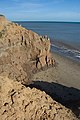
 Erosion continues (2) - geograph.org.uk - 1483124.jpg 640 × 480; 67 KB
-
 Erosion continues - geograph.org.uk - 1483106.jpg 640 × 480; 37 KB
-
 Farm track near Eastrington Station - geograph.org.uk - 1477208.jpg 640 × 480; 86 KB
-
 Farmland and buildings - geograph.org.uk - 1483911.jpg 640 × 480; 64 KB
-
 Farmland north of Roos - geograph.org.uk - 1507505.jpg 640 × 426; 214 KB
-

-
 Farmland West of Beswick - geograph.org.uk - 1497160.jpg 640 × 480; 72 KB
-
 Farmland, Arram Grange - geograph.org.uk - 1497209.jpg 640 × 480; 60 KB
-
 Farmland, Brickyard Farm - geograph.org.uk - 1497169.jpg 640 × 480; 65 KB
-
 Farmland, Decoy Farm - geograph.org.uk - 1497283.jpg 640 × 480; 74 KB
-
 Farmland, Lakes Farm - geograph.org.uk - 1497289.jpg 640 × 480; 72 KB
-
 Farmland, Leconfield Grange - geograph.org.uk - 1497248.jpg 640 × 480; 79 KB
-
 Farmland, Leconfield Grange - geograph.org.uk - 1497260.jpg 640 × 480; 85 KB
-
 Field Entrance off Beverley Road - geograph.org.uk - 1496322.jpg 640 × 456; 55 KB
-
 Field entrance off Mill Lane - geograph.org.uk - 1477205.jpg 640 × 480; 92 KB
-
 Field on Hotham Hill - geograph.org.uk - 1491585.jpg 640 × 480; 67 KB
-
-
 Fields near Cobble Hall, Catwick - geograph.org.uk - 1497747.jpg 498 × 640; 196 KB
-
 Fields near Kilnsea Grange - geograph.org.uk - 1472523.jpg 640 × 480; 60 KB
-
 Fields off Thorn Marsh Road - geograph.org.uk - 1473845.jpg 640 × 480; 29 KB
-
 Fields off Welwick Road - geograph.org.uk - 1472753.jpg 640 × 480; 46 KB
-
 Fields on Sunk Island - geograph.org.uk - 1472881.jpg 640 × 480; 31 KB
-
 Fields on Thorn Marsh - geograph.org.uk - 1473848.jpg 640 × 480; 25 KB
-
 Fields towards Enholmes Farm - geograph.org.uk - 1472759.jpg 640 × 480; 43 KB
-
 Firtholme farm - geograph.org.uk - 1472526.jpg 640 × 480; 53 KB
-
 Fishing off Bempton Cliffs - geograph.org.uk - 1474490.jpg 640 × 474; 56 KB
-

-
 Footpath between field and railway (geograph 1999576).jpg 2,304 × 1,728; 1.63 MB
-
 Footpath near Brickyard Farm - geograph.org.uk - 1497165.jpg 640 × 480; 142 KB
-
 Footpath Road and Rail (geograph 1999592).jpg 2,304 × 1,728; 1.83 MB
-
 Footpath to Butt Farm (geograph 1999742).jpg 2,304 × 1,728; 1.79 MB
-
 Footpath to Hilston - geograph.org.uk - 1507496.jpg 466 × 640; 226 KB
-
 Footpath to Lockington - geograph.org.uk - 1497155.jpg 640 × 480; 54 KB
-
 Fosse Hill Jetksi Centre, near Catwick - geograph.org.uk - 1497557.jpg 640 × 426; 222 KB
-
 Furze Road, near Tunstall - geograph.org.uk - 1507501.jpg 640 × 426; 180 KB
-
 Gated entrance off Station Road North Cave.jpg 640 × 480; 77 KB
-
 Gated Field Entrance - geograph.org.uk - 1496203.jpg 640 × 480; 88 KB
-

-
 Gateway to West Farm - geograph.org.uk - 1472920.jpg 640 × 480; 54 KB
-
 Grange Road, Leconfield - geograph.org.uk - 1497256.jpg 640 × 480; 63 KB
-
 Grange Road, Leconfield - geograph.org.uk - 1497259.jpg 640 × 480; 93 KB
-
 Gravel pits near Brandesburton - geograph.org.uk - 1497678.jpg 640 × 426; 183 KB
-
 Gravel pits near Brandesburton - geograph.org.uk - 1497686.jpg 640 × 426; 190 KB
-
 Greenhouse, Sewerby Hall Walled Garden - geograph.org.uk - 1509498.jpg 640 × 480; 137 KB
-
 Groynes at Wyke Bight - geograph.org.uk - 1472502.jpg 640 × 480; 55 KB
-
 Groynes on Spurn Eastern Coastline - geograph.org.uk - 1469362.jpg 640 × 480; 71 KB
-
 Harvested field, Londsborough - geograph.org.uk - 1474150.jpg 640 × 480; 77 KB
-
 Haverfield Lodge, Welwick - geograph.org.uk - 1472595.jpg 640 × 480; 58 KB
-
 Hayton Church - geograph.org.uk - 1473943.jpg 640 × 424; 67 KB
-
 Hedon Church from Magadelen Lane - geograph.org.uk - 1503952.jpg 510 × 640; 110 KB
-
 Hessle Haven - geograph.org.uk - 1473759.jpg 640 × 480; 62 KB
-
 High Street, Patrington - geograph.org.uk - 1472743.jpg 640 × 480; 53 KB
-
 Hogsea Lane, near Hilston - geograph.org.uk - 1507301.jpg 640 × 469; 226 KB
-
 Holderness Country Park - geograph.org.uk - 1507054.jpg 640 × 386; 220 KB
-
 Holiday Chalets, North Landing - geograph.org.uk - 1509447.jpg 640 × 447; 67 KB
-
 Holm Dale - geograph.org.uk - 1473923.jpg 640 × 480; 77 KB
-
 Hornhill Top Farm - geograph.org.uk - 1496426.jpg 640 × 480; 78 KB
-
 Hornsea groyne - geograph.org.uk - 1483884.jpg 432 × 640; 226 KB
-
 Hornsea sea wall and promenade.jpg 426 × 640; 164 KB
-
 Hornsea seafront.jpg 640 × 448; 183 KB
-
 House on Main Street Roos.jpg 640 × 443; 234 KB
-
 Howden Minster 1.jpg 2,048 × 1,536; 597 KB
-
 Humber bank, Brough - geograph.org.uk - 1473723.jpg 640 × 480; 98 KB
-
 Humber Lightship - geograph.org.uk - 1483740.jpg 640 × 517; 151 KB
-
 Jetski at Fosse Hill - geograph.org.uk - 1497549.jpg 640 × 453; 183 KB
-
 Keyingham Road towards Ottringham - geograph.org.uk - 1472731.jpg 640 × 480; 43 KB
-
 Kilnsea Clays towards Spurn Head - geograph.org.uk - 1472517.jpg 640 × 480; 47 KB
-
 Laurel Farm Aike.jpg 640 × 480; 88 KB
-
 Lay-by on the A164 near Bainton - geograph.org.uk - 1496182.jpg 640 × 480; 45 KB
-
 Low Farm - geograph.org.uk - 1497172.jpg 640 × 480; 76 KB
-
 Low tide, Brough Haven entrance - geograph.org.uk - 1473726.jpg 640 × 480; 71 KB
-
 Low tide, Brough Roads - geograph.org.uk - 1473731.jpg 640 × 480; 75 KB
-
 Main Street Sigglesthorne.jpg 640 × 426; 215 KB
-
 Main Street, Beeford - geograph.org.uk - 1484173.jpg 640 × 480; 91 KB
-
 Main Street, Keyingham - geograph.org.uk - 1472724.jpg 640 × 480; 53 KB
-
 Main Street, Roos - geograph.org.uk - 1507530.jpg 467 × 640; 199 KB
-
 Main Street, Tunstall - geograph.org.uk - 1507098.jpg 640 × 415; 176 KB
-
 Main Street, Welwick - geograph.org.uk - 1472589.jpg 640 × 480; 51 KB
-
 Maize crop at Beeford - geograph.org.uk - 1483421.jpg 640 × 480; 76 KB
-
 Making Wakes - geograph.org.uk - 1485246.jpg 640 × 416; 64 KB
-
 Marsh lane, Camerton - geograph.org.uk - 1472628.jpg 640 × 480; 59 KB
-
 MateuszBajer.jpg 156 × 298; 25 KB
-
 MateuszBajerMolescroft.jpg 300 × 194; 34 KB
-
 Memorial Gardens, Hornsea - geograph.org.uk - 1483895.jpg 640 × 481; 191 KB
-
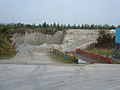 Middleton Quarry - geograph.org.uk - 1496290.jpg 640 × 480; 59 KB
-
 Miles Lane, Leconfield - geograph.org.uk - 1497262.jpg 640 × 480; 69 KB
-
 Mill Lock Fishing Pond - geograph.org.uk - 1491633.jpg 640 × 480; 91 KB
-
 Mineral Works - geograph.org.uk - 1496414.jpg 640 × 480; 48 KB
-
 Minor Road Towards Barff Hill - geograph.org.uk - 1497175.jpg 640 × 480; 70 KB
-
 Minor Road Towards Barff Hill - geograph.org.uk - 1497298.jpg 640 × 480; 77 KB
-
 Minor Road Towards Kilnwick - geograph.org.uk - 1496254.jpg 640 × 480; 85 KB
-
 Minor Road Towards Kilnwick - geograph.org.uk - 1496410.jpg 640 × 480; 68 KB
-
 Minor Road Towards Kilnwick - geograph.org.uk - 1497129.jpg 640 × 480; 53 KB
-
 Minor Road Towards Kilnwick.jpg 640 × 480; 39 KB
-
 Minor Road Towards Kirkburn - geograph.org.uk - 1497135.jpg 640 × 480; 73 KB
-
 Minor Road Towards Leconfield - geograph.org.uk - 1497247.jpg 640 × 480; 57 KB
-
 Minor Road Towards Leconfield - geograph.org.uk - 1497251.jpg 640 × 480; 48 KB
-
 Minor Road Towards Lockington - geograph.org.uk - 1497301.jpg 640 × 480; 68 KB
-
 Minor Road Towards Lund - geograph.org.uk - 1496316.jpg 640 × 480; 58 KB
-
 Minor Road Towards North Dalton - geograph.org.uk - 1496283.jpg 640 × 480; 44 KB
-
 Minor Road Towards North Dalton - geograph.org.uk - 1496303.jpg 640 × 480; 50 KB
-
 Minor Road Towards the A164 - geograph.org.uk - 1497148.jpg 640 × 480; 58 KB
-
 Minor Road Towards Watton - geograph.org.uk - 1497136.jpg 640 × 480; 98 KB
-
 Mires Lane, Everthorpe - geograph.org.uk - 1477229.jpg 640 × 480; 44 KB
-
 Monkwith cliffs - geograph.org.uk - 1507166.jpg 426 × 640; 221 KB
-
 Mv Jipro Isis passes Stony Binks - geograph.org.uk - 1469374.jpg 640 × 480; 55 KB
-
 Newlands Lane - geograph.org.uk - 1473773.jpg 640 × 321; 15 KB
-
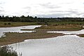 North Cave Wetlands from main hide.JPG 3,008 × 2,000; 1.23 MB
-
 North Ferriby v FC United.jpg 1,049 × 1,579; 1.44 MB
-
 North Landing Car Park - geograph.org.uk - 1509433.jpg 640 × 480; 60 KB
-
 North Road, Lund - geograph.org.uk - 1496353.jpg 640 × 480; 94 KB
-
 Nunburnholme Church - geograph.org.uk - 1473931.jpg 640 × 480; 93 KB
-
 Old and new - geograph.org.uk - 1483944.jpg 640 × 480; 66 KB
-
 Old farm building near South Cliffe - geograph.org.uk - 1491619.jpg 640 × 480; 50 KB
-
 Old Road, Leconfield - geograph.org.uk - 1497264.jpg 640 × 480; 74 KB
-
 Old Road, Leconfield - geograph.org.uk - 1497267.jpg 640 × 480; 74 KB


_-_geograph.org.uk_-_1483253.jpg)


.jpg)


.jpg)


_-_geograph.org.uk_-_1483124.jpg)


_-_geograph.org.uk_-_1497241.jpg)
.jpg)

.jpg)
.jpg)


