Category:September 2009 in Hampshire
Jump to navigation
Jump to search
Ceremonial counties of England: Bedfordshire · Berkshire · Buckinghamshire · Cambridgeshire · Cheshire · Cornwall · Cumbria · Derbyshire · Devon · Dorset · Durham · East Riding of Yorkshire · East Sussex · Essex · Gloucestershire · Greater London · Greater Manchester · Hampshire · Herefordshire · Hertfordshire · Isle of Wight · Kent · Lancashire · Leicestershire · Lincolnshire · Merseyside · Norfolk · North Yorkshire · Northamptonshire · Northumberland · Nottinghamshire · Oxfordshire · Shropshire · Somerset · South Yorkshire · Staffordshire · Suffolk · Surrey · Tyne and Wear · Warwickshire · West Midlands · West Sussex · West Yorkshire · Wiltshire · Worcestershire
City-counties: Bristol ·
Former historic counties:
Other former counties:
City-counties: Bristol ·
Former historic counties:
Other former counties:
Deutsch: Bilder, die im September 2009 in Hampshire aufgenommen worden sind. Bitte beachten Sie, dass dies weder das Datum des Uploads noch das Datum des Scannens eines Fotos ist.
English: Images/pictures taken in Hampshire during September 2009. Note this is not the date of the upload, nor the date a photo was scanned.
Español: Fotografías o imágenes tomadas en Hampshire durante septiembre 2009. No es la fecha de subida ni escaneo, sino la fecha en que las fotografías o imágenes se crearon.
Esperanto: Bildoj faritaj en Hampshire en septembro 2009. Tio ne estas la dato, kiam la bildoj estis alŝutitaj aŭ skanitaj.
Français : Photographies ou images prises en Hampshire durant septembre 2009. Ce n'est pas la date du téléchargement ou du scan.
Galego: Fotografías ou imaxes tomadas en Hampshire durante setembro 2009. Non é a data de subida nin escaneamento, senón a data na que se crearon as fotografías ou imaxes.
Italiano: Fotografie o immagini scattate a Hampshire nel settembre 2009. Nota bene: la data non si riferisce né a quella di upload né a quella in cui la foto è stata digitalizzata.
Norsk bokmål: Bilder tatt i Hampshire i løpet av september 2009. Merk at dette ikke er datoen for opplasting, eller når et bilde har blitt skannet.
Norsk nynorsk: Bilete teke i Hampshire i løpet av september 2009. Merk at dette ikkje er datoen for opplasting, eller når eit bilete har vorte skanna.
Русский: Изображения, сделанные в Hampshire в течение сентябрь 2009 (не дата загрузки изображения).
Українська: Зображення, зроблені в Hampshire протягом вересень 2009. Зауважте, що це не дата завантаження чи дата сканування фотографії.
| September 2008 | ← | September 2009 | → | September 2010 | |||||||
| Jan | Feb | Mar | Apr | May | Jun | Jul | Aug | Sep | Oct | Nov | Dec |
| 139 | 266 | 158 | 200 | 319 | 212 | 146 | 93 | 134 | 321 | 71 | 144 |
|---|---|---|---|---|---|---|---|---|---|---|---|
Subcategories
This category has the following 2 subcategories, out of 2 total.
1
Media in category "September 2009 in Hampshire"
The following 132 files are in this category, out of 132 total.
-
 132 KV pylons cheek by jowl - geograph.org.uk - 1502587.jpg 557 × 640; 194 KB
-
 Victorian letter box, Kingsgate Street, Winchester - geograph.org.uk - 1717377.jpg 2,000 × 3,008; 2.35 MB
-
 Winchester station 17-17-17 09-09-09 - geograph.org.uk - 1483589.jpg 640 × 426; 166 KB
-
 Twyford Waterworks, Hampshire - geograph.org.uk - 1717298.jpg 3,008 × 2,000; 3.6 MB
-
 The Royal Oak at Langstone Quay - geograph.org.uk - 1506495.jpg 640 × 360; 55 KB
-
 59001 Yeoman Endeavour at Eastleigh 100.jpg 1,600 × 1,200; 305 KB
-
 69 bus in the High Street - geograph.org.uk - 1511519.jpg 480 × 640; 69 KB
-

-
 A303, Popham - geograph.org.uk - 1506570.jpg 640 × 480; 66 KB
-
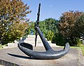 Admiralty pattern anchor, 1848 - geograph.org.uk - 1502569.jpg 640 × 500; 122 KB
-
-

-
 Andover - Chantry Centre - geograph.org.uk - 1779679.jpg 640 × 480; 60 KB
-
 Antonio's in Fareham town centre - geograph.org.uk - 1511310.jpg 480 × 640; 75 KB
-

-
 Blind bend on Warren Road - geograph.org.uk - 1503784.jpg 640 × 360; 71 KB
-
 Bluestar 1301 HF58 GZE and Southampton Briton Street.JPG 3,712 × 2,088; 3.18 MB
-
 Bluestar 507 T165 AUA.JPG 3,712 × 2,088; 2.87 MB
-
 Bluestar 509 M846 RCP 2.JPG 2,997 × 1,816; 1.06 MB
-
 Bluestar 625 K125 BUD 2.JPG 3,712 × 2,088; 3.01 MB
-
 Bluestar 729 H729 DDL 2.JPG 3,712 × 2,088; 1.7 MB
-
 Bluestar 818 N539 LHG 2.JPG 3,073 × 2,088; 1.19 MB
-
 Bluestar 818 N539 LHG rear 2.JPG 3,077 × 1,902; 961 KB
-
 Bluestar 818 N539 LHG rear.JPG 3,712 × 2,088; 3.07 MB
-
 Brijan Tours 101 XAZ 1346 rear.JPG 2,966 × 1,650; 1 MB
-
 Brijan Tours 101 XAZ 1346.JPG 3,712 × 2,088; 3.13 MB
-

-
 Bus stop on the B2177 (1) - geograph.org.uk - 1480333.jpg 640 × 480; 83 KB
-
 Car park in Springwell - geograph.org.uk - 1474321.jpg 640 × 480; 86 KB
-
-

-

-

-

-
 Church tower at St John's, Shedfield - geograph.org.uk - 1475348.jpg 480 × 640; 81 KB
-
 Cottage in North Hayling - geograph.org.uk - 1507162.jpg 360 × 640; 78 KB
-
-
 Cycle Parking, Portsmouth, Hampshire - geograph.org.uk - 1500322.jpg 640 × 428; 133 KB
-
 Disreputable shed on Hayling Island - geograph.org.uk - 1507351.jpg 640 × 360; 54 KB
-

-
 Duisburg Way, Southsea, Hampshire - geograph.org.uk - 1499718.jpg 640 × 428; 62 KB
-
 Durnstown, cattle grid - geograph.org.uk - 1506195.jpg 640 × 480; 63 KB
-
 Durnstown, railway - geograph.org.uk - 1506201.jpg 640 × 480; 108 KB
-
 Durnstown, stile - geograph.org.uk - 1506171.jpg 640 × 480; 154 KB
-
 Durnstown, wetlands - geograph.org.uk - 1506183.jpg 640 × 480; 107 KB
-

-
 Fawley tugs.jpg 850 × 461; 427 KB
-

-
 First Hampshire & Dorset 44510 YX58 HWJ 2.JPG 3,712 × 2,088; 3.09 MB
-
 First Hampshire & Dorset 46324 N324 ECR.JPG 3,712 × 2,088; 3.07 MB
-

-

-

-

-

-

-
 Footpath on Hayling Island - geograph.org.uk - 1506658.jpg 640 × 360; 97 KB
-

-
 Grapevines - geograph.org.uk - 1638771.jpg 640 × 480; 59 KB
-
 Guy James in Camber Dock, Portsmouth - geograph.org.uk - 1508072.jpg 640 × 427; 59 KB
-
 Haslar Marina at Night - geograph.org.uk - 1590459.jpg 640 × 426; 118 KB
-

-
 Hordle, scout hall - geograph.org.uk - 1475968.jpg 640 × 480; 54 KB
-
 Hordle, Three Bells - geograph.org.uk - 1476019.jpg 640 × 480; 70 KB
-
 Hoverport and amusements - geograph.org.uk - 1514938.jpg 640 × 480; 171 KB
-

-

-

-
 King Street, Portsmouth, Hampshire - geograph.org.uk - 1502141.jpg 640 × 428; 61 KB
-
 Langstone Bridge notice - geograph.org.uk - 1506540.jpg 640 × 360; 47 KB
-
 Langstone Harbour Information Board - geograph.org.uk - 1507462.jpg 640 × 360; 52 KB
-
 Langstone Harbour, Hants. - geograph.org.uk - 1508939.jpg 640 × 420; 95 KB
-
 Large field on Hayling Island - geograph.org.uk - 1506674.jpg 640 × 360; 81 KB
-
 Late summer in Derby Road - geograph.org.uk - 1485069.jpg 640 × 480; 67 KB
-

-
 Light on water in Langstone Harbour - geograph.org.uk - 1507483.jpg 640 × 360; 32 KB
-
 Local train at Bitterne Station - geograph.org.uk - 1509833.jpg 640 × 460; 127 KB
-
 Looking southwards down Station Road - geograph.org.uk - 1493666.jpg 640 × 480; 69 KB
-

-
 Lymington Harbour, Hampshire - geograph.org.uk - 1520442.jpg 640 × 480; 73 KB
-
 Marshland east of Hayling Island - geograph.org.uk - 1507239.jpg 640 × 360; 73 KB
-
 Moscow Stars.jpg 850 × 567; 481 KB
-

-

-
 Church porch at North Hayling - geograph.org.uk - 1506751.jpg 360 × 640; 63 KB
-
 Old Fleet Manor on Hayling Island - geograph.org.uk - 1507366.jpg 640 × 360; 81 KB
-
 Paddock in the area of Sandy Shoot - geograph.org.uk - 1500052.jpg 640 × 480; 47 KB
-

-

-
 St Cuthbert's Memorial Garden - geograph.org.uk - 1490279.jpg 640 × 480; 111 KB
-

-

-
 Rear view of St Michael, Chalton - geograph.org.uk - 1498463.jpg 640 × 480; 85 KB
-
 Road junction on Hayling Island - geograph.org.uk - 1507315.jpg 640 × 360; 92 KB
-
 Rowers at Lymington - geograph.org.uk - 1523855.jpg 640 × 480; 76 KB
-
 Scaffolding on house in Springwell - geograph.org.uk - 1474316.jpg 640 × 480; 72 KB
-

-

-

-
 Spinnaker Tower - geograph.org.uk - 1492880.jpg 640 × 428; 79 KB
-
 Spinnaker Tower - geograph.org.uk - 1514990.jpg 480 × 640; 135 KB
-
 Spinnaker Tower view - geograph.org.uk - 1492908.jpg 640 × 428; 72 KB
-
 Spinnaker Tower, Portsmouth - geograph.org.uk - 1511600.jpg 640 × 427; 38 KB
-
 Spit of land in Langstone Harbour - geograph.org.uk - 1507485.jpg 640 × 360; 44 KB
-

-

-
 St. John the Evangelist (1) - geograph.org.uk - 1518651.jpg 640 × 428; 47 KB
-
 St. John the Evangelist (3) - geograph.org.uk - 1518665.jpg 640 × 428; 52 KB
-

-

-
 Sway Butchers Ltd. - geograph.org.uk - 1506356.jpg 640 × 480; 76 KB
-
 Sway Manor - geograph.org.uk - 1506289.jpg 640 × 480; 98 KB
-
 Sway Post Office - geograph.org.uk - 1506298.jpg 640 × 480; 78 KB
-
 Sway Recreation Ground - geograph.org.uk - 1451972.jpg 640 × 427; 160 KB
-
 Sway Village Hall - geograph.org.uk - 1506362.jpg 640 × 480; 109 KB
-
 Sway, Birchy Hill - geograph.org.uk - 1506155.jpg 640 × 480; 126 KB
-
 Sway, railway bridge - geograph.org.uk - 1506210.jpg 640 × 480; 79 KB
-
 Sway, surgery - geograph.org.uk - 1506316.jpg 640 × 480; 120 KB
-
 Sway, thatched cottage - geograph.org.uk - 1506202.jpg 640 × 480; 72 KB
-
 The altar at St Michael, Chalton - geograph.org.uk - 1499898.jpg 640 × 480; 61 KB
-
 The font at St Michael, Chalton - geograph.org.uk - 1499890.jpg 480 × 640; 56 KB
-
 The lectern at St Michael, Chalton - geograph.org.uk - 1499879.jpg 480 × 640; 61 KB
-
 The notice board at St Peter's, Soberton - geograph.org.uk - 1476017.jpg 480 × 640; 111 KB
-
 The organ at St Michael, Chalton - geograph.org.uk - 1499762.jpg 521 × 640; 54 KB
-
 The pulpit at St Michael, Chalton - geograph.org.uk - 1499759.jpg 480 × 640; 59 KB
-
 Tomb in Chalton Churchyard - geograph.org.uk - 1498438.jpg 640 × 480; 116 KB
-

-
 Tractor at work on Hayling Island - geograph.org.uk - 1506701.jpg 360 × 640; 41 KB
-

-
 View along City Road - Winchester - geograph.org.uk - 1530442.jpg 640 × 480; 60 KB
-

-
 West entrance to Winchester station - geograph.org.uk - 1530775.jpg 640 × 480; 72 KB


_-_geograph.org.uk_-_1474699.jpg)


_-_geograph.org.uk_-_1480333.jpg)


_-_geograph.org.uk_-_1474662.jpg)
_-_geograph.org.uk_-_1474675.jpg)


_-_geograph.org.uk_-_1509931.jpg)
_-_geograph.org.uk_-_1509941.jpg)


_-_geograph.org.uk_-_1512575.jpg)


_-_geograph.org.uk_-_1518651.jpg)
_-_geograph.org.uk_-_1518665.jpg)
_-_geograph.org.uk_-_1499903.jpg)
_-_geograph.org.uk_-_1498478.jpg)


