Category:Seaforth Island
Jump to navigation
Jump to search
mountain in Outer Hebrides, Scotland, UK  | |||||
| Upload media | |||||
| Instance of | |||||
|---|---|---|---|---|---|
| Part of | |||||
| Location | Outer Hebrides, Scotland | ||||
| Located in or next to body of water | |||||
| Width |
| ||||
| Length |
| ||||
| Topographic prominence |
| ||||
| Population |
| ||||
| Area |
| ||||
| Elevation above sea level |
| ||||
 | |||||
Media in category "Seaforth Island"
The following 11 files are in this category, out of 11 total.
-
 A view over Loch Seaforth-Loch Shiphoirt - geograph.org.uk - 4751870.jpg 640 × 480; 129 KB
-
 Approaching Seaforth Island - geograph.org.uk - 653630.jpg 640 × 480; 72 KB
-
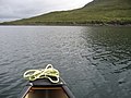
 Leaving Seaforth Island - geograph.org.uk - 3686176.jpg 2,560 × 1,563; 1.97 MB
-
 Loch Shiphoirt (Seaforth) - geograph.org.uk - 574598.jpg 640 × 480; 70 KB
-
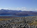
 Lower slopes of Mullach Bhiogadail - geograph.org.uk - 1275309.jpg 640 × 427; 55 KB
-
 Mulag1.jpg 640 × 427; 36 KB
-
 Mulag2.jpg 640 × 480; 75 KB
-
 Seaforth Island (Eilean Shiphoirt) - geograph.org.uk - 3265640.jpg 1,584 × 1,178; 1.15 MB
-
 Seaforth Island - geograph.org.uk - 626987.jpg 640 × 439; 43 KB
-
 Summit cairn on Seaforth Island - geograph.org.uk - 653622.jpg 640 × 480; 33 KB
-
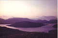
 View from Beinn Mhor - geograph.org.uk - 622545.jpg 640 × 480; 77 KB


_-_geograph.org.uk_-_574598.jpg)


_-_geograph.org.uk_-_3265640.jpg)

