Category:Islands of the Outer Hebrides
Jump to navigation
Jump to search

Wikimedia category | |||||
| Upload media | |||||
| Instance of | |||||
|---|---|---|---|---|---|
| Category contains | |||||
| |||||
Subcategories
This category has the following 127 subcategories, out of 127 total.
A
- Am Plastair (4 F)
B
- Bearasaigh (15 F)
- Bhacasaigh (1 F)
- Boreray, North Uist (13 F)
- Bradastac (1 F)
C
- Campaigh (2 F)
- Ceabhaigh (2 F)
- Ceallasaigh Beag (1 F)
- Ceallasaigh Mòr (1 F)
- Cearstaigh (2 F)
- Cliatasaigh (3 F)
- Copaigh (1 F)
- Craigeam (2 F)
D
- Dubh Sgeir (near Càrlabhagh) (1 F)
- Dubh Sgeir (near Islibhig) (1 F)
- Dubh Sgeir (near Leverburgh) (3 F)
- Duisgeir (near Scarp) (3 F)
- Dùn Corr Mòr (4 F)
E
- Eilean a' Ghobha (1 F)
- Eilean Chaluim Chille (11 F)
- Eilean Chearstaigh (2 F)
- Eilean Liubhaird (12 F)
- Eilean Mhealasta (15 F)
- Eilean Mhuire (2 F)
- Eilean Mòr, Loch Langavat (1 F)
- Eilean Tighe (1 F)
- Ensay, Outer Hebrides (32 F)
F
- Fiaraigh (5 F)
- Fladaigh (near Harris) (2 F)
- Flodaigh, inner Loch Roag (2 F)
- Floday (3 F)
- Flodday (near Vatersay) (1 F)
- Flodday, Loch Maddy (2 F)
- Fodragaigh (10 F)
- Fraoch-Eilean (4 F)
- Fuaigh Beag (3 F)
- Fuaigh Mòr (8 F)
- Fuday (17 F)
- Fuiay (9 F)
G
- Gasaigh (4 F)
- Gearuim Mòr (1 F)
- Gighay (12 F)
- Gilsaigh (1 F)
- Glas Eilean Mòr, Loch Maddy (2 F)
- Gousman (1 F)
- Grimsay, South Uist (9 F)
- Grodhaigh (6 F)
- Grèineam (near Mealasta) (5 F)
H
- Hamalan (1 F)
- Hamarsaigh (1 F)
- Haskeir (12 F)
- Hasselwood Rock (2 F)
- Hellisay (18 F)
- Hermetray (4 F)
K
- Killegray (14 F)
- Kirkibost Island (6 F)
L
- Lingeigh, Barra (4 F)
- Lingeigh, North Uist (5 F)
- Lingeigh, Sound of Barra (5 F)
- Liongam (8 F)
- Little Bernera (11 F)
- Lìth Sgeir (3 F)
M
- Maol Dòmhnaich (11 F)
- Mina Stac (5 F)
- Màs Sgeir, An Caolas (1 F)
- Màs Sgeir, Pol Gainmhich (1 F)
- Màsgeir (2 F)
N
O
- Opasaigh (1 F)
- Oronsay, Outer Hebrides (7 F)
- Orosay (7 F)
P
- Pabaigh Beag (3 F)
- Pabaigh Mòr (12 F)
- Pabbay, Barra Isles (15 F)
- Pabbay, Harris (40 F)
R
- Rainish Eilean Mòr (1 F)
- Roaiream (4 F)
- North Rona (31 F)
- Ronay (11 F)
- Rosinish (1 F)
S
- Sandray (34 F)
- Scarp, Scotland (38 F)
- Seaforth Island (11 F)
- Seana Chnoc (9 F)
- Sgarabhaigh (2 F)
- Sgarbhstac (3 F)
- Sgeir Dhearg, Outer Hebrides (1 F)
- Sgeir Mac Righ Lochlainn (1 F)
- Sgeotasaigh (8 F)
- Siolaigh (7 F)
- Skerries of the Outer Hebrides (46 F)
- Soraidh (2 F)
- Sròmaigh (3 F)
- Stac Biorach (5 F)
- Stac Dona (1 F)
- Stac Shoaigh (12 F)
- Stulaigh (3 F)
- Sula Sgeir (29 F)
- Sursaigh (1 F)
- Sòdhaigh Beag (1 F)
- Sòdhaigh Mòr (1 F)
W
- Wiay, Outer Hebrides (17 F)
Media in category "Islands of the Outer Hebrides"
The following 82 files are in this category, out of 82 total.
-
 Bayble Island - geograph.org.uk - 623923.jpg 640 × 512; 87 KB
-
 Bayble Island - geograph.org.uk - 919885.jpg 2,592 × 1,944; 1.23 MB
-
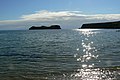 Bayble Island - geograph.org.uk - 919902.jpg 640 × 425; 71 KB
-
 Berneray01LB.jpg 4,608 × 3,456; 4.99 MB
-
 Borve-berneray.jpg 1,849 × 1,388; 440 KB
-
 Bràigh Mòr - geograph.org.uk - 1293357.jpg 640 × 277; 46 KB
-

-
 Curachan skerry - geograph.org.uk - 1476886.jpg 640 × 479; 62 KB
-
 Eilean a' Geòidh - geograph.org.uk - 4974609.jpg 640 × 441; 60 KB
-
 Eilean a' Gheòidh - geograph.org.uk - 1477244.jpg 640 × 371; 65 KB
-
 Eilean anTighe - geograph.org.uk - 1614740.jpg 640 × 480; 41 KB
-
 Eilean Baile Bharcais - geograph.org.uk - 1350316.jpg 640 × 411; 237 KB
-
 Eilean Bhatarsaidh - geograph.org.uk - 827607.jpg 627 × 467; 80 KB
-
 Eilean Grioda - geograph.org.uk - 834016.jpg 640 × 480; 91 KB
-
 Eilean Mhiathlais - geograph.org.uk - 1379767.jpg 640 × 480; 48 KB
-
 Eilean Mor Phabail - geograph.org.uk - 18494.jpg 480 × 640; 55 KB
-

-
 Eilean na h-Àirigh - geograph.org.uk - 857960.jpg 640 × 480; 79 KB
-
 Eilean Orasaidh narrows - geograph.org.uk - 1511236.jpg 640 × 426; 311 KB
-
 Eilean Riosaidh - geograph.org.uk - 827635.jpg 581 × 466; 67 KB
-
 Eilean Rosaidh from Cnoc Dubh - geograph.org.uk - 1511217.jpg 640 × 426; 164 KB
-
 Eilean Shiophoirt with the Harris hills beyond - geograph.org.uk - 1740353.jpg 4,000 × 3,000; 6.45 MB
-
 Eilean Thinngartsaigh - geograph.org.uk - 1655853.jpg 640 × 480; 129 KB
-
 Eileana Dubha - geograph.org.uk - 1343544.jpg 640 × 401; 210 KB
-
 Eileann Chairminis, West Harris - geograph.org.uk - 559013.jpg 640 × 480; 104 KB
-
 Eileann Leathan from Eabhal - geograph.org.uk - 1399526.jpg 640 × 480; 68 KB
-
 Fathoire - geograph.org.uk - 1510526.jpg 640 × 480; 61 KB
-
 Felseninsel Bearasaigh, gesehen vom Ufer bei Bostadh, Great Bernera.jpg 5,184 × 3,456; 6.37 MB
-

-
 Ganstotal and Garbh Eilean - geograph.org.uk - 1099183.jpg 640 × 480; 62 KB
-
 Gloraig Huisinis - geograph.org.uk - 872459.jpg 640 × 480; 49 KB
-
 Greanamul - geograph.org.uk - 1367506.jpg 640 × 420; 222 KB
-
 Greanamul in Coalas Phabaigh - geograph.org.uk - 3536520.jpg 1,024 × 681; 62 KB
-
 Grèineam - geograph.org.uk - 4575764.jpg 640 × 419; 115 KB
-
 Gumersam Bheag - geograph.org.uk - 4575736.jpg 640 × 424; 169 KB
-
 Gàiskeir Beag - geograph.org.uk - 4597615.jpg 640 × 480; 64 KB
-
 Hairsgeir Beag - geograph.org.uk - 4597594.jpg 640 × 493; 76 KB
-
 Iosaigh from Beinn Losgaintir - geograph.org.uk - 832920.jpg 640 × 426; 58 KB
-
 Island of many names - geograph.org.uk - 2062215.jpg 2,790 × 1,632; 732 KB
-
 Islands in the Sound of Barra - geograph.org.uk - 1367493.jpg 640 × 387; 187 KB
-
 Islands of Sgeir a' Chail - geograph.org.uk - 781443.jpg 640 × 470; 47 KB
-
 Light. Calbhaigh - geograph.org.uk - 878423.jpg 640 × 480; 95 KB
-
 Lingay01LB.jpg 4,608 × 3,456; 3.6 MB
-
 Liursaigh Dubh - geograph.org.uk - 1399524.jpg 640 × 480; 60 KB
-
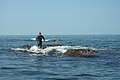
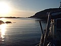 Mary Doune enters anchorage - geograph.org.uk - 761868.jpg 640 × 480; 56 KB
-
 Mhealista Island - geograph.org.uk - 872496.jpg 640 × 480; 58 KB
-
 Mid summer evening over the Shiants - geograph.org.uk - 880151.jpg 480 × 640; 27 KB
-
 Mullach Sgrithir - geograph.org.uk - 1098409.jpg 640 × 480; 37 KB
-
 Na Stacan Dubha - geograph.org.uk - 1367525.jpg 640 × 362; 186 KB
-
 Navigation light - geograph.org.uk - 781438.jpg 640 × 480; 42 KB
-
 North East corner, Calbhaigh. - geograph.org.uk - 878412.jpg 640 × 480; 91 KB
-
 North-west skerries, Flodaigh - geograph.org.uk - 1462893.jpg 640 × 427; 80 KB
-
 On the small isle of Greanamul - geograph.org.uk - 1477580.jpg 640 × 479; 78 KB
-
 Ordnance Survey 1-250000 - HW.jpg 4,000 × 4,000; 451 KB
-
 Oronsay in Loch Nam Madadh - geograph.org.uk - 781457.jpg 640 × 480; 36 KB
-
-
 Pecam - geograph.org.uk - 642282.jpg 640 × 427; 47 KB
-
 Rubha Chlaidh skerry - geograph.org.uk - 1476918.jpg 640 × 479; 55 KB
-
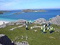
 Sarah'sislandjune19.jpg 10,153 × 3,108; 14.57 MB
-
 Sgeir a Chais - geograph.org.uk - 1456226.jpg 640 × 480; 54 KB
-
 Sgeir an Leum Mhòir - geograph.org.uk - 1293491.jpg 640 × 405; 56 KB
-
 Sgeir an Lèim Mhòir - geograph.org.uk - 1492817.jpg 640 × 480; 70 KB
-
 Sgeir Fhiaclach Skerries - geograph.org.uk - 1476884.jpg 640 × 356; 43 KB
-
 Sgeir Fraoich - geograph.org.uk - 1093238.jpg 640 × 480; 103 KB
-
 Sgeir Gallan - geograph.org.uk - 1462878.jpg 640 × 427; 78 KB
-
 Sgeir Ghlas - geograph.org.uk - 1492807.jpg 640 × 480; 51 KB
-
 Sgeir Ghlas Beacon - geograph.org.uk - 830717.jpg 640 × 329; 38 KB
-
 Sgeir Ghlas Bheag - geograph.org.uk - 1347231.jpg 640 × 401; 235 KB
-
 Sgeir Ghlas Bheag - geograph.org.uk - 1347235.jpg 640 × 404; 244 KB
-
 Sgeir Ghlas Bheag - geograph.org.uk - 1347241.jpg 640 × 414; 237 KB
-
 Sgeir Isgean - geograph.org.uk - 1456557.jpg 640 × 480; 65 KB
-
 Sgeir Isgean - geograph.org.uk - 1508696.jpg 640 × 426; 186 KB
-
 Sgeir Leathann - geograph.org.uk - 1456173.jpg 640 × 480; 76 KB
-
 Sgeir na Pacaid - geograph.org.uk - 829846.jpg 619 × 467; 79 KB
-
 Skerry near Lingeigh - geograph.org.uk - 1476937.jpg 640 × 393; 55 KB
-

-
 South Lewis Harris and North Uist NSA.png 1,476 × 1,605; 2.1 MB
-
 Tabhaidh Mhor - geograph.org.uk - 639671.jpg 640 × 480; 81 KB
-
 Tabhaigh Beag - geograph.org.uk - 1093157.jpg 640 × 480; 112 KB
-
 The Old Woman of the Moors - geograph.org.uk - 1524529.jpg 640 × 480; 50 KB
-
-
 Caolais Cearstaigh - geograph.org.uk - 1414582.jpg 640 × 480; 152 KB


_Rubhan_Greine_(back_right)_-_geograph.org.uk_-_975900.jpg)


