Category:SVG maps of the Viceroyalty of New Spain
Jump to navigation
Jump to search
Media in category "SVG maps of the Viceroyalty of New Spain"
The following 23 files are in this category, out of 23 total.
-
 Viceroyalty of New Spain-Territories.svg 863 × 444; 1.23 MB
-
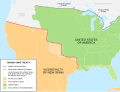 Adams-Onís treaty map-en.svg 626 × 478; 684 KB
-
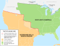
 Adams-Onís treaty map-es.svg 626 × 478; 684 KB
-
 Adams-Onís treaty map-it.svg 626 × 478; 683 KB
-
 Borders proposed by the Count of Aranda-es.svg 983 × 639; 3.21 MB
-
 Borders proposed by the Count of Aranda.svg 983 × 639; 3.39 MB
-
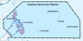 Capitanía general de Filipinas.svg 494 × 243; 200 KB
-
 East and West Florida 1810-es.svg 731 × 505; 872 KB
-
 Las devastaciones de osorio Español.svg 2,238 × 1,289; 333 KB
-
 Louisiana (1762) orthographic projection.svg 536 × 536; 223 KB
-
 Map of Saint Domingue English.svg 5,999 × 5,524; 153 KB
-
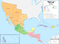
 Mapa del Virreinato de la Nueva España (1794).svg 885 × 758; 1.41 MB
-
 Mapa del Virreinato de la Nueva España (1819).svg 885 × 664; 1.06 MB
-
 PROVINCIAS YUCATÁN 1549.svg 1,768 × 1,981; 246 KB
-
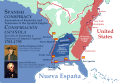 Spanish Conspiracy.svg 1,185 × 811; 5.87 MB
-
 Spanish Florida Map 1803-es.svg 619 × 448; 837 KB
-
 Spanish North America.svg 5,088 × 5,084; 15.05 MB
-
 Spanish Territory Under french Control (English).svg 1,545 × 1,165; 682 KB
-
 Terrirotio español bajo control frances (español).svg 1,545 × 1,165; 734 KB
-
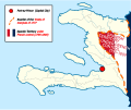 Territory of the Empire of Haiti in English.svg 1,779 × 1,485; 228 KB
-
 The Devastations of Osorio.svg 2,238 × 1,289; 311 KB
-
 Tratado de Aranjuez Espanol.svg 7,186 × 3,464; 88 KB
-
 Treaty of Aranjuez English.svg 7,186 × 3,464; 94 KB


_orthographic_projection.svg)

.svg)
.svg)


.svg)
.svg)


