Category:Maps of the Viceroyalty of New Spain
Jump to navigation
Jump to search
English: Maps of the Spanish colonial Viceroyalty of New Spain (Virreinato de Nueva España) of 1535—1821 in North America.
Subcategories
This category has the following 13 subcategories, out of 13 total.
C
O
S
Media in category "Maps of the Viceroyalty of New Spain"
The following 28 files are in this category, out of 28 total.
-
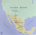
 Coronado expedition.jpg 1,230 × 532; 130 KB
-
 Andres Urdaneta Tornaviaje.jpg 1,590 × 1,306; 1.54 MB
-
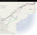
 16th century Portuguese Spanish trade routes.png 2,835 × 1,188; 2 MB
-
 16th century Spanish trade routes.png 2,835 × 1,188; 775 KB
-

-
 Adams onis map.png 800 × 654; 226 KB
-
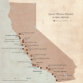
 California missions. LOC 2008627969.jpg 5,431 × 7,560; 7.15 MB
-
 California missions. LOC 2008627969.tif 5,431 × 7,560; 117.47 MB
-
 CaminoRealAdentro.png 698 × 682; 374 KB
-
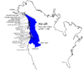
 Chichimeca Nations.png 959 × 645; 96 KB
-
 Chichimecas - esp.png 713 × 961; 169 KB
-
 Chichimecas.png 713 × 961; 165 KB
-
 ChichimecNations.png 1,073 × 723; 139 KB
-
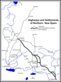
 El Camino Real de los Tejas National Historic Trail.png 630 × 606; 222 KB
-
 Flag map of Viceroyalty of New Spain (1794).png 2,055 × 1,786; 169 KB
-
 Flujo minero en Nueva España.jpg 2,131 × 1,350; 181 KB
-
 Neufrankreich.svg 1,530 × 1,090; 694 KB
-
 Non-Native American Nations Control over N America 1792.png 800 × 895; 160 KB
-
 NovohispanMap.jpg 1,513 × 1,397; 320 KB
-
 Nueva España.JPG 3,072 × 2,304; 1.73 MB
-
 Nutca.png 1,105 × 942; 229 KB
-
 NutcaAR.png 5,147 × 4,345; 3.05 MB
-
 NutcaEN.png 1,103 × 931; 229 KB
-
 Obrajes importantes en la Nueva España (De 1604 a 1793-1801).png 1,017 × 593; 80 KB
-
 Political Evolution of Central America and the Caribbean 1700 and on.gif 850 × 638; 348 KB
-
 Spanish North America.png 7,949 × 7,944; 25.09 MB
-
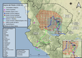
 SpanishMissionsinCA.png 5,400 × 5,400; 9.23 MB
-
 Sucesos Guerra de la Mixtón.png 1,811 × 1,281; 3.67 MB


.png)


.png)


Categories:
- Viceroyalty of New Spain
- Maps of Spanish North America
- Maps of the history of North America
- Maps of the history of Mexico
- Maps of the history of the Caribbean
- Maps of the history of the United States
- Maps of the history of Guatemala
- Maps of the history of Honduras
- Maps of the history of El Salvador
- Maps of the history of Nicaragua
- Maps of the history of Costa Rica