Category:SVG maps of Germany
Jump to navigation
Jump to search
Countries of Europe: Albania · Andorra · Armenia‡ · Austria · Azerbaijan‡ · Belarus · Belgium · Bosnia and Herzegovina · Bulgaria · Croatia · Cyprus‡ · Czech Republic · Denmark · Estonia · Finland · France‡ · Georgia‡ · Germany · Greece · Hungary · Iceland · Republic of Ireland · Italy · Kazakhstan‡ · Latvia · Liechtenstein · Lithuania · Luxembourg · Malta · Moldova · Monaco · Montenegro · Netherlands‡ · North Macedonia · Norway · Poland · Portugal‡ · Romania · Russia‡ · San Marino · Serbia · Slovakia · Slovenia · Spain‡ · Sweden · Switzerland · Turkey‡ · Ukraine · United Kingdom · Vatican City
Specific status: Faroe Islands · Jersey · Svalbard – Limited recognition: Abkhazia‡ · Kosovo · South Ossetia‡
‡: partly located in Europe
Specific status: Faroe Islands · Jersey · Svalbard – Limited recognition: Abkhazia‡ · Kosovo · South Ossetia‡
‡: partly located in Europe
Subcategories
This category has the following 8 subcategories, out of 8 total.
Media in category "SVG maps of Germany"
The following 103 files are in this category, out of 103 total.
-
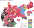 1919 German federal election by Constituency.svg 743 × 607; 3.2 MB
-
 1920 German federal election by District - Simple.svg 1,512 × 1,179; 4.61 MB
-
 1920 German federal election by District.svg 726 × 572; 3.32 MB
-
 1925 German presidential election by District (1st round) - Simple.svg 1,512 × 1,179; 4.4 MB
-
 1925 German presidential election by District (1st round).svg 726 × 572; 3.1 MB
-
 1925 German presidential election by District (2nd round) - Simple.svg 1,512 × 1,179; 4.38 MB
-
 1925 German presidential election by District (2nd round).svg 726 × 572; 3.07 MB
-
 1928 German federal election by District - Simple.svg 1,512 × 1,179; 4.67 MB
-
 1928 German federal election by District.svg 726 × 572; 3.55 MB
-
 1929 German referendum - Petition.svg 726 × 572; 3.28 MB
-
 1929 German referendum - Referendum.svg 726 × 572; 3.31 MB
-
 1930 German federal election by District - Simple.svg 1,512 × 1,179; 4.6 MB
-
 1930 German federal election by District.svg 726 × 572; 3.73 MB
-
 1932 German presidential election by District (1st round) - Simple.svg 1,512 × 1,179; 4.4 MB
-
 1932 German presidential election by District (1st round).svg 726 × 572; 3.65 MB
-
 1932 German presidential election by District (2nd round) - Simple.svg 1,512 × 1,179; 4.35 MB
-
 1932 German presidential election by District (2nd round).svg 726 × 572; 3.64 MB
-
 1949 German federal election - Results by constituency.svg 512 × 595; 1.5 MB
-
 1953 German federal election - Results by constituency.svg 512 × 595; 1.49 MB
-
 1957 German federal election - Results by constituency.svg 512 × 595; 1.47 MB
-
 1961 German federal election - Results by constituency.svg 512 × 595; 1.46 MB
-
 1980 German federal election - Results by constituency.svg 512 × 595; 1.29 MB
-
 1983 German federal election - Results by constituency.svg 512 × 595; 1.3 MB
-
 1987 German federal election - Results by constituency.svg 512 × 595; 1.3 MB
-
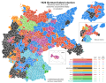
 1990 German federal election - Results by constituency.svg 4,135 × 4,807; 1.88 MB
-
 1994 German federal election - Results by constituency.svg 4,135 × 4,807; 1.87 MB
-
 1998 German federal election - Results by constituency.svg 4,135 × 4,807; 1.89 MB
-
 2002 German federal election - Results by constituency.svg 4,135 × 4,806; 1.81 MB
-
 2005 German federal election - Results by constituency.svg 4,135 × 4,806; 1.81 MB
-
 2009 German federal election - Results by constituency.svg 4,135 × 4,807; 1.94 MB
-
 2021 German federal election - Greens result.svg 1,469 × 1,708; 1.21 MB
-
 BayreuthMap.svg 1,715 × 1,216; 244 KB
-
 Bonding Standorte.svg 595 × 842; 185 KB
-
 Cambios territoriales de Alemania (1919-1990).svg 976 × 818; 379 KB
-
 D-A-CH beschriftet.svg 1,257 × 1,514; 715 KB
-
 December 1924 German federal election by District - Simple.svg 1,512 × 1,179; 4.6 MB
-
 December 1924 German federal election by District.svg 726 × 572; 3.27 MB
-
 Deportation d'Elsie Maréchal (janvier 1944 - avril 1945 ).svg 1,268 × 1,058; 514 KB
-
 DeutscheLandverluste-HE.svg 730 × 550; 62 KB
-
 Deutschland aus Berliner Sicht.svg 596 × 842; 445 KB
-
 Deutschland Distanz zur Küste.svg 886 × 1,063; 1.27 MB
-
 Deutschland Landeskirchen ev 2012.svg 500 × 646; 83 KB
-
 Deutschland Landeskirchen ev neu.png 500 × 646; 9 KB
-
 Deutschland Landeskirchen ev.svg 500 × 646; 88 KB
-
 East Prussian Campaign (17—23 Aug 1914) - ru.svg 2,591 × 1,671; 1.8 MB
-
 East Prussian Campaign (23—26 Aug 1914) - ru.svg 2,591 × 1,671; 1.79 MB
-
 East Prussian Campaign (27—30 Aug 1914) - es.svg 2,591 × 1,671; 1.71 MB
-
 East Prussian Campaign (27—30 Aug 1914) - ru.svg 2,591 × 1,671; 1.7 MB
-
 EKD Hessen-Nassau.svg 500 × 646; 84 KB
-
 Elections fédérales allemandes de 2021 - Résultats par Circonscription & Sièges de liste.svg 1,469 × 1,708; 1.37 MB
-
 Expropriation of the princes - Petition.svg 726 × 572; 3.15 MB
-
 Expropriation of the princes - Referendum.svg 726 × 572; 3.13 MB
-
 Frisia-Orientale.svg 800 × 600; 895 KB
-
 GADM DEU Administrative Divisions.svg 465 × 630; 537 KB
-
 Gauhauptstadtplanungen.svg 800 × 600; 102 KB
-
 Gebietskarte BOS Leitstellen Deutschland.svg 800 × 1,083; 1.39 MB
-
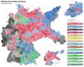
 German Federal Election 2017 - Results by Constituency & Regional Seats.svg 1,469 × 1,708; 1.21 MB
-
 German Federal Election 2021 - Results by Constituency & Regional Seats.svg 1,469 × 1,708; 1.45 MB
-
 German Federal Election, 1919.svg 909 × 708; 1.46 MB
-
 German Federal Election, 1920.svg 900 × 713; 797 KB
-
 German Federal Election, 1928.svg 900 × 713; 789 KB
-
 German Federal Election, 1930.svg 900 × 713; 786 KB
-
 German Federal Election, December, 1924.svg 900 × 713; 790 KB
-
 German Federal Election, July, 1932.svg 900 × 713; 791 KB
-
 German Federal Election, March, 1933.svg 900 × 713; 791 KB
-
 German Federal Election, May, 1924.svg 900 × 713; 791 KB
-
 German Federal Election, November, 1932.svg 900 × 713; 791 KB
-
 German state government compositions.svg 750 × 850; 91 KB
-
 German states by GRP in 2018.svg 600 × 810; 189 KB
-
 German territorial losses 1919 and 1945.svg 512 × 429; 380 KB
-
 Germany Eishockey Oberliga 2008-09.svg 1,073 × 1,272; 698 KB
-
 Germany Köppen.svg 765 × 1,179; 889 KB
-
 Germany Missing Saxony.svg 1,000 × 1,360; 101 KB
-
 Germany population states hexagonal.svg 1,600 × 2,208; 42 KB
-
 Germany, Hamburg locator map (2015.04.21).svg 600 × 813; 1.85 MB
-
 Germany-New Zealand size comparison.svg 464 × 665; 357 KB
-
 Infrastrukturatlas-Rufbus statt Geisterbus (Wittlich Shuttle).svg 620 × 472; 1.38 MB
-
 July 1932 German federal election by District - Simple.svg 1,512 × 1,179; 4.49 MB
-
 July 1932 German federal election by District.svg 726 × 572; 3.98 MB
-
 Karte Innerdeutsche Grenze-pl.svg 744 × 1,052; 146 KB
-
 Karte Innerdeutsche Grenze.svg 1,075 × 1,273; 333 KB
-
 Landeskirchen der EKD.svg 908 × 1,228; 132 KB
-
 Locator map of Germany.svg 680 × 520; 660 KB
-
 Mainfranken locator.svg 1,073 × 1,272; 690 KB
-
 March 1933 German federal election by District - Simple.svg 1,512 × 1,179; 4.4 MB
-
 March 1933 German federal election by District.svg 726 × 572; 4.07 MB
-
 May 1924 German federal election by District - Simple.svg 1,512 × 1,179; 4.63 MB
-
 May 1924 German federal election by District.svg 726 × 572; 3.31 MB
-
 Morgenthau Plan map.svg 671 × 442; 132 KB
-
 NeueLaender.png 774 × 983; 90 KB
-
 November 1932 German federal election by District - Simple.svg 1,512 × 1,179; 4.42 MB
-
 Occupation in Germany by district, 1925.svg 1,512 × 1,179; 4.58 MB
-
 Population density in Germany by district, 1925.svg 1,512 × 1,179; 4.32 MB
-
 Regionen des AVR-Caritas in Deutschland.svg 1,897 × 2,549; 653 KB
-
 Religion in Germany by district, 1925.svg 1,512 × 1,179; 4.51 MB
-
 Restricted Zones SOXMIS.svg 657 × 776; 951 KB
-
 States of Germany mk.svg 592 × 801; 289 KB
-
 The possession of the Guelfs in the days of Henry the Lion-ru.svg 744 × 763; 91 KB
-
 Verbreitungsgebiet Schnürsenkel-Schuhband.svg 1,000 × 1,200; 95 KB
-
 Verbreitungsgebiet vorsagen-einsagen.svg 1,000 × 1,200; 95 KB
-
 Wahlbeteiligung 2021.svg 540 × 586; 1.63 MB
-
 WeinbaugebieteDeutschland.svg 1,300 × 1,200; 352 KB
-
 Z-Netz ZMapMap 1993 01.svg 512 × 600; 296 KB


_-_Simple.svg)
.svg)
_-_Simple.svg)
.svg)


_-_Simple.svg)
.svg)
_-_Simple.svg)
.svg)


.svg)


.svg)


_-_ru.svg)
_-_ru.svg)
_-_es.svg)
_-_ru.svg)


.svg)

.svg)


