Category:SVG maps of German territorial losses 1919 and 1945
Jump to navigation
Jump to search
Media in category "SVG maps of German territorial losses 1919 and 1945"
The following 19 files are in this category, out of 19 total.
-
 Cambios territoriales de Alemania (1919-1990).svg 976 × 818; 379 KB
-
 Curzon line de.svg 563 × 513; 37 KB
-
 Curzon line en.svg 563 × 513; 243 KB
-
 Curzon line pl.svg 563 × 513; 69 KB
-
 Curzon line ru.svg 565 × 525; 8 KB
-
 DeutscheLandverluste-HE.svg 730 × 550; 62 KB
-
 DeutscheLandverluste.svg 730 × 550; 61 KB
-
 Former German territories.svg 450 × 456; 485 KB
-
 FronteraPolaca--timeshistoryofwa21londuoft-p408.svg 2,014 × 2,816; 1.98 MB
-
 German losses after WWI.svg 1,000 × 848; 579 KB
-
 German territorial losses 1919 and 1945.svg 512 × 429; 380 KB
-
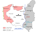
 German territorial losses 1945.svg 512 × 429; 309 KB
-
 Germanborders (ru).svg 730 × 550; 218 KB
-
 Germanborders-es.svg 730 × 550; 64 KB
-
 Germanborders.svg 730 × 550; 75 KB
-
 Map-Germany-1945.svg 3,492 × 2,966; 726 KB
-
 Oder-Neisse 1945.svg 572 × 536; 528 KB
-
 Pertes territoriales allemagne 1919 1945-es.svg 730 × 550; 343 KB
-
 Pertes territoriales allemagne 1919 1945.svg 730 × 550; 91 KB
.svg)


.svg)


