Category:SVG locator maps of countries of North America (gray and green globe scheme)
Jump to navigation
Jump to search
Temperate regions: North America · South America · Africa · Europe · Asia · Oceania – Polar regions: – Other regions:

Countries of North America: Antigua and Barbuda · the Bahamas ≈ Bahamas · Barbados · Belize · Canada · Costa Rica · Cuba · Dominica · the Dominican Republic ≈ Dominican Republic · El Salvador · Grenada · Guatemala · Haiti · Honduras · Jamaica · Mexico · Nicaragua · Panama · Saint Kitts and Nevis · Saint Lucia · Saint Vincent and the Grenadines · Trinidad and Tobago‡ · the United States‡ ≈ United States‡
Other territories: Anguilla · Bermuda · the British Virgin Islands ≈ British Virgin Islands · the Cayman Islands ≈ Cayman Islands · the Florida Keys ≈ Florida Keys · Greenland · Guadeloupe · Martinique · Montserrat · Puerto Rico · Saint-Barthélemy · Saint Martin (France) · Saint-Pierre and Miquelon · the Turks and Caicos Islands ≈ Turks and Caicos Islands · the United States Virgin Islands ≈ United States Virgin Islands
‡: partly located in North America
Subcategories
This category has the following 10 subcategories, out of 10 total.
C
Media in category "SVG locator maps of countries of North America (gray and green globe scheme)"
The following 21 files are in this category, out of 21 total.
-
 Antillas (orthographic projection).svg 550 × 550; 364 KB
-
 Antilles (orthographic projection).svg 550 × 550; 354 KB
-
 ATG orthographic.svg 600 × 600; 1.23 MB
-
 BRB orthographic.svg 600 × 600; 1.18 MB
-
 BLZ orthographic.svg 600 × 600; 1.05 MB
-
 CAN orthographic.svg 551 × 551; 1.83 MB
-
 Caribbean (orthographic projection).svg 550 × 550; 327 KB
-
 Dominican Republic (orthographic projection).svg 550 × 550; 367 KB
-
 El Salvador (orthographic projection).svg 550 × 550; 353 KB
-
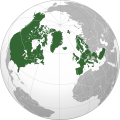
 European Union maximum enlargement.svg 537 × 536; 349 KB
-
 Greenland (orthographic projection).svg 553 × 553; 326 KB
-
 Jamaica (orthographic projection).svg 550 × 550; 374 KB
-
 KNA orthographic.svg 600 × 600; 1.17 MB
-
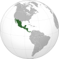 Mexico and Central America (orthographic projection).svg 550 × 550; 212 KB
-
 Middle America (orthographic projection).svg 550 × 550; 218 KB
-
 North Atlantic Treaty Organization (orthographic projection).svg 550 × 550; 484 KB
-
 Puerto Rico (orthographic projection).svg 550 × 550; 197 KB
-
 Spanish speakers in the Americas (orthographic projection).svg 550 × 550; 1.4 MB
-
 TTO orthographic.svg 600 × 600; 1.15 MB
-
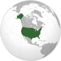 United States (orthographic projection).svg 541 × 541; 396 KB
-
 VCT orthographic.svg 600 × 600; 1.25 MB
.svg)
.svg)


.svg)
.svg)
.svg)

.svg)
.svg)

.svg)
.svg)
.svg)
.svg)
.svg)

.svg)

Categories:
- SVG locator maps of countries (gray and green globe scheme)
- SVG locator maps of countries of North America (gray and green scheme)
- SVG locator maps of countries of North America (gray globe scheme)
- SVG locator maps of North America (gray and green globe scheme)
- Locator maps of countries of North America (gray and green globe scheme)