Category:RAF Lashenden
Jump to navigation
Jump to search
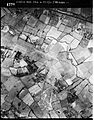
English: RAF Lashenden was a temporary World War II airfield used by the RAF and USAAF. It is now Headcorn Aerodrome, a small private airstrip southeast of Headcorn in Kent, England.
| Object location | | View all coordinates using: OpenStreetMap |
|---|
Media in category "RAF Lashenden"
The following 5 files are in this category, out of 5 total.
-
 354-353d-p51b-lashden.jpg 600 × 277; 36 KB
-
 RAF Lashenden - 11 May 1944.jpg 1,636 × 1,631; 674 KB
-
 RAF Lashenden - 16 January 1947.jpg 1,673 × 2,130; 850 KB
-
 RAF Lashenden - 22 May 1944 - Airphoto.jpg 1,163 × 737; 166 KB
-
 RAF Lashenden - 22 May 1944 0002.jpg 1,663 × 1,705; 730 KB


