Category:Headcorn Aerodrome
Jump to navigation
Jump to search
English: Headcorn Aerodrome is a small private airstrip southeast of Headcorn in Kent, England. It occupies the site of the temporary World War II airfield RAF Lashenden used by the RAF and USAAF.
ICAO: EGKH
| Object location | | View all coordinates using: OpenStreetMap |
|---|
airport in the United Kingdom  | |||||
| Upload media | |||||
| Instance of | |||||
|---|---|---|---|---|---|
| Location | England | ||||
| Operator | |||||
| Inception |
| ||||
| Elevation above sea level |
| ||||
| ICAO airport code |
| ||||
 | |||||
Subcategories
This category has the following 4 subcategories, out of 4 total.
A
L
R
Media in category "Headcorn Aerodrome"
The following 7 files are in this category, out of 7 total.
-
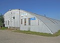 Air Museum - geograph.org.uk - 1436401.jpg 640 × 457; 254 KB
-
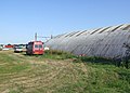
 Airfield Aerials - geograph.org.uk - 1421935.jpg 640 × 480; 24 KB
-
 Alternative take off site - geograph.org.uk - 1436452.jpg 640 × 457; 391 KB
-
 Headcorn Aerodrome - geograph.org.uk - 1436411.jpg 640 × 457; 294 KB
-
 Lashden-aug1947.jpg 600 × 558; 104 KB
-
 Pickett Hamilton Fort at Headcorn Airfield (geograph 4100822).jpg 1,024 × 698; 407 KB
-


.jpg)
