Category:Political maps of Romania
Jump to navigation
Jump to search
Countries of Europe: Albania · Austria · Azerbaijan‡ · Belarus · Belgium · Bosnia and Herzegovina · Bulgaria · Croatia · Cyprus‡ · Czech Republic · Denmark · Estonia · Finland · France‡ · Georgia‡ · Germany · Greece · Hungary · Iceland · Republic of Ireland · Italy · Kazakhstan‡ · Latvia · Moldova · Montenegro · Netherlands‡ · Norway · Poland · Portugal‡ · Romania · Russia‡ · Serbia · Slovenia · Spain‡ · Sweden · Switzerland · Turkey‡ · Ukraine · United Kingdom
Specific status: Jersey – Limited recognition: Kosovo · South Ossetia‡
‡: partly located in Europe
Specific status: Jersey – Limited recognition: Kosovo · South Ossetia‡
‡: partly located in Europe
Subcategories
This category has the following 3 subcategories, out of 3 total.
Media in category "Political maps of Romania"
The following 13 files are in this category, out of 13 total.
-
 2004l.png 780 × 600; 161 KB
-
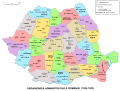 Administrative map of Romania, 1950-1952.svg 1,650 × 1,250; 2.05 MB
-
 Administrative map of Romania, 1952-1956.png 1,400 × 1,001; 338 KB
-
 Administrative Map of Romania, 1956.png 3,520 × 2,844; 819 KB
-
 Administrative map of Romania, 1960-1968.jpg 6,438 × 5,100; 5.22 MB
-
 Administrative map of Romania, 1960-1968.svg 1,650 × 1,250; 3.02 MB
-
 Blue-USRPLUS a intrat in CJ .png 664 × 476; 58 KB
-
 Harta alegeri locale 2020.png 2,003 × 1,414; 649 KB
-
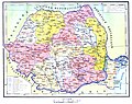
 R.S.R., hartă administrativă, 1966.jpeg 2,263 × 1,591; 1.17 MB
-
 Romania chamber of deputies colleges diaspora coloured.svg 940 × 477; 1.95 MB
-
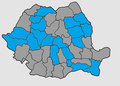
 Romanian County Presidents.svg 666 × 471; 58 KB
-
 RomMoldAdmi.png 1,069 × 572; 143 KB
-
 USR CC-CJ Map.svg 2,348 × 1,673; 477 KB


